
One of the Unesco World Heritage Sites is “Ancient and Primeval Beech Forests of the Carpathians and Other Regions of Europe”. The “other regions of Europe” actually makes the site expand into 94 forests in 18 European countries – three of these forest are in Spain. A primeval forest, in layman’s terms “old-growth forest” is one that has been allowed to thrive without significant alteration from humans. Most of Europe’s temperate forests have been altered by human activities, so the protected areas are patched throughout the continent.
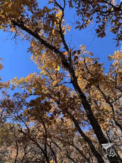
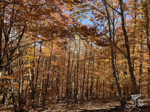
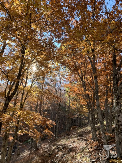
One of the protected areas is the beech forest Hayedo de la Tejera Negra. The European beech (Fagus sylvatica) is a deciduous tree from the same family as oaks. The trees usually measure up to around 30 m, tend to have a slim trunk and grow branches high on the tree. The leaves are simple, though they are toothed, the shape is soft. They change colour in autumn from green to gold and tend not to be shed but stay in the tree unless the weather brings them down. They grow in humid areas, but they require a well-drained soil. Forests tend to be thick and dark, with few other species as the beech canopy takes up all the light.
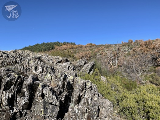
The forest is located in the centre of Spain, and it is part of the natural park Parque Natural de la Sierra Norte de Guadalajara, some 30 km away from the Aljibe Waterfalls. Beech forests tend to grow in colder climates, so this one is a relict forest from times when Spain was cooler and wetter (maybe what is called the Little Ice Age between 1300 and 1850). The fact that it remains is due to a very precise location – low valleys with a lot of shades and shadow where fog and mist are common and it rains rather often. Furthermore, the calcite-rich area makes the soil ideal for beeches. The reality of it being a Primeval forest is thrown has doubts cast as the forest was actually cut down twice – 1860 and 1960.
The beech forest technically belongs to Cantalojas, in the north of the province of Guadalajara, Spain. There is an inner parking lot that has to be reserved in advance for just under 5€ (access between 10:00 and 13:00), and a free-access parking lot at the edge of it. In order to get there, the first step is to arrive in Cantalojas. There, a bumpy rail gets to the beginning of the park, where the checkpoint stands, you can either leave your car here and walk the longer trail (Senda del Robledal), or if you have an inner parking reservation, you will get waved through the longer driving path, 8 km long. Once in the parking lot, you may walk the inner trail.
After my first try to visit the park was fouled by the driving path being closed on weekdays and the parking lot full, and my second by the bad weather, I was finally on my way on Friday the 12th of November – took long enough! The roughly 100 km took a bit more than expected due to a good part of the road having a lower speed-limit than normal, as it is considered a “dangerous mountain road”. There is also loose cattle around the roads, and I came across a few cows having a field day. In the end, I drove for an hour and forty-five minutes, and started walking around 11:30. I took the shorter, inner trail, called Senda de Carretas, which is around 6 km long. Depending on which resource you look at, between two and three hours are expected to hike it.
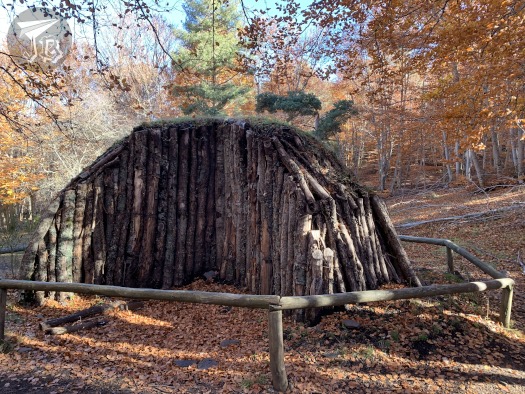
The trail starts in the lower valley, between the creek Río Lillas and the lower pine forest, whose trees won’t lose their leaves anyway. Thus, even if the weather is turning cold this area is still very green. The name of the trail translates into “Trail of Carts” as it was used in the past to transport coal that was produced in the beech forest. As the trail turns to the left, it starts ascending, leaving behind the valley and the pines. First, there is an area of low bushes and trees, where pieces of calcite rock are abundant, then it delves first into the oak forest, which has already turned brown.

There were way more people than I had been expecting for a weekday – a lot of them were hiking in groups and unfortunately loud, which made catching a glimpse of any animal impossible. The forest was beautiful though. Around one-third in I came across the sculpture that recreates the old coal-ovens, La Carbonera.
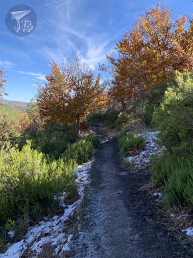
I continued hiking up, and after a pretty wooden bridge, the steep slope started. This was a bit harder than I had anticipated, and made the mistake of taking a break in-between, so I lost my pace. At the end of the slope I found the open prairie Pradera de la Mata Redonda, which looks down on the valley and up onto the multi-coloured mountain.

After a short look-around, I continued on the hiking path. Here I could actually see something unexpected… snow! Do you remember that my second attempt had been thwarted by the weather? Well, there were the remainders of so… This was in my opinion the most beautiful part of the forest, as the descend starts. The beech forest was completely golden at this point, and the ground was also covered on leaves. This is the part that gives the forest its fame, and it is well-deserved, at least in autumn.
When I reached a fork on the road, I continued for a little on the Senda del Robledal (Oak forest trail), then took the path down towards the parking lot. The forest opened up and I eventually got to the parking lot, where I got on the car and drove away at around 14:45. I took a little over three hours in total and walked 7.46 km.
On my way back I drove past more cows chilling out – the complete drive was a bit under 200 km. And I did not have signal for the whole day, which was a nice change for a while.

