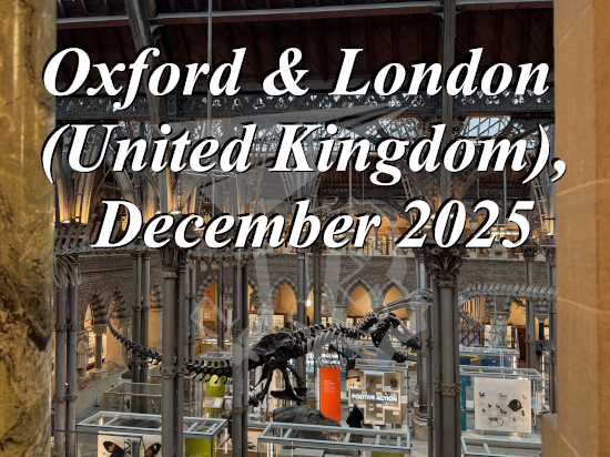
I think it was in early September 2025 when I saw the announcement that fesFE[M], one of the Japanese visual kei bands that I enjoy, was doing a mini tour in Spain. It was originally stated that they would play in Málaga, Madrid and Barcelona, though the first never happened in the end. I put it on my calendar and made sure to keep up with social media for announcements, since the organiser was not considered the most reliable one. There was very little promotion, but I was able to learn through the band’s own Instagram when tickets would go on sale.
I paid 30 € (+ 2 € fees) for a ticket, 47 € (+ 3 € fees) for the VIP upgrade on 11th November 2025, to attend the MAMA. × fesFE[M]: Harmony in Dissonance EU Tour in Madrid on Saturday 21st February 2026. The concert turned up to be the same weekend as the Medieval Fair in Tendilla, so I had to give that up this year.
I first saw fesFE[M] in 2019, when they came to support Jupiter, also in Madrid. They were the discovery of the day – despite the horrible planning on the promoter’s side, which made us VIPs miss most of their performance. After the concert, the band was happy to take pictures and sign CDs. Later that year, I made a point to see them again in the Saitama Summer Rock Festival, though I was not lucky enough to meet any of them there.
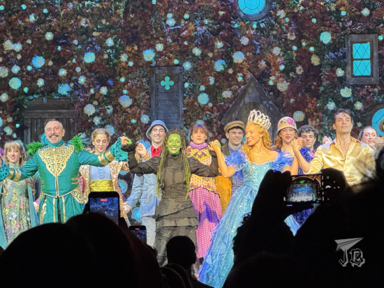
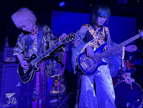
fesFE[M] is a six-man band, where all the members have a “doll” persona. At the moment, they are “Japanese clothing dolls”, donning pretty yukata and Japanese traditional masks (well, their cheap versions). When I saw them in 2019, they were tragic or horror puppets. The ensemble features Rion [リオン] on vocals; Aito [アイト] and Zeno-P [ゼノP] on guitars; Tohru [徹] on bass; Rensa [蓮沙] on drums; and Jun (not a doll, but the “dollmaster” – I think they meant puppeteer) on keyboards. They have a very particular style that ranges from energetic to creepy, and I of course could not pass the opportunity to see them again.
MAMA. defines its own style as “visual hybrid music”, whatever that means. The core of the band is composed by vocalist Mei [命依], guitarists Kagome [かごめ] and JiMYY, and bassist Mana [真], alongside a support drummer whose name I honestly didn’t catch.
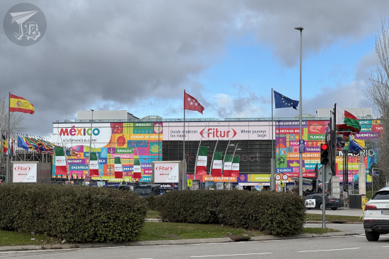
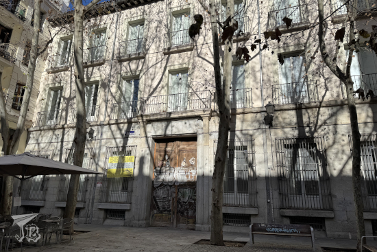
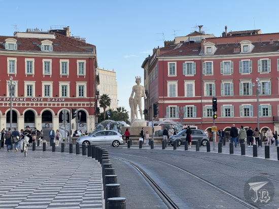
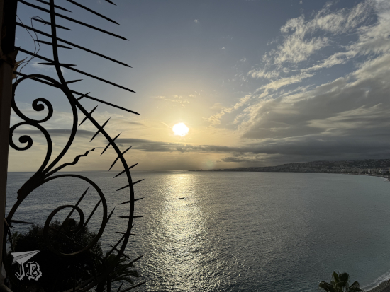
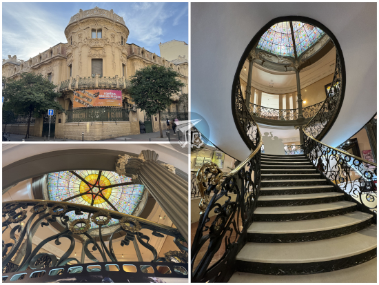
My original plan was driving to Madrid’s venue Sala Silikona, and back home, but two factors altered that plan. First, Chinese New Year – though it fell on the 17th, the parade was scheduled for Sunday the 22nd. The second was the schedule, released a week before the concert – VIP access would open at 19:00, doors would be at 20:00, and the support act, AKNIA, would start at 20:30. That meant driving back in the middle of the night and waking up early to take a train back to Madrid on Sunday. I decided that I was not doing that – and thus I searched for a hotel along the underground line that stopped near the venue. It was not cheap, but it was convenient.
I decided to head to Madrid mid-morning, and took a connection towards the park in the Usera district Parque de Pradolongo, where the first activities to celebrate Chinese New Year were to take place – I wanted to check those out. In its core, Chinese New Year marks the beginning of spring – hence its official name “Spring Festival” [春節 | chūn jié], and it’s a worldwide celebration that has been classified as Intangible Cultural Heritage as Spring Festival – Social practices of the Chinese people in celebration of traditional new year, with traditions that have been recorded since the Han Dynasty (202 BCE – 220 CE). It is celebrated on the first day of the first lunisolar month, which is in turn determined by the new moon – usually the second new moon after the winter solstice. Technically, the year starts on the new moon closest to lichun [立春], the first Chinese solar term, determined by the Sun reaching the celestial longitude of 315º. In the Western calendar, all that translates into sometime between the 21st of January and the 20th of February. In 2026, the date fell on the 17th of February, marking the start of the year of the Fire Horse. Public celebrations include lion and dragon dances, fireworks, firecrackers, and red decorations.
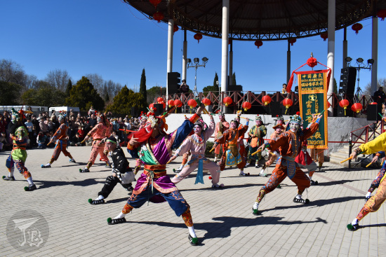
For the last few years, the Chinese community in Madrid has been organising ever-growing activities to celebrate the Spring Festival. I had to miss welcoming the Year of the Snake, but I was there for the Parade of the Year of the Dragon (2024). I think they only had the parade and the food market that year, but there were tons of activities this time around. One them was an exhibition of the traditional Yingee Dance [英歌] by the Fumei Yingge Dance Troupe [富美英歌舞团队 | Fù měiyīng gēwǔ tuánduì]. The performing company was founded in 1998 in the village of Fumei (Guangdong), and since 2005 it has been a sort of ambassador for the dance, travelling internationally under the blessing of the Ministry of Foreign Affairs.
Yingge (literally “The Hero’s Song”) Dance is a folk dance with elements of acrobatics, Chinese opera and martial arts, typical of the eastern region of the coastal province of Guangdong. It is performed after the beat of one or several drums. The dancers’ make up calls back to the 108 heroes of the 14th-century Chinese novel Water Margin [水滸傳 | Shuǐhǔ Zhuàn], attributed to Shi Nai’an [施耐庵]. With 108 protagonists and 100 chapters, its plot would be too complex to explain, but it boils down to “good vs evil” struggle. In 2026, Yingee became national intangible cultural heritage. It combines dancing, martial arts (especially the style known as “southern fist” [南拳 | nán quán]), and Chinese opera acting. During the dance, every performer holds two wooden sticks or mallets which are used for acrobatics and noise. There are also jumps and leaps and incredible stunts.
I reached the park Parque de Pradolongo a bit later than I would have liked, even if I was lucky with my connection. The food trucks and the stands were already overrun, and the poor girls who were supposed to give out information had none. It turned out that the dancing troupe had run into some transport trouble, so instead of a first show at noon, they would do it at 12:30. Just as well. I waited around and I actually stayed for two of the performances, repositioning myself between the first and the second to get a better view. It was extremely impressive, not only due to the artists’ coordination, also because the acrobatics seemed impossible.
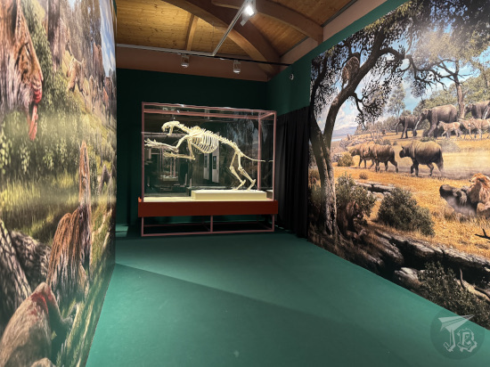
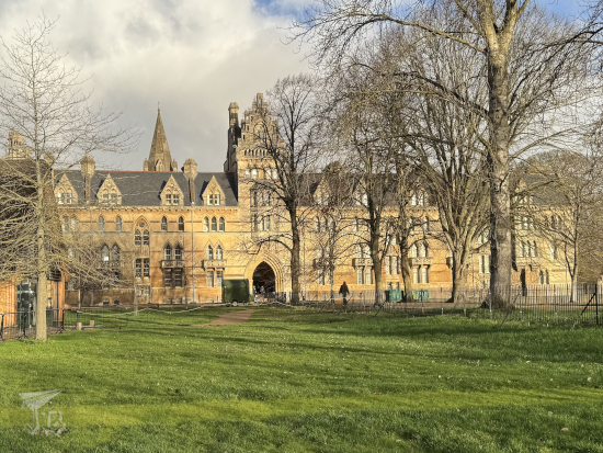
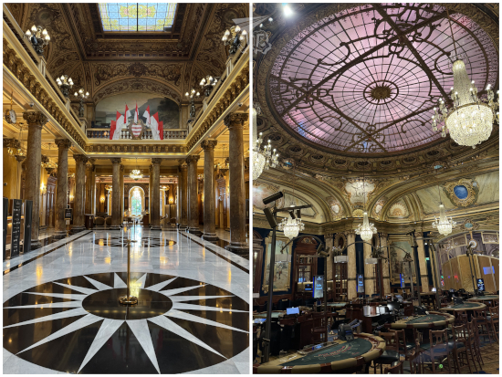
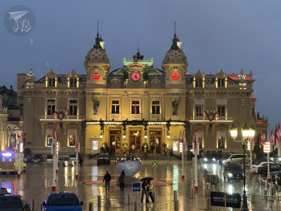
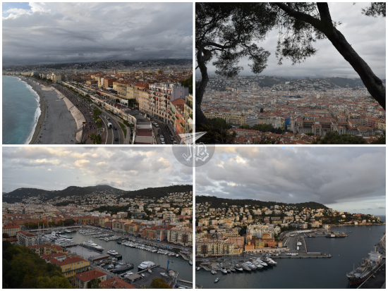
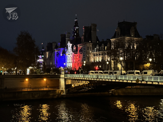
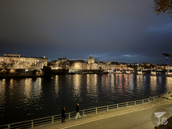
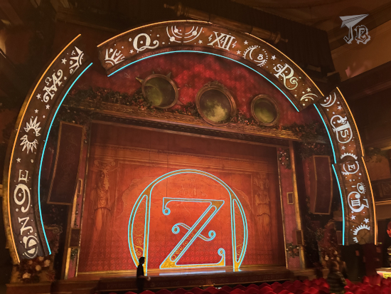
After the second dance, I walked around the park to figure out the layout of the parade for the following day, then headed back towards the train system. It did not take long to reach my hotel. The façade was under restoration, and the automatic doors did not want to let me in. My room ended up being on the 8th floor, with views of the Madrid rooftops. I popped out for a second to buy some lunch, and got ready for the concert. Since VIP was around 19:00 I left the hotel around 17:00, so I arrived at the venue Sala Silikona, where the the MAMA. × fesFE[M]: Harmony in Dissonance EU Tour concert was to take place, around 17:30. The queue was pretty relaxed. There were no incidents at the queue, and we even managed to successfully handle the security guard’s power trip. I found it a bit offensive though, that after carding everyone around me, he said he did not have to see my ID…
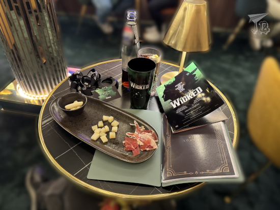
The VIP included early entry, a present – which turned out to be a bunch of trading cads – and photos with the bands. We also got a lanyard, and sooner than I would have imagined I found myself inside the venue, where we were admitted in small groups. I knew one of the organisers so I asked her to allow me to ask for fesFE[M]‘s autographs on the printed photo I had from 2019, and she told me it was fine as long as I had my own marker – which I did. The only drawback was that I had not found a silver one, only a black one.
I first had my picture taken with MAMA.. I thanked them for coming and we exchanged basic pleasantries. Then I got my turn with fesFE[M]. I told them it had been a long time since I saw them in Saitama in 2019 (hence I became “Saitama-san) and got them to sign our photograph together. They acted both surprised and happy, and asked if the picture was from their last time in Madrid. Of course it was, you silly geese. It was a nice moment when I had their undivided attention and they looked genuinely happy. After that, we took a reboot of that same photo – I am in the same position, only instead of holding the signed CD from Madrid’s 2019 concert, I am holding the autographed picture from that day. I look exactly as awful.
Afterwards, I got out of everyone’s way and found a spot on the tiny first row. I think we were like eight people there, tops. I was a little to the left and, for once, it was the almost-perfect place to be. The stage was not raised, there was no barrier whatsoever… You can say this was a close-up experience. I say that my spot was almost perfect because while it was awesome for viewing (I never thought I’d end up too close for pictures in a concert)… I ended up with a guitar head slammed against my shoulder and a bit of a “war wound”. It did not really hurt at any point, but it’s made for an interesting crescent-shaped scar…
The Spanish support band AKNIA (with a backwards K) might have been good, but they had not done their sound homework. The quality was pretty much a disaster, to the point that at some point the singer stopped and helplessly pleaded “my guitar is not working”. They looked and sounded pretty young and full of enthusiasm but I don’t think they were the right choice for the crowd.
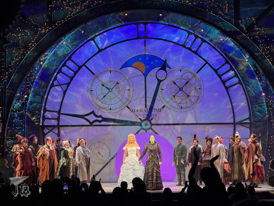
The venue was so weird that the bands had to walk through the crowd to get to the tiny stage – despite there being a door there, it was blocked by the instruments. As the support act went away, the venue’s crew plugged and re-plugged instruments and brought out a stand for the main vocalists to stand on… a couple of honest-to-god beer boxes. The first band to come out was MAMA.. Aside the support drummer, there is four of them, and three – Mei, JiMYY and Mana – stayed on my side of the stage all the time, while Kagome owned the other side. Maybe… three metres away, it was a cosy gig. They were okay, I kind of liked them. They did not steal my heart though (which is good, because there is no way I can support even more bands).
MAMA.’s setlist:
1. Omen
2. Cry Morry
3. Nope
4. 罪×罰 [Tsumi to batsu]
5. ALiCE iNSOMNiA
6. めいさんの成分 (抽出) [Mei-san no seibun (Chūshutsu)]
7. Witch??
8. 命日 [Meinichi]
9. Pink Moon
10. 毒入りミルクはママ.の味 [Doku iri milk wa mama. no aji]
11. Murder Red Chainsaw
12. Maria

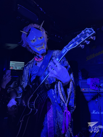
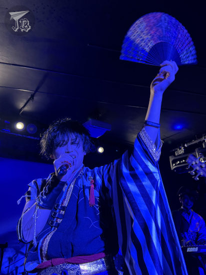
It was finally time for fesFE[M], and the beer box was now right in front of me. I think I got hit by Rion’s sleeves twenty to thirty times. I haven’t seen any artist that close in my entire life. I am still not sure who hit me with their guitar / bass, it might have been JiMYY, Tohru or Zeno-P. But I did not notice that until later.
I used to say that Kamijo is the only singer who has ever sung to me – and hence my huge soft spot for him. But now I’ve gotten a heart-gesture from Rion, too. I think I had not enjoyed a concert this much in years. It was silly and fun and cathartic. I mean, I got my favourite song from the band, Night Circus, in second place. The rest of the concert did not disappoint.
As they were preparing, vocalist Rion glued a lot of katakana for his emcees under his feet – and I actually managed to get those papers after the concert, along with a guitar pick and some hair decoration from Zeno-P’s. While Rion did slip into a lot of Japanese, he was at least brave enough to try some Spanish. It was adorable. And yet, I’m not sure how any of them can breathe in so many tight layers.
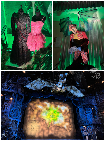
The band came out in “traditional Japanese outfits” and wearing masks – cheap masks from the one-hundred-yen store – that they kept in for the first song. They might have tried to make it look creepy, but it looked like cute, like kids dressing up using their older siblings’ cosplay. I am all in for the look though, it fit the mood.
fesFE[M]’s setlist, including the emcees, since I managed to grab the papers from stage and thought it would be fun to transcribe them:
1. 月蝕の逢瀬 [Gesshoku no ōse]
2. Night Circus
3. Mr Imitation
4. the WORLD; Nightmare cover
| MC: | ホラ·マドリー!!ク·アレグリア·エスタール·アキ. エスタイス·リストス·パラ·ラ·フウエスタ? ヴァモス!! | ¡Hola Madrid! Qué alegría estar aquí. ¿Estais listos para la fiesta? ¡Vamos! | Hello Madrid! (We’re) so happy to be here. Are you ready for the party? Let’s go! |
5. バラバラパーティー [Bara Bara Party]
6. 狂咲幻花 [Kyoushou Genka]
7. 君のアニマに届かぬモノログ [Kimi no anima ni todokanu Monologue]
8. Doll in ブルーベリィジャム [Doll in blueberry jam]
9. 黒き森と愛惰と [Kuroki mori to aijou to]
10. Doll’s bride
| MC: | ケダ·ポコ·ペロ·トダビア·ポデモス· マィス ·マドリー!! ヴァモス·ア·ダロ·トド·アスタ·エル·フィナール!! | ¡Queda poco pero todavía podemos (seguir) más, Madrid! ¡Vamos a darlo todo hasta el final! | There’s little (time) left, but we can still (continue) a bit more, Madrid. Let’s give everything to the end! |
11. Obake no Tomodachi
12. Darkness and collusion
13. 百花繚乱 -A riot of colors- [Hyakka ryouran -A riot of colors-]
| MC: | ラスト!!ラスト. マドリー·ダロ·トド | Last!! Last. Madrid, dalo todo. | Last, last. Madrid, give it all |
14. フレイヤ [Freya]
| MC: | グラシアス | Gracias. | Thank you. |


I enjoyed myself so much that at the end of the concert I dropped 60 quid on a fan, a pick, and a “2shot”, which is a small Polaroid with one of the members. Rion had been nice and noticed me, so I decided to get a photo with him. Afterwards, I headed back to the underground, bought a snack in a fast-food joint that closed in the wee-hours of the morning, and turned in for the day after fighting my contacts off.
The next morning I woke up and headed down for breakfast – it was included in the room rate. The buffet was pretty well-stocked and it had coffee, juices and chocolate con churros (hot chocolate and fried dough pastries). Next, I left my backpack at reception and headed off towards the train. I had arranged I would meet my sibling at the train station near the park Parque de Pradolongo to find a place to watch the Chinese New Year Parade. The Chinese New Year started on the 17th of February, and will end on the 5th of February 2027; it is a lunisolar calendar. The Calendar Year is bing wu nian [丙午年].
The Chinese lunisolar calendar has been used for around 4,000 years, as it was first established during the Xia Dynasty in the 21st century BCE, but it does not use numbers. Each year is named after a Heavenly Stem (in this case Bing) and an Early Branch (Wu), and assigned a zodiac sign, one of the five elements (earth, wood, water, fire and metal), and either Yin or Yang. The combinations of 10 Heavenly Stems and 12 Earthly Branches generates a super-cycle of 60 years. Apparently, this is not confusing at all.
The accompanying zodiac comprises a cycle of twelve animals chosen according to an old legend – the Jade Emperor wanted 12 guardians for his castle, so he commanded the animals to go to him. The first animals to arrive would be the guardians, and the earlier they arrived, the higher their rank would be. These animals were, in order, the mouse, the ox, the tiger, the rabbit, the dragon, the snake, the horse, the sheep / goat, the monkey, the rooster, and the pig. The thirteenth animal to arrive was the cat, who got left out from the horoscope after being tricked by the rat, hence kickstarting the rivalry between cats and rats. Each animal has its meaning, strengths, weaknesses, and compatibility with others, of course.
Chinese New Year is also called “Spring Festival”, a festivity which falls on the first day of the Chinese Year. While some claim that “Lunar Year” is more inclusive than “Chinese Year”, the community in Spain advertises it as the latter, which is the notation I use. Hence, the New Chinese Year is the Year of the Fire Horse: the horoscope is the Horse (马, mǎ), the element is fire (火, huo), and it is a Yang year.
The Madrid festivities have been moved from the main streets in Usera to the park Parque de Pradolongo and while it is great for some of the activities, I think it was not the best place to hold the parade, mainly because the route was too narrow. People – especially dancers and martial artists – got stuck and did not have enough space to move.
The parade started at noon, and it took about an hour and a half to pass in front of us. We were pretty close to the beginning, as I wanted a barrier spot and tiled ground under my feet (and also to avoid solar flares in photographs). I was flabbergasted though by the sheer audacity of some people – a couple of older ladies who arrived 10 minutes before the whole thing started and wanted barrier spot. They managed to push the family next to me away and had the nerve to complain I was not moving. Lady, I arrived almost an hour and a half in advance to grab the spot. Why on earth do you think I’d give it up to you? I’ve survived Japanese festival crowds, you ain’t shoving me out of your way…
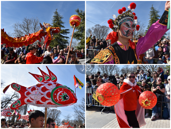
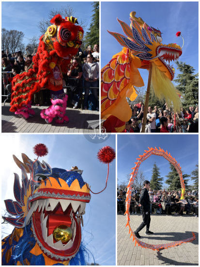
All kinds of groups walk the parade – Embassy representatives, language and primary schools, associations, shops and business… Everyone of them marches alongside the designated dragon- and lion-dancers. It was less elaborated than the other time I had seen it, but still pretty cool. The parade opened with inflatable horses to commemorate the starting year. People of all ages (both Chinese and Spanish) participated demonstrating traditional dances with fans and lanterns. There were also martial artists. As Madrid’s “Chinatown” is a popular neighbourhood amongst Latin American people, they also participate in the parade. One of the last groups to come were Bolivian, and one of their Carnival (Carnaval de Oruro) characters came to dance with me!

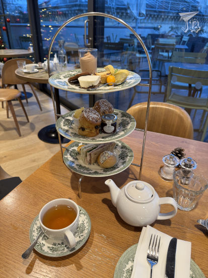
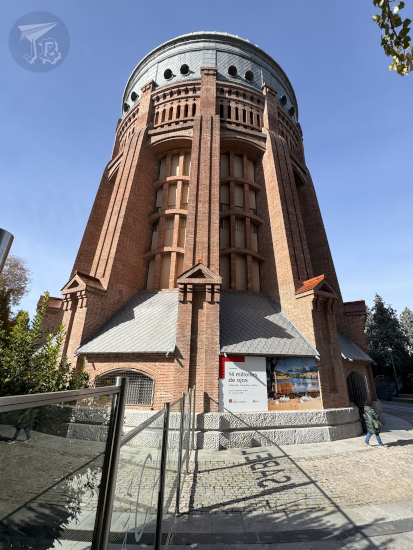
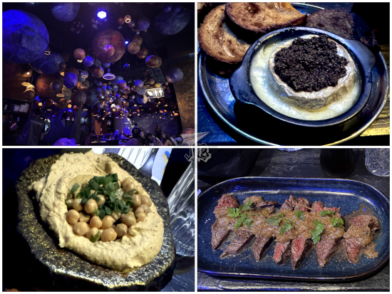
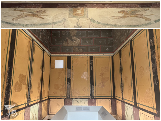
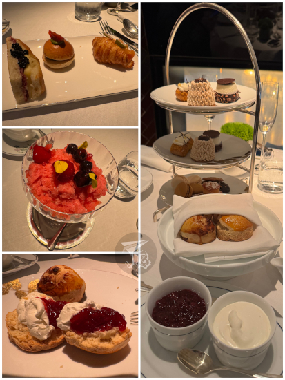
After the parade, we headed back into town. We thought we could check the Sweet Space Museum, but it was closed. We picked up my luggage from the hotel instead and spent some time in a Starbucks until 16:00, when I had booked afternoon tea at Flor y Nata in the hotel Rosewood Villa Magna. I feel like I’m on a mission to try all the afternoon teas in Madrid…
When we arrived at the hotel, at first we thought the place would be in the terrace behind it, where there are several cafés and restaurants. It wasn’t, so we had to walk inside the hotel. I was certainly not dressed for that – or so I thought. I realised that I have more style – and manners – than some of the people who can afford more than afternoon tea at that place.
The staff were incredibly friendly – but I suspect the reservation had slipped their mind, or their system. We informed them that we had a booking for afternoon tea, and we were seated next to the chimney, at their “usual tea table”, which was not ready. They asked us if we were celebrating anything special, but just my afternoon-tea-addiction I guess.
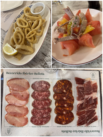
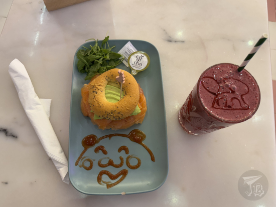
The menu included a glass of white sparkling wine, but I gave mine to my sibling. Tea time started with a selection of savoury sandwiches. Then there was a palate-cleansing yuzu and red berry granita (lovely). I usually have my scones before moving onto the sweets – they were warm and accompanied by raspberry jam and clotted cream – though the menu calls it “sour” cream – and I am team “first cream, then jam”. The sweets included chocolate cake in textures, almond éclair with vanilla and candied pear, spiced Sablé Breton cookies with pecan ganache & praliné, mini financier and mini cookies. This last part was a bit too sweet for me, but the sencha tea we ordered to accompany it all was a good balance. I was, however, unable to finish the desserts. It was fun that the treats were prepared in an open kitchen and we could see the process.
Since the tea was paid for at reservation, we just left when we were full – but seriously, I got the impression that we could have walked there without any kind of booking, ad they would have served us just the same. Or maybe not, considering how packed the space got. As a funny note, all the decorative plants were so pretty that I thought they were plastic. However, they were natural – they broke havoc with my allergies. And regarding the dress code… I understood that some people are happy to spend a lot of money on shabby-looking designer clothes… and to seep at the tables with their feet on the sofas in front of them without a care in the world for their luxury shopping bags…
We eventually walked back towards the train station to catch a train home.