15th July 2025: The Egg Museum & the Mallos {Dinosaur Eggs Loarre & Zaragoza, July 2025}

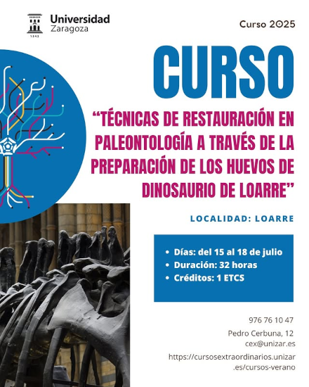
I woke up around 7:30. After I had stressed out so much about reaching there, I almost could not believe I was really in Loarre, at the feet of the Pyrenees mountain range. I lounged around until breakfast started at 8:30. I went down and the choice was limited but adequate – fresh bread (still warm, the bakery was literally under my window, and it had been making me hungry for an hour), tomato spread, Spanish omelette, cheese, sausages, pastries, coffee, milk, and an assortment of jams and butter. The coffee was weak, so I had a couple of cups, but the orange juice was freshly squeezed and awesome. I made myself toast with cheese and omelette, loaded up on the caffeine and went on my way. At 8:58 I was at the museum-lab Laboratorio Paleontológico de Loarre (Oodinolab). And there was my name, on the attendance sheet for the course Técnicas de restauración en paleontología a través de la preparación de los huevos de dinosaurio de Loarre: Palaeontological Restoration Techniques through the preparation of Loarre dinosaur eggs. Everything was going to be all right. I have to admit I was 100% ready to show all my emails and confirmation should any problem have arisen… but it was all right (which… I should have known due to the email received previously… but I am an overthinker by nature).

After signing attendance and checking details for the certificate, we received a tote bag with postcards, notebooks and pens. The course started with a welcome and introduction by Miguel Moreno Azanza, who is the Universidad de Zaragoza researcher in charge of the lab. The most important goal of the course, he transmitted, was empowering us with knowledge about every step involved in fossil-handling: from digging to commercial exploitation, including geology, conservation, restoration, study and museumification.

The course kicked off with the guided visit of the museum-lab that is usually done for kids and families, including pulling out crates for our backpacks. Thus we learnt about the story of the discovery of the eggs – a fellow researcher of Moreno Azanza’s, José Manuel Gasca, a geologist, runs mountain trail. In 2019, he was training with a few colleagues when during a break he looked at the ground and saw what it looked like a fossilised dinosaur egg. And that is how one of the largest egg-dinosaur sites in Europe was discovered.

From the science standpoint, we also heard about how hardshell eggs played a key part in the evolution of animals coming out of the sea, as they allowed reproduction on land, without having to return to water. There were (are) different strategies to take care of eggs, and spherical eggs mean that they were (are) buried. From fossil tracks, we know that the dinosaur females that laid their eggs in the area buried them for protection using their back legs. We saw two cast jackets too, ready for research, on display.

Collage showing several exhibits of the museum: two cast jackets (with fossils inside), the first sauropod egg excavated (of course, in broken pieces of shell pressed together), a dinosaur vertebra and a reproduction of a sauropod embryo in an egg.

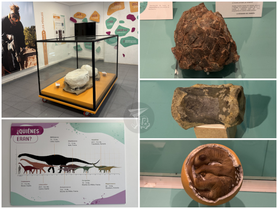
Fossil eggs are categorised as oospecies, unless or until it can be proven which animal laid them. The Loarre dinosaur eggs are tentatively classified as Megaloolithus siruguei (sometimes spelt Megaloolithus sirugei), laid by a species of titanosaurian sauropod – some candidates are Garrigatitan, Ampelosaurus and Lohuecotitan. Sauropods were plant-eating dinosaurs that moved on four straight legs, and had long necks and tails, such as Dippy, the Diplodocus (and other copies, such as the one in Madrid or Paris). During the Cretaceous period, the dominant group of sauropods were the Titanosaurs, the last surviving long-necked dinosaurs until the extinction of dinosaurs – in South America there was Patagotitan; another example is Qunkasaura pintiquiniestra, which I saw in MUPA and MARPA exhibits.

The first dinosaur eggs ever registered were found in the Pyrenees – on the French side though – by Pierre Philippe Émile Matheron in 1846, and described in 1859 by Jean-Jacques Pouech. In 1967, Pierre Souquet documented dinosaur eggshells around the reservoir La Peña, some ten-ish kilometres from Loarre (had I known in 2021…). These were the same oospecies as the ones in Loarre – since the fossil layer is the same, it makes sense.

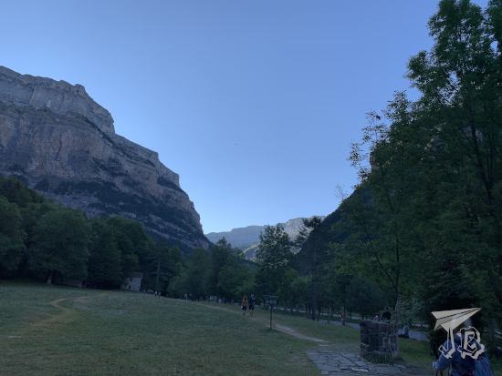
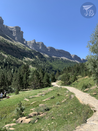
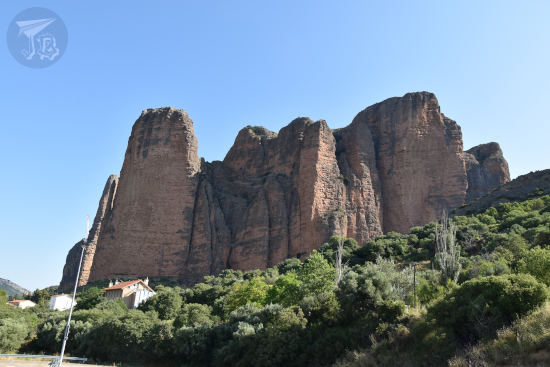
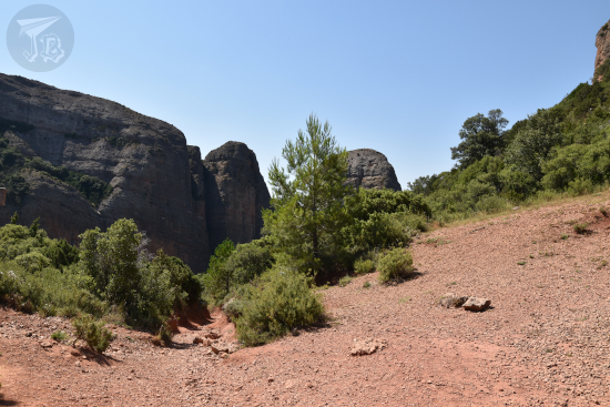
We were supposed to have a video-conference inauguration with someone from the university, but she decided to come in person, and that was moved to 19:00. So instead we hopped onto the vans that the organisation had provided and drove towards the geological formation called Mallos de Riglos, in the village of Riglos (hence the obvious name). The Mallos are a number of vertical domes conformed by reddish conglomerates. I had actually seen these geological structures before, from the other side of the River Río Gállego – not up close. The wording of the email “a slight ascent” had not made me suspect at first we were going to climb all the way up in the heat. Looking back, it was not that bad but a) I was not mentally prepared for it, and b) I have a new backpack, and it’s comfortable but… differently-shaped, so my centre of gravity was all off. There, Lope Ezquerro Ruiz (honourable mention to Manuel Pérez Pueyo, who cracked jokes and held the whiteboard) gave us a few good pointers on geology which made me wonder where he was when I was first studying geology at university.

Looking up at the Mallos de Riglos, vertical structures made from reddis conglomerates

Simply put, if one assumes that the natural laws have not changed with time (Uniformitarianism), then three things happen that define geology: strata deposits are horizontal, deeper strata are always older, and if they are not, it is because something new has eroded or deformed them. Of course, the Pyrenees mountain range is anything but flat.

Pyrenees geological structures on the side of the mountain, from the mountain opposite the river - erosive walls, faults and folds

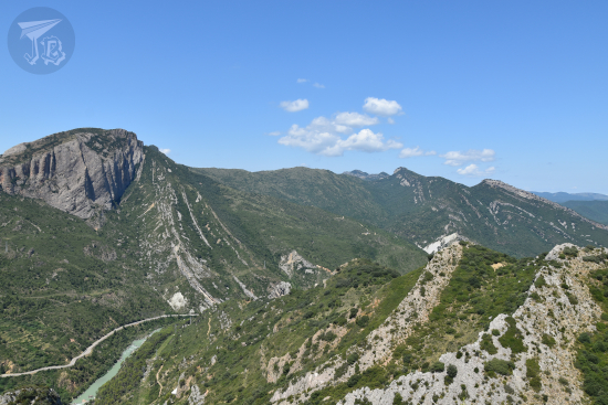
On site, we learnt about the Garum facies, the result of the sedimentation of fluvial and marshy red clays. The layer started forming during the Maastrichtian (the latest age of the Upper Cretaceous, 72.2 to 66 million years ago. Both the Maastrichtian and the Cretaceous ended with a literal bang – the Cretaceous–Palaeogene extinction event, when non-avian dinosaurs went extinct, marked by the K-Pg boundary (formerly K-T boundary), a layer of sediment rich in iridium which probably came from a meteorite impact. The deposit of Garum facies continued through the first age of the Paleocene, the Danian. This means that the K-Pg boundary is somewhere inside the layer, which is pretty cool. And even cooler? There are dinosaur eggs there, obviously from before the mass extinction.

We learnt about this literally standing on the Garum itself. We talked about the time when the a lot of the Iberian Peninsula was a shallow sea with scattered islands, and then sat to try and “see” the processes of folding, faulting and erosion that created the Pyrenees mountain range as the African tectonic plate pushed against the Eurasian plate.

Reddish rock on the ground, called the garum facies

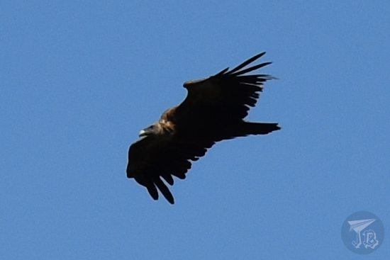
Every now and then, a vulture flew above us, in wide circles. We were apparently not appetising, because it flew away every time. Once we tackled the descent, we headed towards Ayerbe, where we split up for lunch. At 16:00 we met up again so professor Lope Ezquerro Ruiz could demonstrate how strata bend and break using a model and sand. Afterwards, we drove back to Loarre.

Griffon Vulture mid-flight

Walking down the Mallos de Riglos, with two vertical walls at the sides and a river-valley in the background

Simulation of how folding ocurs in rocks using sand

In the modern town hall, we had the first lecture of the afternoon, by José Luis Barco, Manager of the business Paleoymas, a company specialised in protection, development, management and use of cultural and environmental assets, with a strong emphasis on palaeontology and geology. One of their work lines is monetising projects related to palaeontology, as opposed to the “research-focused” stereotype. Between a palaeontological discovery and its communication or exploitation for the general public, there is a gap that can last over a decade.

Paleoymas is responsible for the project Paleolocal, which created the museum-lab in town, with the idea of studying the fossil eggs almost in situ, which would develop a touristic resource and help the village profit from it. The museum-lab is technically part of the Natural Science Museum Museo de Ciencias Naturales de Zaragoza, which has custody of the fossils according to the regional law. However, keeping the eggs in Loarre is a way to involve the community into protecting the palaeontological site, as well as to create a tourist flow to the village itself. See: yours truly, who spent 240 € in lodging there.

The second lecture was given by Miguel Moreno Azanza, who talked about the Theory of Excavating a Palaeontological Site, as one of the activities in the course was working on the field. The summary could be: “forget Alan Grant with a paintbrush, think hydraulic hammer”, but the important lesson is “do not dig up anything you cannot take with you, and register any and everything you see / do / touch”. Also, regarding egg shells, it’s important to write down whether you find them concave up or concave down. This can help decipher whether the egg has rolled or not (for example, if several eggs are found together, were they in a nest, or where they moved there somehow? Did a baby dinosaur break the eggshell?).

Around 19:30, we had the official inauguration of the course, with a representative from the university, Begoña Pérez, and the mayor of Loarre, Roberto Orós, who was nice enough to buy us all a drink afterwards. Not one to turn down a free Coke, I tagged along for a while, and when people started taking their leaves, I returned to my room. I had some crisps in lieu of dinner, took a long (and I mean long) shower, scribbled down some notes and lay down till it was time to sleep.

Palaeontological Restoration Techniques through the preparation of Loarre dinosaur eggs

19th August 2021: A Monastery and a Castle {Spain, summer 2021}

We packed up and in the morning, we continued out trip, heading generally westward towards our next destination, which was about an hour and twenty minutes away. Unfortunately, we got on a slight disagreement with the Sat-Nav again – it sent us through the secondary road and in the end we took two hours going through the curves. Thus, around 10 am we managed to get our tickets to the “royal” monastery Real Monasterio de San Juan de la Peña – which is in the middle of nowhere but technically belongs to Jaca.

The monastery is actually two (or three, depending on how you look at it). The old monastery, Monasterio Viejo de San Juan de la Peña was built in the Romanesque style, and dates back from the tenth century. Its origins, however, seem to be more obscure, related to Iberian and pagan rituals. It is excavated into / built onto the vertical wall of a natural cove occurring in a bare-rock hill or crag in the middle of the forest. It held a convent, a church, and a cloister on the first floor. From the time it was built till the time it was confiscated by the government in the 19th century, it became one of the burial points for the monarchs of the old Kingdom of Aragón and Navarra, thus the “royal” eponym.

One of the many legends regarding the monastery is that it was home to the Holy Grail between the 11th and the 14th century. Later, in the 17th century, there was a fire, and it was decided to build a new monastery. Here is what is weird – there is a building there now, the so-called new monastery Monasterio Nuevo de San Juan de la Peña. Some of the buildings have survived, but most of it is an archaeological museum / excavation of what was there, again until the liberal confiscation.

Issues: You can only visit the old monastery after buying your tickets at the new monastery. And to get from one monastery to the other, you need to take the shuttle, again, awesome during Covid times. Furthermore, there was no control of the number of people there, which resulted in an overcrowding that would have been uncomfortable in normal times, much more during the pandemic. While the bus makes sense due to the fact that there is literally no way to park around the old monastery, some crowd managing would have been necessary.

After visiting both monasteries, we went back to the awful road. I don’t know if it was the curves, the heat, that I had overdone it the day before, or all of the above but I was not feeling well. Thankfully after some food and a stop at the water reservoir Embalse de la Peña, I felt better.

We continued our way and made a stop to look at an interesting geological feature called Mallos de Riglos, which are several almost-detached vertical walls of conglomerate rock left behind by erosive processes that dragged away what used to be around them. They stand up to 275 metres high over the river Río Gállego.

This was a short stop from a viewpoint, but we soon drove on towards the next destination – after one of the most important buildings in religious Romanesque architecture, we were going to see a civil counterpart, the (self-reportedly) best-preserved Romanesque castle in the world: Castillo de Loarre. The truth is that, from afar it looks awesomely cool, though once you are inside, it loses a bit of its appeal as there is no perspective. Besides, it was too hot to hike down the hill for good views.

The keep is built on a rocky hill, and the surrounding buildings are connected to it by a number of doors and haphazard stairs and arcs. Both the main towers and the fortified wall were erected around 1287, in a strategic point between the Muslim and the Christian kingdoms battling over the place. As the Christians expanded their influence, the Muslim tribes retreated towards the Mediterranean, leaving the castle “jobless” in a way, and the castle decayed until it was restored (twice) in the 20th century.

After the castle, we went back to the car, and from there I fought the Sat-Nav (I was not the driver). When I saw that it wanted to send us through another god-forsaken secondary road full of curves for over a hundred kilometres, I advocated for 123 km of main roads and highways. I won (^◇^)y, and around half past seven we arrived in our next destination Sos del Rey Católico, where we would be staying at the Parador for two nights (of course, I got my stamp there). A great improvement from the hotel in Torla-Ordesa, and a welcome one, with awesome sunset views to go with it.

Total driven distance: 272 km. Maybe around five hours and a bit? Some of the roads felt eternal.
Total walked distance: 5.23 km.

18th August 2021: Hiking the Pyrenees: Ruta de la Cola de Caballo (Ordesa y Monte Perdido) {Spain, summer 2021}

The Parque Nacional de Ordesa y Monte Perdido was the second national park to be formalised in Spain, in 1918, and expanded in 1982. The area has been considered a Unesco World Heritage Site and Biosphere Reserve since 1997. The park is located in the southern area of the mid-Pyrenees range. The mountain called Monte Perdido, the “Lost Mountain” is the highest calcareous mountain in the world, which also has one of the few glaciers of Spain, and the different mountains around it create the U-shaped Ordesa Valley Valle de Ordesa. It is home to a wide variety of flora – pines, firs and beeches – and fauna – vultures, chamois and stoats among others.

Well, the plan was clear – wake up early, drive to the entrance of the national park Parque Nacional de Ordesa y Monte Perdido and hike the easy route to the final waterfall, Ruta de la Cola de Caballo. For that reason, we chose the hotel which was closest to the entrance of the park.

Then, upon arrival, we learnt that we could not drive, and had to ride the bus. In normal times, urgh, but in Covid-times, even urgh-er. Furthermore, the bus stop at the visitor centre was dead right on the other side of the village, which was not far… But in-between there was a little one-way tunnel that buses had preference for, and zero visibility when you approached from the hotel side.

Anyway, we had been fortunate enough that at least we could buy bus tickets at the hotel (because what is more Spanish than making something compulsory, then charging for it?), we had set the alarm and went to sleep… And the alarm clock did not go off. We got up a little after seven, got ready in a hurry, then drove off to the bus stop, which fortunately had a parking lot to ditch the car. By the time we arrived a few buses had already left, and there was a queue worth almost four buses worth of people before us – well, we got on the fourth bus a bit before eight. That was at least lucky, because there’s supposedly only a bus every half-hour at that time, and we were on our way just before 8 o’clock.

After a short journey we arrived at the start of the route, the valley called Pradera de Ordesa, where we had coffee and a toast to get going. Then we started walking. The problem was that my group did not really realise the difference between a walk and a hike – which ended up being exhausting.

The route Ruta de la Cola de Caballo runs through a Unesco Heritage area. It is an easy, return trail that starts at the Pradera and trails up parallel to the river Río Arazas to the high valley at the feet of Monte Perdido, called Circo del Soaso. You basically walk up and down the same route, around 18 km in six hours. If you remember, I took a bit under two and a half hours to hike the whole Cascada del Aljibe three-hour trail. This… was not like that time. By the time we had been walking for 4.5 hours, we had only reached the two-hour mark. That was the time when my group got cold feet and I continued alone, covered the remaining hour and back, and caught up with them as they walked down, in an hour and a half.

We started off at the Pradera de Ordesa, the area where the bus left us and we had our breakfast. The trail is easy to follow, marked with abundant signs, and, going straight you leave the river Río Arazas to the right. As you walk up the trail, the forest opens around you, and the trail is continuously upwards.

From the trail you can sometimes climb down to the riverbed and even stand on the boulders in the river.

As the sun came up, in the clearings of the way you could look up above the tree line at the peaks, with two distinctive colours: greys – calcites, quartz and slates – and reddish-brown – sandstone and red clays. Both these types of rocks tell that over 250 million years ago, the area was covered by the ocean.

The first milestone we reached was the waterfall Cascada de Arripas from the viewpoint Mirador de los Bucardos.

Around us, the forest stood tall and straight, seemingly holding the ground at points – mostly pines and breeches at this height.

The next spot was a second waterfall, I think Cascada del Estrecho.

As time passed and we walked, the day became brighter and the trees more scarce, giving the area a brighter look.

Eventually we ended up at the tree line for our valley – while there were still trees on other slopes, we were under the sun until we reached the next group of waterfall Gradas del Soaso – the river finds a fracture area and falls in a number of waterfalls that look like stands (gradas).

From here, the route became steeper and more arduous and my group decided to call it a day, at a quarter to one. Given the option to continue and able to do so faster, I went on and we agreed to meet back at the parking lot. I popped my headphones in, then hiked up for about thirty minutes through some stairs half carved, half built into the rocks and I eventually reached the upper valley at the feet of Monte Perdido, the cirque Circo del Soaso. A cirque is a bowl-shaped valley created by ancient glaciers.

The trail there becomes… paved for a while, which was a bit bizarre. The valley opens in front of you with Monte Perdido in front of you towards the left, and the Pyrenees stand all around you.

As I walked into the valley I spotted a small hill and behind it finally stood the end of the trail and the beginning of the valley – the biggest waterfall of the area Cascada de la Cola de Caballo (Horsetail Waterfall), which was packed!

I did not walk to the foot of the waterfall, so after hanging around for a little, I turned back, had something to drink and hiked downwards. I put the camera away as I came down in order to protect it, and picked up the pace. Around half past two I caught up with the group. I am not made for sprints but I am like an ox – once I find my rhythm I can go on forever.

On our return way, we deviated to another route to walk back, and stopped by another waterfall, Cascada de la Cueva.

Once again the pace was slow, and we eventually reached the lower valley to catch a bus around half past four, but I swear the last half hour felt eternal. By the time we reached the hotel we were too tired to explore the village, though I would have liked that. But there was ice-cream, which was nice. In the end the total walked distance clocked at 20.11 km – though the official legth of the trail is around 18 km.

17th August 2021: Towards the Pyrenees, via the cathedrals {Spain, summer 2021}

The total driven distance today was around 450 km, but we did that in three legs with with two visits in-between.

The first stop was Huesca, in the province of the same name, in Aragón. After ditching the car (and having our first Sat-nav disagreement for the trip), we walked towards the city centre. The first thing we peered into was a little grocer’s shop Ultramarinos La Confianza, which dates back to 1871 and is reported to be the longest-running grocer’s in Spain. Unfortunately, due to Covid restrictions there was a queue outside and we could only see it from the outside.

We proceeded to the cathedral of the Lord’s Transfiguration Catedral de la Transfiguración del Señor, a Gothic-style building that stands in the centre of the town, just in front of the council hall. The cathedral has only one tower which used to be crowned by a spire, but that was lost during the civil war. The main gate is decorated with carvings of the Apostles.

However, we did not enter through the main gate, but the lateral one which gave us access to the religious museum of the cathedral Museo Diocesano de Huesca. The museum has several art pieces from different periods, and gives access to the Gothic cloister of the cathedral, and to older structures, among them, a peek into the original Romanesque cloister.

Adjacent to the cathedral stands the Bishop’s palace, also part of the museum. The most impressive part is the hall called Salón del Tanto Monta , which sports a Mudejar wooden ceiling carved and polychrome in 1478, restored twice since then. The wording “Tanto Monta” refer to the Catholic King Fernando, indicating that he had as much importance in his wife’s kingdom as she did – I’ll get into that history titbit another day though.

We finally walked into the cathedral itself, which is presided by the high altar made from alabaster and sculpted in the 16th century by Damián Forment, the most important sculptor at the time.

Again due to Covid, we could not visit the council hall and see the painting that illustrates a rather sordid legend – the king Ramiro II called upon some treacherous noblemen under the excuse to show them “the greatest bell in the kingdom” and beheaded all of them. Some of the legends add that he used one of the severed heads as a clapper. The town hall hosts a painting by José Casado del Alisal depicting this side of the legend, even though it has been long debunked. What was open was the little church in the convent Monasterio de Nuestra Señora de la Asunción, though the most interesting part of the monastery is the building itself, in a very characteristic style using bricks that reminds of the Mudejar style.

The next stop was another monastery San Pedro el Viejo, one of the oldest Romanesque buildings in Spain. The church was used as Royal Pantheon and some of the old Monarchs of the former Kingdom of Aragón are buried there. Though it has been completed and renovated in different styles, the cloister dates back to 1140 – albeit some of the capitals have been “cloned” in restoration.

The inside of the church has been populated by Baroque chapels (urgh). However, some of the original polychromy can still be seen.

These are the main sights for the town of Huesca, so we decided to go on. We tried to find a place to have lunch, but most places were closed as the local festival had just finished. Searching, we ended up passing by and underneath the Porches de Galicia, a covered street considered a historical landmark, but there is no actual information on it that I could find.

On our way out, we walked past the fountain Fuente de las Musas, representing the Greek Muses.

The second leg of the journey took us to Jaca, where we visited the cathedral and the Diocesan museum. The cathedral of St. Peter Catedral de San Pedro Apóstol, a predominantly Romanesque building (with, of course, Baroque decoration), although the wooden ceilings have been replaced. The building itself was completed around the year 1130. The altar holds the organ and is richly decorated with frescoes.

The adjacent museum Museo Diocesano de Huesca, also called the Romanesque Museum, which contains a large number of Romanesque paintings that have been collected from the different churches around the area, and sculptures from the period. It also yields entrance to the cloister, which has a small garden populated with roses, bright purple thistles, and tiny shy lizards that ran away as I peered in.

It was a little too late to enter and walk around the old fortress Ciudadela de Jaca, the military museum, so I just walked around it. Unfortunately, the star shape is not appreciated from the ground, so take my word for it – it is star-shaped. Due to droughts, however, the moat is devoid of water, and it has been turned into a… deer park.

So after this we drove off to the final destination of the day, the small village of Torla-Ordesa, which is the entryway to the Pyrenees area on the Huesca province, particularly the nearby national park Parque Nacional de Ordesa y Monte Perdido.

We had a bit of an organisation issue here. Because the park is a National one, there is zero reliable information from the administration itself – it turns out that to reach the park you need to take the bus from the visitor’s centre in Torla-Ordesa, you cannot get there on your own (lovely for Covid times, don’t you think?). Furthermore, the park has top capacity which is measured by the buses that depart from the centre – around 30 buses, which is usually reached around 10 am in summer. This made us change all our plans. So we set the alarm for 6:30 am to get an early start, and went to bed.

As mentioned before, driven distance was around 450 km. Total walking distance: 7.5 km.