29th December 2022: Abu Simbel and Nubia {Egypt, Winter 2022-2023}

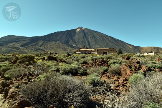
Modern eras have brought lots of different needs and technologies, and both become one when we think about harnessing nature. The Aswan dam is one of such examples. There are actually two of them. The Old Aswan Dam was built in the wake of the 20th century (1899 – 1902), and the newer, Aswan High Dam was completed in 1970, creating Lake Nasser. The rationale was securing fresh water for Egypt and stopping the dependence on the Nile floodings; however there have been associated problems – not only environmental such as the habitat of the Nile crocodile and the loss of fertility in the delta; thousands of people were displaced from the to-be-flooded area, and houses and whole villages were swallowed by water. A lot of these villages had their own cultural heritage, which was to disappear forever. Thus started Unesco’s International Campaign to Save the Monuments of Nubia between 1960 and 1980. This effort relocated as many as 24 monuments (one of them, the Temple of Debod, ended up in Madrid, Spain) to safer grounds. The temples of Abu Simbel are probably the star of the rescue efforts.

The Abu Simbel [أبو سمبل] Complex is part of the Unesco World Heritage Site Nubian Monuments from Abu Simbel to Philae. It comprises two buildings – the Great Temple of Ramesses II and the Small Temple of Hathor and Nefertari. Both of them were carved out and into a sandstone cliff on the West Bank of the Nile during the reign of Ramesses II or Ramesses the Great (14th-13th Century BCE, Nineteenth Dynasty of the New Kingdom), considered one of the most powerful Pharaohs in the New Kingdom, who reigned for many years. It was lost to time, and only rediscovered in 1813 and excavated in 1817. The Complex was relocated to higher ground between 1964 and 1968 to prevent its sinking in Lake Nasser. In order to do so, the mountain and the temples were cut into huge blocks and built 65 m higher and 200 m back from the river. The relocation managed to keep the relative position to the sun, but shifted it by one day – the temple was designed so the first ray of sun hit Ramesses’ face in the sanctuary on the 21st of October and February, and now that happens on the 22nd.

At some point one has to wonder what was more impressive – building the complex, or relocating it so you can’t really tell. The mountain itself is hollow in order to reduce the stress on the temple after the move, but wow. Just, wow.

As far as I understand, buses are not supposed to stay longer than a couple of hours in the complex. Our disembark time was 2:30, and even if I went to bed ridiculously early, I did not get much sleep because my cabin was above the motorboat rotors, and my cabin vibrated like hell. Before we left, we had a choice of coffee or tea, and we were given a “picnic” consisting on some sweet bread with… buffet leftovers, a piece of fruit and a small juice – that was traded often.

The trip each way was 3.5 hours, so we wanted more than the 30 minutes the tour guide wanted to give us, and we were there between 6:30 (though we did not enter the site until a bit later) and 9:00. Fine, I own up – I was late coming back and only made it to the bus at 9:08. The tour guide was so not amused by that.

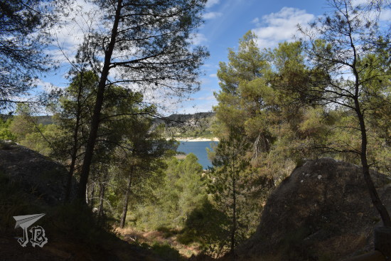
Arriving at the Abu Simbel site, you approach from behind the mountain, and as you surround it, you’re greeted by Lake Nasser [بحيرة ناصر], the reservoir created by the dam. The sun was climbing up slowly when we arrived, still with sunrise colour.

Sunrise over a lake. There is a lonely palm tree on the left

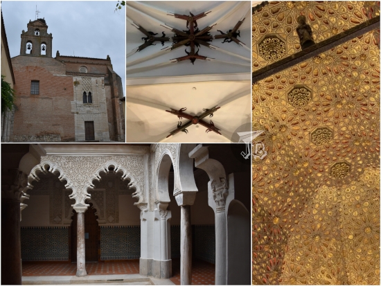
You keep turning and you are greeted by the four colossi that flank the entrance to the Great Temple of Ramesses II. The colossi represent deified Ramesses II, to whom the temple was dedicated along the gods Amun, Ra (in his Ra-Horakhty advocation) and Ptah (creator of the world and patron of craftsmen). The inside features a hypostyle hall with columns carved in the shape of Ramesses colossi, a colonnade hall and the inner sanctuary, where the venerated gods were revered.

Panorama of both Abu Simbel temples: Ramesses II to the left, Nefertari and Hathor to the right. The sky is blue, the monuments are orange-gold, and a lot of people gather at the entrances.

Collage of the Great Temple of Ramesses II: façade with four sitting colossi; inner hall, with colossi against the columns; an carving of Ramesses in a war position; inner sanctuary with the gods and Ramesses sitting, the light hitting their faces.

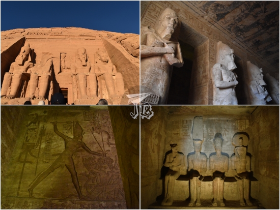
To the right stands the Temple of Hathor and Nefertari. Here, Queen Nefertari is represented as big as Ramesses and shown with the horns of the goddess Hathor, both signs of her importance (consorts were usually represented knee-high of their kings). The inner area has a hall with rectangular columns carved and painted, and the sanctuary features Hathor as a cow emerging from the mountain rock.

Small Temple of Abu Simbel colllage: Entryway with the colossi; inner hall with the face of Hathor carved into the columns; carving of Nefertari with the goddess' crown; inner sanctuary with the image of a woman with a cow head coming out from the wall, the light hitting her face

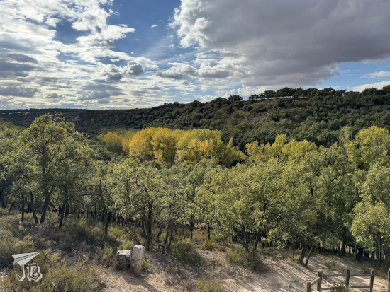
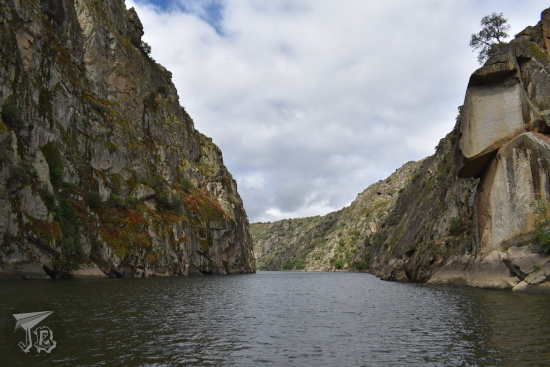
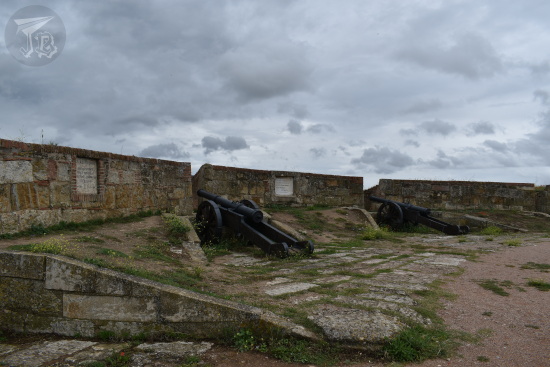
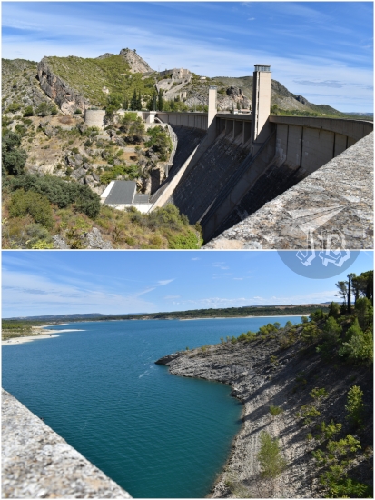
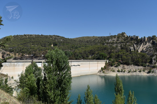
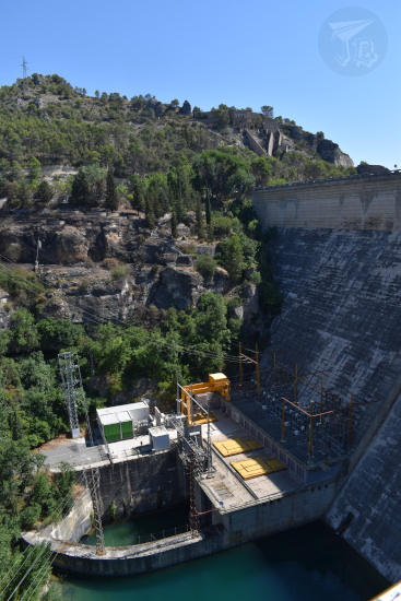
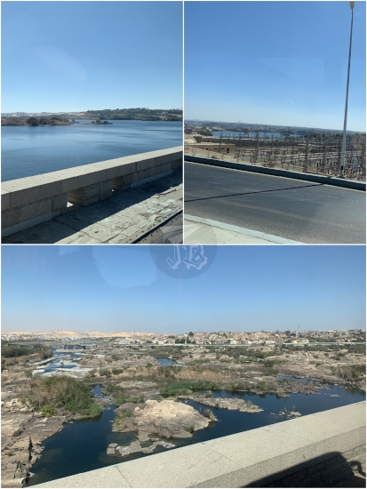
Despite really, really not wanting to leave, I made my way back and ran into two other people from the group. We had to leave through the tourist bazaar and were just slightly late. On the way back, slightly more awake than when we had left, we did not get to see any mirages, but we crossed the old Aswan Low Dam [خزان أسوان]. We had a view of the power plant on one side, and on the other side the First Cataract of the Nile, a series of rapids that have been slowed down by the building of the dam. In ancient times, it was believed that the Nile sprouted here and flowed both north and south. The main part of the cataract is now under the dam, and the remaining rapids have been turned into a nature reserve. There are Ancient Egypt remains and engravings in some ruins on the islands.

Views from the low Aswan Dam: southern side calm waters and power plant; northern side rapids

We were back on board the motorboat at 12:35 for lunch, and met again around 16:15 for a felucca sail on the Nile [نهر النيل] around the Aswan [أسوان] area. Before leaving, I decided to exchange 20 € into Egyptian pounds in order to have some change for the couple of meals we had outside, just in case I needed pounds to buy drinks. For convenience I chose the reception of the motorboat. They short-changed me, twice. First, they used a 23 EGP / 1 € exchange rate, while the official rate is 25 EGP / 1 €. Then, the guy at reception calculated 460 EGP and gave me 450, smirking “I owe you 10 pounds.” Stay tuned for the conclusion of the story.

The felucca sailing had been rescheduled from the following day so it could be tied to the trip through the Nature reserve and the Nubian village (and possibly to accomodate the charter flight times). A felucca [فلوكة ] is a traditional sailing boat, usually with one sail. Feluccas are still used for transportation through and across the Nile, and from ours, we caught some interesting views.

A sailboat docked with a precariously narrow plank to board it

A view of a sailboat on the Nile from another sailboat. The knots and ropes of the boarded felucca are visible in the foreground.

We got to see the Tombs of the Nobles | Qubbet el-Hawa [قبة الهوا] (Dome of the Wind), which I wish we could have visited. The tombs date back from the Old and Middle Kingdom with dignitaries and governors from the Fourth Dynasty to the Roman period buried here. The site is still being excavated, and also part of the Unesco World Heritage Site Nubian Monuments from Abu Simbel to Philae, even if it is neither Nubian nor between them.

A ruined structure perched on a bare mountain or dune. On the left there is a building, and on the right some open façades in stone.

We also sailed by the Mausoleum of Aga Khan [قبر اغاخان] and the family house beneath it. Sultan Muhammad Shah, Aga Khan III, was a religious leader among the Nizari Isma’ilism, a branch of Islam, and he was buried in Aswan after his death in 1957.

A building perched on the top of a mountain. It has a dome and several towers. A similar building stands at its feet, painted white, in the middle of a garden

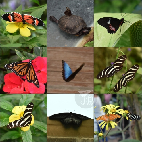
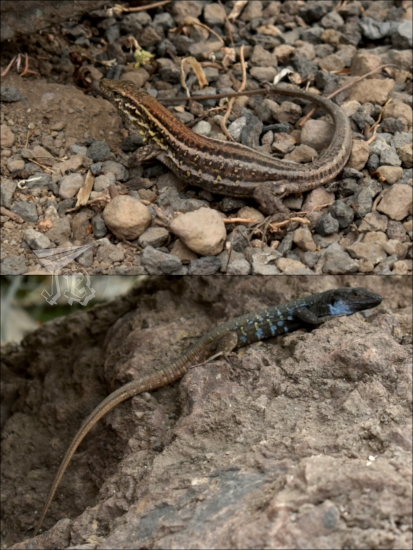
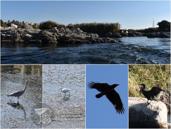
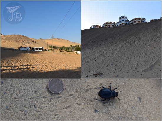
Apparently I missed some dancing as I was taking pictures of the site. Then, the people from the felucca sold us some trinkets, and finally we transferred to a different kind of engine boat, from where we sailed off towards Salouga and Ghazal Nature Reserve [محمية سالوجا وغزال الطبيعية] (the rapids formed by the First Cataract), around Seheyl Island [جزيرة سهيل], and a great sand dune. The Aswan area is famous among birdwatchers for its diversity. We got to see some glossy ibises (Plegadis falcinellus), little egrets (Egretta garzetta), reed cormorant (Microcarbo africanus), maybe an osprey or two (Pandion haliaetus), some corvids and stilts… Up the dune we made port at, we also caught sight of a couple of Egyptian beetles (Scarabaeus sacer).

Collage: a rocky island surrounded by rapidly-running water, and several birds wadding and mid-flight

Collage. Two views of a huge sand dune: the buildings look tiny against it. A picture of a scarab walking on sand and leaving its print. It is a bit biger than a 5cent coin

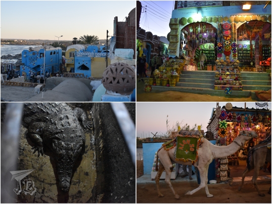
The Nubian village, Gharb Seheyl [غرب سهيل], which is little more than a big bazaar. We were invited to the house of a man who claimed to have been a dancer for the Spanish Teatro Real. We hung out there for an hour or so, and eventually were let off to walk around the village, a succession of shops selling the same trinkets as everywhere else, plus women trying to sell “Nubian dolls”. The house we were at kept live Nile crocodiles (Crocodylus niloticus), and at a lot of places we saw some mounted ones, I guess for tourist’s entertainment, but that did not feel quite right.

Collage of the Nubian village: a view from a rooftop, showing the houses painted in sand and blue colours; a shop with colourful trinkets, flowers, and statuetes; a Nile crocodile staring up; a dromedary passing by a souvenir shop.

After sunset, we sailed off back to the motorboat, without stopping anywhere, even if the whole city was lit. The boats were also shiny with neons and bright colours.

Collage: boats at night, docking and navigating the Nile. Two views of Aswan: lit ruins of the tombs of the Nobles, a mosque and a hotel

At the motorboat, we just had dinner and I went to bed early to catch some sleep. When I arrived at the cabin, I discovered that the staff had taken one of my beds away. I guess they got tired of making both of them as I used both bed covers? I was amused, just like I had been by all the figures they made out of towels (I got swans, a crocodile, and a monkey) though I wish the cleaning had been a bit more… thorough.

25th September 2022: Ruta de las Caras (Buendía, Spain)

As I had a visitor, I proposed a hiking route I had heard about as a silly adventure. The area around the reservoir Pantano de Buendía is home to an… interesting hiking route.

In the early 1990s, a couple of friends called Eulogio Reguillo and Jorge Juan Maldonado, a builder and a pottery maker, got the idea to create a sculpture on the rock. That, which in other circumstances could have be just been considered “defiling nature” became a Land art project – the two “artists” have carved gigantic faces into the sandstone, and the route has become a tourist spot – the Route of the Faces or Ruta de las Caras.

The route has been on my radar for a while (but I’d been feeling lazy about the drive) and I thought it would be a fun bizarre thing we could do together. It did not disappoint. You can do the complete route from the nearby village of Buendía, which is around 9 km, or drive up to the beginning of the route at the edge of the reservoir and hike around 2 km. We decided to do this, as the complete route did not offer much else to do / see.

The route features a lot of official and unofficial sculptures, along with graffiti on the rocks. It is circular and runs through a pine forest which makes it suitable for both warm and cold weather – as long as the roads to get to the village are not frozen. Though temperature had plopped down compared to the previous day, it was still mostly over 20 ºC, so nice enough to be out in a sweatshirt.

Pine trees with a bit of water in the background - the reservoir

The rock carvings vary in size, style and elaboration. There are some religious motives, such a couple of Christian Virgin Marys, and some figures from Indian (Hindu and Buddhist) inspiration, but the ideas are so all over the place that they probably just let the artists do whatever they felt like. While the first carvings date from the 1990s, the route is still being carved, and we missed one of the faces as it is in a “new” area which is still not signalled. Some of the sculptures we did see include:

  • Moneda de Vida – The Coin of Life
  • Cruz Templaria – Templar Cross
  • Krishna (Hindu deity)
  • Maitreya (future Buddha in Buddhist eschatology)
  • Arjuna (a character in one of the Hindu epics)
  • Espiral del brujo – The Male Witch’s Spiral
  • Chemary (short for the name “José María”, Joseph Mary)
  • Sin nombre – Unnamed (and unfinished)
  • La monja – The nun
  • Chamán – Shamman
  • Beethoven (the composer, yes)
  • Duende de la grieta – Goblin in the Crack
  • Dama del pantano – Lady of the Reservoir
  • Virgen de la flor de Lis – Virgin of the Fleur-de-lis
  • Virgen de las caras – Virgin of the Faces

Different faces and shapes carved in sandstone

Different faces and shapes carved in sandstone

Our favourite was the skull overlooking the reservoir, called De muerte – Deadly – which one could actually climb – noooot absolutely sure it was “legal”, but the rules only said “do not carve or alter the rocks” and the sculptures are coated in a protective liquid. And after all, this started as a random art-vandalism thing.

Large skull carving (top) + the look from the viewpoint - the reservoir is pretty depleted, there is a lot of sand, but also some green trees (bottom)

On the way back we stopped at the dam that closes off the Reservoir Presa del Pantano de Buendía, where we played with the echo.

Massive concrete dam, and the water behind it, a rich azure. The water looks cool.

Then, we moved on and once again stopped at the dam in the Entrepeñas reservoir Presa del Pantano de Entrepeñas – and I got the exit wrong again afterwards, exactly like the previous time. We saw a flock of vultures, and as they were circling in search for prey, they were a ‘kettle’.

The silhouette of two vultures circling

To end the day with befor my friend was off to the airport, we headed back and stopped to have lunch at a tiny Mexican place in the shopping centre on our way. And there I discovered that yes, there is such a thing as too much cheese on nachos. In the end, we walked around 4.11 km (6464 steps), so I think we were allowed to deal with the junk-y food.

Nachos + tacos. Everything looks a bit greasy.

13th September 2022: Wadi Rum (and the bus) {Jordan, September 2022}

I had a boiled egg, potato hash-browns and coffee breakfast because my body was craving salt, I guess. Then we set off on the bus, where we ended up spending around seven hours (the 412 km are supposed to be done in 5 hours and a half, but that does not take into account bad traffic). Urgh. Our first stop was a viewpoint over the whole canyon area.

Wadi Musa valley panorama, showing the deep gorge from above

The second stop was a souvenir shop that had probably somehow bribed our guide or driver for it. None of us even bought anything, but we were forced to be there for about half an hour before we could continue to the only organised activity for the day – a two-hour jeep tour throughout the Natural Reserve and Unesco World Heritage Site of Wadi Rum | Wādī Ramm [وادي رم]. It is the largest wadi “valley”, created by alluvial fans and wind deposits, rather than the idea of a river bed. They are often found in deserts.

During the tour in Wadi Rum Reserve [محمية وادي رم] we drove through the desert and stopped at some rock formations that had built a gigantic dune. Wadi Rum used to be a granite and sandstone rocky formation. Thousands of years worth of wind eroded the sandstone back to sand, forming and shaping the desert dunes. Huge granite structures still stand, such as the Seven Pillars of Wisdom [عمدة الحكمة السبعة], just at the beginning of the route. One of the stops is the tourist-named Big Red Sand Dune, which you can climb for kicks, giggles and some nice views of the landscape.

Driving into Wadi Rum. The roof of the jeep is visible, along with a rock formation in the background. Between us and the rock formation there is the other jeep, causing a dust cloud

Back of a dune we had to climb, and the rock + sand landscape that could be seen from the top. Wind erosion marks have created soft ridges. The rocks are red-grey and the sand is rose-gold

Then we drove off to see some petroglyphs, and were offered dromedary rides. These petroglyphs, depicting early humans and their cattle – bovines and dromedaries – are the reason for the Heritage status.

A rock wall with some dromedaries in the foreground + a close up of the petroglyphs engraved in the rock, also showing dromedaries (by JBinnacle)

Finally we were shown a Bedouin tent at the feet of the Lawrence Canyon, a beautiful rock formation with faces of Jordan monarchs. Unfortunately, we did not get to see any onyx or fennec foxes, but I did see a small lizard. The Bedouins treated us to a cup of tea, but then we had to tip the driver about 10€…

Lawrence Canyon, a deep cut in the rock filled with sand at the bottom + details of engraved faces and Arab script, a lizard and a bit of tea, along with a traditional Bedouin coffee maker

Afterwards, we started off our trip back northwards back to Amman | ʻAmmān [عَمَّان]. Though the trip is supposed to take about 4 hours, it was way more than that, and we did not arrive at the hotel until way past 18:00. We went through the security checks and ended up learning that we could not travel between floors, so we could not go to the others’ rooms using the lifts, and the stairs were blocked… Well, at least we had… views?

A view of Amman skyline in the dark

After we managed to regroup, we had dinner and decided to try to check in online for the flight next day’s flight – and I was successful. Apparently, the airline only cared about us filling in our Covid certificate to enter Jordan, we were on our own for the way back.

10th July 2022: Reservoirs (Buendía & Entrepeñas, Spain)

I tried going for a hike because I was feeling cooped up, and tried to make the most out of the draught Spain is going through. The centre of Spain is sprinkled with large reservoirs, a lot of them built during Franco’s dictatorship as part of the efforts to get the country to recover from the war. The reservoir Embalse de Buendía is fed by the river Guadiela and it was finished in the year 1958. Before that, there used to be a bathing complex used by the royals, along with a village there. I have wanted to get there for a while, but it is tricky because the trail is reported to be in bad condition. So I decided to walk down the trail Camino de La Isabela to gauge whether my small city car would make it. Thus, think about this as a recognisance mission.

I parked the car at the beginning of the trail around 8:10 in the morning and started walking. I saw a small lizard which had shed off its tail, and some footprints – birds, canid, and I’m pretty sure a deer.

Close-up of a brown lizard which is growing its tail back.

Collage of animal footprints: paws, tallons and hooves

The temperature was nice at that time and I walked for about an hour until I got to the shore of the reservoir, then another 20 minutes or so until I got to see the derelict settlement. The water was still too high so I decided not to walk there.

A view of the reservoir. The sun is shining and there are some green / yellow plants ashore.

The reservoir. On one of the inlets you can guess the ruins, along with some columns that peek over the water.

I just hung out at the shore and found a bunch of dragonflies (I think Sympetrum fonscolombii red-veined darters (female and male)). Then I started walking back, because the temperature was rising fast.

A yellow and a red dragonfly.

I made it back to the car around 11:00 and drove off towards a second reservoir in the area, Embalse de Entrepeñas. I have driven by more than a few times, and I would always be drawn to a little side road that seemed to overlook the reservoir. It is actually the beginning of a hiking trail, but it was already too hot to keep going. Instead, I peered around the actual dam and hydroelectric station.

A white-grey dam closes the reservoir. There are trees in the foregrond and the water looks almost turquoise.

The electricity power-plant that is fed by the water behind the dam. There are a lot of wires coming out at different heights.

It was too hot to do anything, the beginning of the heat wave, so I just drove off and made a stop to see some friends on the way. I’ll keep an eye on the water level of the reservoir Embalse de Buendía in case I can come back to the area, now that I’ve figured out how far I can reach with the car.

Walking distance: 16846 steps / 11.76 km

31st May 2022: Anaga {Tenerife, birthday 2022}

I got up on the early side as I had booked breakfast at 8:00. I was surprisingly not hungry, even if I had not finished dinner the previous evening. My plane was a little before 17:00 and I had to return the car at 13:30 (I must have messed up the time, because I was convinced I had chosen 14:30). however, there was still one spot in the island I wanted to check out – the Nature Reserve Parque Rural de Anaga, in the north of the island and about half an hour’s drive away from the airport. This is a mountain area covered in primitive subtropical moist broadleaf forests, called laurisilva canaria. The mountain range is the oldest part of the island of Tenerife.

During the Tertiary Period, the whole Mediterranean area was covered in forests which had wide, dark leaves. They disappeared with the glacial era that started with the Quaternary. The forest has not changed nor evolved with time, so it has remained as it was 40 million years ago. It was preserved in several humid areas due to the wind patterns while the continents dried out and deserts opened. Sometimes, these forests are called laurel forests, as laurel (Laurus novocanariensis) is one of the typical plants. There are other trees as tils (Ocotea foetens), bushes, vines, ferns and mosses.

I drove around two hours to get from the Parador to Anaga, and was lucky to snatch one of the last parking spots. I asked at the visitor’s centre about a route that was not too long and I was recommended a two-hour one, called Bosque de los Enigmas, the Enigma Forest.

The beginning of it was really cool. The tils and the laurels twisted almost magically and I was alone on the path. I saw some birds, though capturing them on camera was hard, possibly a grey wagtail (Motacilla cinerea) and a female blackbird (Turdus merula; which is not really black). Aside from being a nature reserve, Anaga is also a bird protection area.

A path into the primitive forest. The trees curve over and around the trail, and everything is dark

A shot up a tree, the trunk is covered in moss

An old waterway or river bed turned into a path. There are walls of dirt to the side, and the roots of the trees are showing

Collage: a grey fluffy bird looking at the camera, and a black one with its back turned, completely ignoring it.

At some point, unfortunately, I lost the trail. I reached the viewpoint Mirador de Zapata going in the wrong direction. Though the weather was very appropriate for an evergreen subtropical forest, this meant that I could either backtrack, or go along the road for a while. I decided on the side of the road as that way I knew how long I would take to reach the parking lot.

A view of the tree tops from above. In the backgrond, partially obscured by the thick fog, there is a village, and the sea is beyond it.

I eventually reached the beginning of the trail again and I had not been run over a car, which was a plus, and before leaving I could look over a second viewpoint Mirador de la Cruz del Carmen, which offers a peek onto the whole massif.

Traces of water runoff paths, which have eroded the soil and torn some trees down

A view of the tree tops from above. In the backgrond, partially obscured by the thick fog, there is a village, and volcanic mountains beyond it.

After this, I drove back to the airport to turn back the car and have some lunch. I had hoped that the smaller airport would be less strict than one of the big hubs, but it turned out they were even more vigilant. So off with the shoes again. We took off at the brink of time, landed at the expected hour… and on the way back home got caught in an hour-long double traffic jam. Ho boy!

All in all, nothing really went according to plan, even if the plans were just a draft. But all in all I had a good time and got to spend some time with myself, which I desperately needed. So yay luckiest unlucky trip ever!

29th May 2022: La Orotava, Icod de los Vinos & Parque Nacional del Teide {Tenerife, birthday 2022}

I got up rather early in the morning (especially considering that the Canary Islands are an hour behind my usual time zone) and I was surprised at how many people there were already on the streets of Santa Cruz de Tenerife before 8:30 on a Sunday morning. I drove out of the town and headed north-west, where I came across my first stop – a viewpoint of Mount Teide called Mirador de Humboldt honouring the German explorer from the late 18th century (though I kept thinking that there was a missing penguin opportunity there). The viewpoint overlooks the ocean and Mount Teide, which Humboldt climbed in 1799.

Mount Teide, a volcano, looms in the background. The top is bare and barren, but the slopes look green and fertile, with plantations and some villages. In the foreground, there is a bronze sculpture of Alexander Humbolt, sitting on the low wall of the lookout, and looking to the side.

I continued driving towards La Orotava, the municipality which Mount Teide actually belongs to. After parking the car, I walked towards the historical centre and ended up at the square Plaza de la Constitución, which stands next to the church Iglesia de San Agustín. Mount Teide loomed over the streets, ready to celebrate Pentecost Sunday. And guess what? The main church is called… Parroquia Matriz de Nuestra Señora de la Concepción. The initial hermit church was built in the 15th century, and it was completely rebuilt in the Baroque style throughout the 18th century, though the interior was remade in the 19th century and there was yet another renovation in the 20th century. It is considered the most important building of the Canarian Baroque.

A collage of La Orotava. The buildings are built with white plaster and black volcanic rock. Mount Teide peeks from the background.

The most representative construction in La Orotava is the “house of balconies” Casa de los Balcones. The house was built in the 17th century. The façade shows a front-long balcony on the third floor, and five smaller balconies on the second, all of them made from dark teak wood. The interior holds a museum, but I decided to give that a miss because I reached there at the same time as a very disorganised group of forty or fifty people who were going in at the time.

A colonial house. It is built in white brink. It has three floors. On the ground, there are brown windows. On the first floor, five balconies, with decorated ironwork. On the second floor, a long balcony or gallery in dark wood.

Instead, I went back to the car and drove towards Icod de los Vinos. There, my first stop was the butterfly house Mariposario del Drago, since the ethnographical museum Museo del Guanche is closed.

A collage showing colourful butterflies - red, orange, blue, black, black and white. One of them is chilling on the shell of a turtle, and another one is caught mid-flight. Most are on flowers and plants.

The butterfly house stands next to a botanical park Parque del Drago built around the symbol of the town – and maybe the whole island – the Drago Milenario. This is the largest and oldest specimen of Canary Islands dragon tree or drago (Dracaena draco). Folklore says that it is a thousand years old, hence the name “the thousand-year-old dragon tree”, though in reality, it is probably around 600 years.

The dragon-blood tree. It has a knotted grey trunk and bony branches. Around it there are bright-green palm and laurel trees

The park, built around the drago, holds local species trying to reproduce the local biotopes with height, there is also a small volcanic cave. It was here where where I managed to catch my first glance at the local fauna – two of the endemic lizards (though not as big as the one I had seen in the museum): lagarto tizón (Gallotia galloti) or tizon lizard, a blue-spotted male and a brown-striped female.

Two lizards. One camouflages on the grey and brown ground. The other on has a brown tail, but the body is black and bright blue

Then I went back to the car to climb up a crazy slope until I reached the visitors’ centre of the lava tube Cueva del viento. A lava tube is a “cave” formed the flowing lava of a volcano. As the outer part solidifies, the inner core continues flowing until it empties the tube. The guided visit is the only way you can enter the tube, so I had reserved that a few weeks earlier.

The visit started with a small introduction in the visitor’s centre, with a lot of “gotcha” questions on the guide’s part. I tried really, really hard not to be a smartarse, but I did sit down on the floor at a point because I did not feel like standing around for twenty minutes. The important information we received was that there were two types of lava that had formed the island of Tenerife: pahoehoe and block lava.

Then we took the centre’s vehicles to the outer area of the cave, where we could see the solidified lava, now turned into stone. Pahoehoe lava is basaltic, it flows slowly, and it is the responsible for creating the tubes. As it flows and solidifies, it creates undulations and wrinkles. On top of it, only small trees and bushes can grow.

Old Pahoehoe lava trails. The rock looks wrinkled or similar to pillows.

Block lava is more acidic, with a higher silica contents, it flows less and creates “blocks” as it solidifies. Pines can be found growing on top.

Pines around an old colada, which seems rocky and broken.

The cave itself was very cool. Unfortunately, there were a couple of families with kids and grandparents, all trying to be braver than the next – and thus acted loud and boisterous. More interesting information – mummified guanche aboriginals had been found in the cave, along with remains of a giant rat and lizard that were the ones reproduced in the Museo de Ciencia y Antropología de Tenerife. It is one of the biggest lava tubes in the world, with up to three levels and maybe 18 km of tunnels, though only a short walk can be had.

Inside the lava tube. It looks alien, like the rock is going to start dripping any second

Back in the parking lot, I had a snack and headed off towards the Parador de las Cañadas del Teide, where I had booked my next couple of nights. On the way, I went through several amazing volcanic landscapes that I could not photograph as I was driving. However, I did stop at several lookouts throughout the Parque Nacional del Teide.

Mirador de Samara.

Pines growing up on the dusty remains of a lava flow. In the background, there are three mountains - three craters of the same volcano

Mirador de las Narices del Teide, which shows the collapse on the mountain during the last known eruption.

A view of the black collapse of lava from the last eruption. Everything is barren, brown and grey, except for a black spillage coming down ominously. The sky is blue in the background, which makes the whole thing look even more bizarre.

Mirador Zapato de la Reina.

The top of Teide. This is the point where vegetation has become scarce, with low bushes, that creep up the slope. The summit looks naked.

Finally, I arrived in the area of Las Cañadas del Teide or Las Siete Cañadas where the Parador de las Cañadas del Teide stands. I was lucky that the season was good to see the flowering bugloss Echium wildpretii (tajinaste in Spanish), an endemic flora species mostly found on the Teide slopes. After checking in I wandered around the different tracks and paths – Cañada Blanca, Roques de García and Mirador de la Ruleta, which show the different stages of various volcanic eruptions.

Mount Teide rises in the background. It looks wrinkled due to the different eruptions. At its foot, a low building, looking completely out of place. In the foreground, small bushes in grey and green.

Collage: Different rocks and structures created by lava and erosion, the rocks are reddish or grey, and they have weird shapes. The tajinaste is a tall bush, with tiny red flowers, it stands about 1m above the rest of the plants.

I turned in early, and I had booked my dinner in the Parador both nights I’d be sleeping there, so that was an easy one. The staff made it a little awkward though, even if I was not the only solo traveller around. After dinner, I tried to get some pictures of the night sky, but I was unsuccessful.