30th May 2022: The Slopes of Mount Teide {Tenerife, birthday 2022}

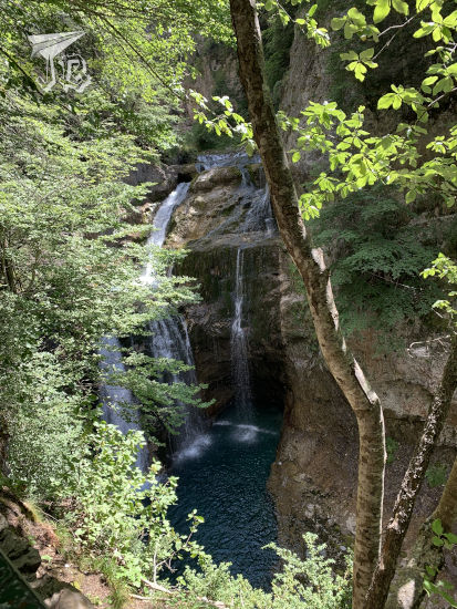
Due to the amount of near-misses, I had started thinking about this as the luckiest unlucky trip in a long time. Unfortunately, this was the day the luck ran out. As I woke up and turned on the phone I received the notification that the cable-car to go up Mount Teide was closed due to bad weather, which was a bit of a blow. I mean, I was in the middle of the natural park, without anything to do within a couple of hours by car as the hiking trails are closed on Monday mornings as it is then when the mouflon population is controlled – using rifles. I did not want to end up shot.

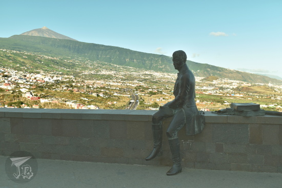
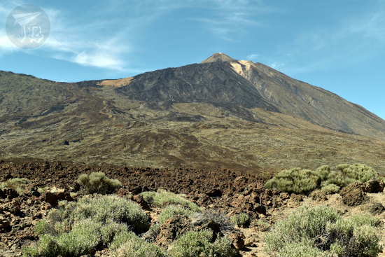
If you consider that the island Tenerife is one big volcano, Mount Teide is the most famous eruptive fissure. Considering it an independent item, it is a stratovolcano. The cone stands around 7500 metres from the sea floor, with an emerged 3715 m above sea level. Its base is located on a previous crater called Las Cañadas. Mount Teide last erupted in 1909, so it is still considered an active volcano, and it hosts a bunch of towns on its slopes, that might get obliterated in an eruption. Aside from being a National Park, the area is a Unesco World Heritage Site.

Historically, an eruption was reported by Christopher Columbus in 1492. Most recent eruptions happened in 2805, 1798 and 1909. Looking back, Mount Teide formed around 160,000 years ago, after the collapse of Las Cañadas. The last summit eruption happened in the 9th century, which caused the black lava blocks that seem to run down the slopes.

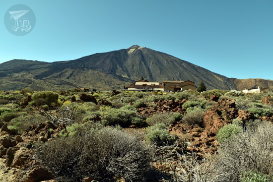
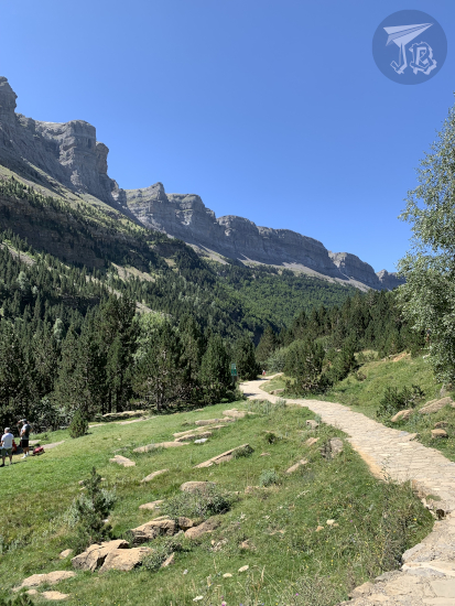
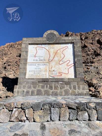
The whole point of my being there was going up the mountain, so I resolved to try and do that. I knew there was little chance I could make it to the top even with the access permission, but I would try. I decided to gamble the track Sendero de Montaña Blanca, which is the most typical one. For this, I had a good breakfast and started walking around 9:45 am. The track runs 8 km and starts at an altitude from 2348 m. If you have the permission, you can access the track Sendero de Telesforo Bravo that peaks the volcano at 3718 metres.

A stone and tile marker, with a map of the trail.

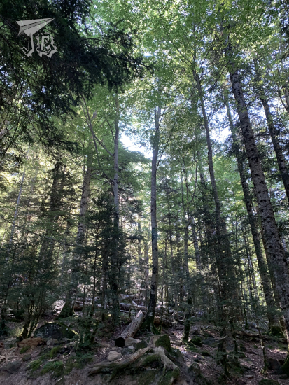
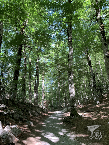
The first part of the morning, I spent on Montaña Blanca. I hiked around 3 km upwards in an hour or so. A park ranger told me that the bad weather was actually strong winds and to be careful. I’d never hiked with wind, so I decided that I would not do anything stupid. As I walked, I went by the accretion balls affectionately called “Teide Eggs” Huevos del Teide.

Collage: The Montaña Blanca trail. The landscape is desertic, reddish and brown, and there is barely any vegetation. When turning back, the sea peeks in the distance, and when looking up there are black rocks from an eruption.

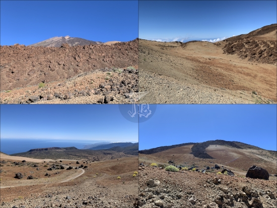
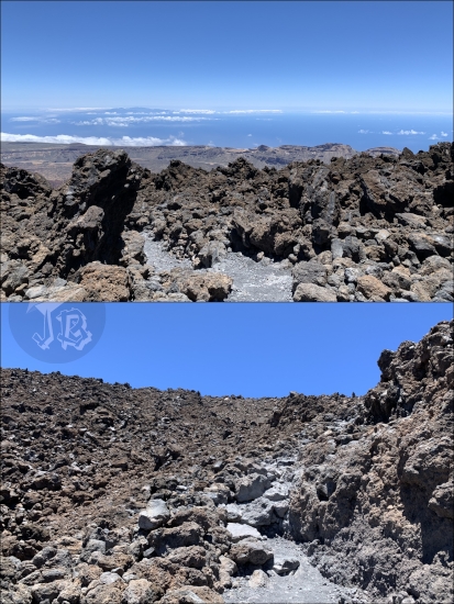
Eventually, I reached the actual foot of Mount Teide, and this is when things got hard – and spectacular. The slope became much steeper and the wind made it hard to move forward. I walked between the two dark petrified lava flows, and could see Montaña Blanca and the Atlantic Ocean beneath.

View from the slope of Teide. Montaña Blanca is underneath, in red-gold. To the sides, the black and dark grey rocks trailing the old lava flows

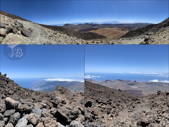
I reached Refugio de Altavista at 3260 m around 14:00. At this point I was two kilometres away from the next station and 650 m away from the crater. Unfortunately, the elevation was still around 500 m. At this point the wind was very strong and shortly after the refuge I saw an area of the slope I knew I could climb up… but I knew I wouldn’t climb down with such strong wind, not safely. So I realised I had to turn back, even if that meant I wouldn’t see the peak, much less reach it. However, it was the sane thing to do.

Standing in the middle of the two solidified coladas - looking down there are black and grey rocks, and the sea in the horizon. Looking up, only more rocks.

It took me two and a half hours to hike down, and I made it back at the Parador around 17:30. I had a shower and I felt tired, though not as sore as I imagined. For dinner, I tried some local speciality “wrinkled potatoes” papas arrugadas, which are boiled in saltwater, and they are so high-class that can be eaten without being peeled. They come with some dips, a bit too spicy for my taste, but they were delicious.

Small voiled potatoes and three small bowls of sauces. The potatoes are unpeeled and they look wrinkled.

I was a bit bummed that I did not manage to reach the crater, but I think I did a good job, almost 1000 metres up and down. I guess it just meant I had to go back at some point…

29th May 2022: La Orotava, Icod de los Vinos & Parque Nacional del Teide {Tenerife, birthday 2022}

I got up rather early in the morning (especially considering that the Canary Islands are an hour behind my usual time zone) and I was surprised at how many people there were already on the streets of Santa Cruz de Tenerife before 8:30 on a Sunday morning. I drove out of the town and headed north-west, where I came across my first stop – a viewpoint of Mount Teide called Mirador de Humboldt honouring the German explorer from the late 18th century (though I kept thinking that there was a missing penguin opportunity there). The viewpoint overlooks the ocean and Mount Teide, which Humboldt climbed in 1799.

Mount Teide, a volcano, looms in the background. The top is bare and barren, but the slopes look green and fertile, with plantations and some villages. In the foreground, there is a bronze sculpture of Alexander Humbolt, sitting on the low wall of the lookout, and looking to the side.

I continued driving towards La Orotava, the municipality which Mount Teide actually belongs to. After parking the car, I walked towards the historical centre and ended up at the square Plaza de la Constitución, which stands next to the church Iglesia de San Agustín. Mount Teide loomed over the streets, ready to celebrate Pentecost Sunday. And guess what? The main church is called… Parroquia Matriz de Nuestra Señora de la Concepción. The initial hermit church was built in the 15th century, and it was completely rebuilt in the Baroque style throughout the 18th century, though the interior was remade in the 19th century and there was yet another renovation in the 20th century. It is considered the most important building of the Canarian Baroque.

A collage of La Orotava. The buildings are built with white plaster and black volcanic rock. Mount Teide peeks from the background.

The most representative construction in La Orotava is the “house of balconies” Casa de los Balcones. The house was built in the 17th century. The façade shows a front-long balcony on the third floor, and five smaller balconies on the second, all of them made from dark teak wood. The interior holds a museum, but I decided to give that a miss because I reached there at the same time as a very disorganised group of forty or fifty people who were going in at the time.

A colonial house. It is built in white brink. It has three floors. On the ground, there are brown windows. On the first floor, five balconies, with decorated ironwork. On the second floor, a long balcony or gallery in dark wood.

Instead, I went back to the car and drove towards Icod de los Vinos. There, my first stop was the butterfly house Mariposario del Drago, since the ethnographical museum Museo del Guanche is closed.

A collage showing colourful butterflies - red, orange, blue, black, black and white. One of them is chilling on the shell of a turtle, and another one is caught mid-flight. Most are on flowers and plants.

The butterfly house stands next to a botanical park Parque del Drago built around the symbol of the town – and maybe the whole island – the Drago Milenario. This is the largest and oldest specimen of Canary Islands dragon tree or drago (Dracaena draco). Folklore says that it is a thousand years old, hence the name “the thousand-year-old dragon tree”, though in reality, it is probably around 600 years.

The dragon-blood tree. It has a knotted grey trunk and bony branches. Around it there are bright-green palm and laurel trees

The park, built around the drago, holds local species trying to reproduce the local biotopes with height, there is also a small volcanic cave. It was here where where I managed to catch my first glance at the local fauna – two of the endemic lizards (though not as big as the one I had seen in the museum): lagarto tizón (Gallotia galloti) or tizon lizard, a blue-spotted male and a brown-striped female.

Two lizards. One camouflages on the grey and brown ground. The other on has a brown tail, but the body is black and bright blue

Then I went back to the car to climb up a crazy slope until I reached the visitors’ centre of the lava tube Cueva del viento. A lava tube is a “cave” formed the flowing lava of a volcano. As the outer part solidifies, the inner core continues flowing until it empties the tube. The guided visit is the only way you can enter the tube, so I had reserved that a few weeks earlier.

The visit started with a small introduction in the visitor’s centre, with a lot of “gotcha” questions on the guide’s part. I tried really, really hard not to be a smartarse, but I did sit down on the floor at a point because I did not feel like standing around for twenty minutes. The important information we received was that there were two types of lava that had formed the island of Tenerife: pahoehoe and block lava.

Then we took the centre’s vehicles to the outer area of the cave, where we could see the solidified lava, now turned into stone. Pahoehoe lava is basaltic, it flows slowly, and it is the responsible for creating the tubes. As it flows and solidifies, it creates undulations and wrinkles. On top of it, only small trees and bushes can grow.

Old Pahoehoe lava trails. The rock looks wrinkled or similar to pillows.

Block lava is more acidic, with a higher silica contents, it flows less and creates “blocks” as it solidifies. Pines can be found growing on top.

Pines around an old colada, which seems rocky and broken.

The cave itself was very cool. Unfortunately, there were a couple of families with kids and grandparents, all trying to be braver than the next – and thus acted loud and boisterous. More interesting information – mummified guanche aboriginals had been found in the cave, along with remains of a giant rat and lizard that were the ones reproduced in the Museo de Ciencia y Antropología de Tenerife. It is one of the biggest lava tubes in the world, with up to three levels and maybe 18 km of tunnels, though only a short walk can be had.

Inside the lava tube. It looks alien, like the rock is going to start dripping any second

Back in the parking lot, I had a snack and headed off towards the Parador de las Cañadas del Teide, where I had booked my next couple of nights. On the way, I went through several amazing volcanic landscapes that I could not photograph as I was driving. However, I did stop at several lookouts throughout the Parque Nacional del Teide.

Mirador de Samara.

Pines growing up on the dusty remains of a lava flow. In the background, there are three mountains - three craters of the same volcano

Mirador de las Narices del Teide, which shows the collapse on the mountain during the last known eruption.

A view of the black collapse of lava from the last eruption. Everything is barren, brown and grey, except for a black spillage coming down ominously. The sky is blue in the background, which makes the whole thing look even more bizarre.

Mirador Zapato de la Reina.

The top of Teide. This is the point where vegetation has become scarce, with low bushes, that creep up the slope. The summit looks naked.

Finally, I arrived in the area of Las Cañadas del Teide or Las Siete Cañadas where the Parador de las Cañadas del Teide stands. I was lucky that the season was good to see the flowering bugloss Echium wildpretii (tajinaste in Spanish), an endemic flora species mostly found on the Teide slopes. After checking in I wandered around the different tracks and paths – Cañada Blanca, Roques de García and Mirador de la Ruleta, which show the different stages of various volcanic eruptions.

Mount Teide rises in the background. It looks wrinkled due to the different eruptions. At its foot, a low building, looking completely out of place. In the foreground, small bushes in grey and green.

Collage: Different rocks and structures created by lava and erosion, the rocks are reddish or grey, and they have weird shapes. The tajinaste is a tall bush, with tiny red flowers, it stands about 1m above the rest of the plants.

I turned in early, and I had booked my dinner in the Parador both nights I’d be sleeping there, so that was an easy one. The staff made it a little awkward though, even if I was not the only solo traveller around. After dinner, I tried to get some pictures of the night sky, but I was unsuccessful.

18th August 2021: Hiking the Pyrenees: Ruta de la Cola de Caballo (Ordesa y Monte Perdido) {Spain, summer 2021}

The Parque Nacional de Ordesa y Monte Perdido was the second national park to be formalised in Spain, in 1918, and expanded in 1982. The area has been considered a Unesco World Heritage Site and Biosphere Reserve since 1997. The park is located in the southern area of the mid-Pyrenees range. The mountain called Monte Perdido, the “Lost Mountain” is the highest calcareous mountain in the world, which also has one of the few glaciers of Spain, and the different mountains around it create the U-shaped Ordesa Valley Valle de Ordesa. It is home to a wide variety of flora – pines, firs and beeches – and fauna – vultures, chamois and stoats among others.

Well, the plan was clear – wake up early, drive to the entrance of the national park Parque Nacional de Ordesa y Monte Perdido and hike the easy route to the final waterfall, Ruta de la Cola de Caballo. For that reason, we chose the hotel which was closest to the entrance of the park.

Then, upon arrival, we learnt that we could not drive, and had to ride the bus. In normal times, urgh, but in Covid-times, even urgh-er. Furthermore, the bus stop at the visitor centre was dead right on the other side of the village, which was not far… But in-between there was a little one-way tunnel that buses had preference for, and zero visibility when you approached from the hotel side.

Anyway, we had been fortunate enough that at least we could buy bus tickets at the hotel (because what is more Spanish than making something compulsory, then charging for it?), we had set the alarm and went to sleep… And the alarm clock did not go off. We got up a little after seven, got ready in a hurry, then drove off to the bus stop, which fortunately had a parking lot to ditch the car. By the time we arrived a few buses had already left, and there was a queue worth almost four buses worth of people before us – well, we got on the fourth bus a bit before eight. That was at least lucky, because there’s supposedly only a bus every half-hour at that time, and we were on our way just before 8 o’clock.

After a short journey we arrived at the start of the route, the valley called Pradera de Ordesa, where we had coffee and a toast to get going. Then we started walking. The problem was that my group did not really realise the difference between a walk and a hike – which ended up being exhausting.

The route Ruta de la Cola de Caballo runs through a Unesco Heritage area. It is an easy, return trail that starts at the Pradera and trails up parallel to the river Río Arazas to the high valley at the feet of Monte Perdido, called Circo del Soaso. You basically walk up and down the same route, around 18 km in six hours. If you remember, I took a bit under two and a half hours to hike the whole Cascada del Aljibe three-hour trail. This… was not like that time. By the time we had been walking for 4.5 hours, we had only reached the two-hour mark. That was the time when my group got cold feet and I continued alone, covered the remaining hour and back, and caught up with them as they walked down, in an hour and a half.

We started off at the Pradera de Ordesa, the area where the bus left us and we had our breakfast. The trail is easy to follow, marked with abundant signs, and, going straight you leave the river Río Arazas to the right. As you walk up the trail, the forest opens around you, and the trail is continuously upwards.

From the trail you can sometimes climb down to the riverbed and even stand on the boulders in the river.

As the sun came up, in the clearings of the way you could look up above the tree line at the peaks, with two distinctive colours: greys – calcites, quartz and slates – and reddish-brown – sandstone and red clays. Both these types of rocks tell that over 250 million years ago, the area was covered by the ocean.

The first milestone we reached was the waterfall Cascada de Arripas from the viewpoint Mirador de los Bucardos.

Around us, the forest stood tall and straight, seemingly holding the ground at points – mostly pines and breeches at this height.

The next spot was a second waterfall, I think Cascada del Estrecho.

As time passed and we walked, the day became brighter and the trees more scarce, giving the area a brighter look.

Eventually we ended up at the tree line for our valley – while there were still trees on other slopes, we were under the sun until we reached the next group of waterfall Gradas del Soaso – the river finds a fracture area and falls in a number of waterfalls that look like stands (gradas).

From here, the route became steeper and more arduous and my group decided to call it a day, at a quarter to one. Given the option to continue and able to do so faster, I went on and we agreed to meet back at the parking lot. I popped my headphones in, then hiked up for about thirty minutes through some stairs half carved, half built into the rocks and I eventually reached the upper valley at the feet of Monte Perdido, the cirque Circo del Soaso. A cirque is a bowl-shaped valley created by ancient glaciers.

The trail there becomes… paved for a while, which was a bit bizarre. The valley opens in front of you with Monte Perdido in front of you towards the left, and the Pyrenees stand all around you.

As I walked into the valley I spotted a small hill and behind it finally stood the end of the trail and the beginning of the valley – the biggest waterfall of the area Cascada de la Cola de Caballo (Horsetail Waterfall), which was packed!

I did not walk to the foot of the waterfall, so after hanging around for a little, I turned back, had something to drink and hiked downwards. I put the camera away as I came down in order to protect it, and picked up the pace. Around half past two I caught up with the group. I am not made for sprints but I am like an ox – once I find my rhythm I can go on forever.

On our return way, we deviated to another route to walk back, and stopped by another waterfall, Cascada de la Cueva.

Once again the pace was slow, and we eventually reached the lower valley to catch a bus around half past four, but I swear the last half hour felt eternal. By the time we reached the hotel we were too tired to explore the village, though I would have liked that. But there was ice-cream, which was nice. In the end the total walked distance clocked at 20.11 km – though the official legth of the trail is around 18 km.