22nd August 2021: Romanesque Soria {Spain, summer 2021}

We just spent the morning in Soria, in the region of Castilla y León, before we got on our way back in the early afternoon, but I have to say that the good morning sunset was spectacular.

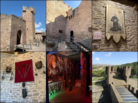
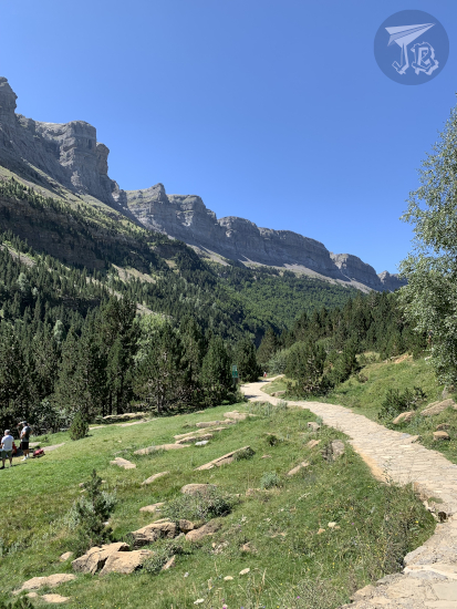
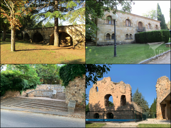
As again we had a breakfast slot at 8:00, we were out to see stuff at around 9:00. The Parador de Soria is located on the top of the Castle Park Parque del Castillo, we just had to go down. First we came across some of the ruins and the buildings that had populated the area in Medieval times.

As we continued our trek downwards we ended up at the church of Our Lady of the Thorn Iglesia de Nuestra Señora del Espino, which was closed as it was still early on a Sunday morning.

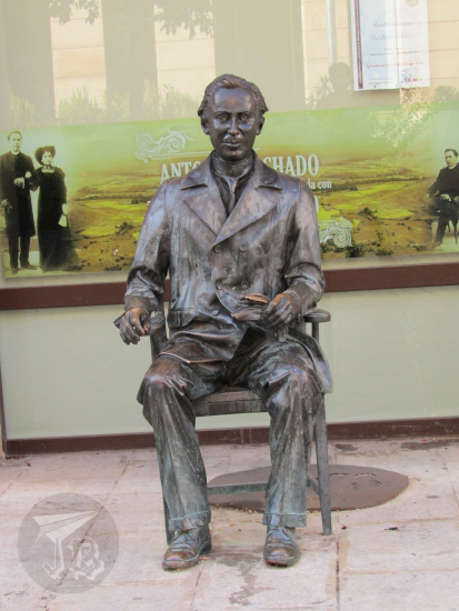
In the tiny garden in front of the church there is a dead tree that has been preserved by pouring fibreglass and other synthetic materials on it – the dry elm tree, Olmo Seco. In 1912, the Spanish poet Antonio Machado wrote a poem – to an old elm tree, struck by lightning and half-rotten, which has sprouted a few green leaves after April rain and May sun… Well, this is the tree, preserved for all to see, with the poem in a small sign (and another in Braille) right next to it.

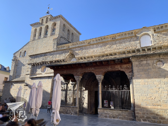
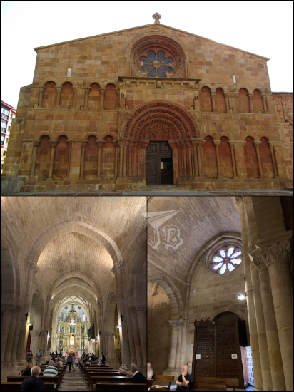
After staying there for a few minutes, we went on our trek downwards and we reached another church, the church of St. John San Juan de la Rabanera. It is known that the church had already been built in 1270. In the Renaissance and Baroque periods it was heavily remodelled, but restorations during the 20th century recovered most of the Romanesque purity. The main portal, although Romanesque too, used to be part of another church. The apse keeps all the Romanesque decoration – unfortunately, it was closed too.

We kept strolling around the town centre and came across a bunch of palaces – some of them have been repurposed into public-service buildigns such as the local government, revenue and taxes services, town’s archive, a high school… others were for sale or rent.

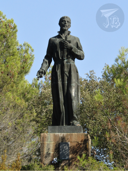
In front of the high school we found the sculpture to the poet I mentioned before, Escultura a Antonio Machado.

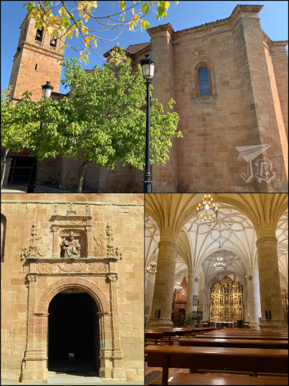
Not far from there we found the church of Saint Dominic Iglesia de Santo Domingo. Like the church of St. John, it is a reformed Romanesque temple. The most important and impressive part of the church is the main façade, in golden stone with amazing carvings (considered by some the best Romanesque façade in the country), and a rose window.

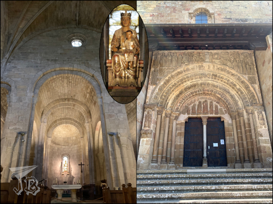
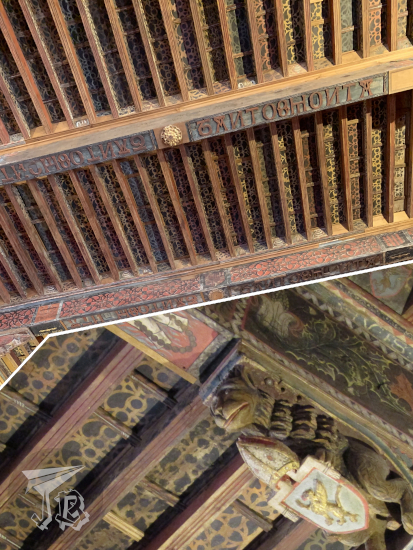
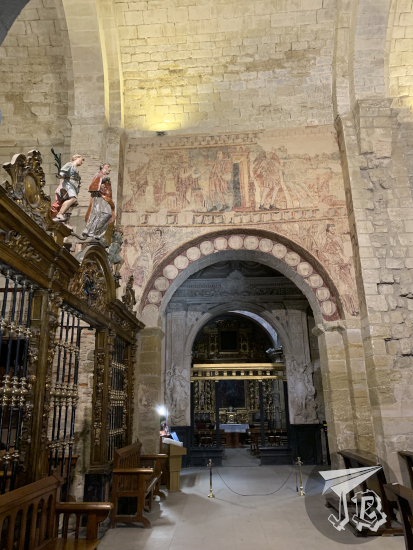
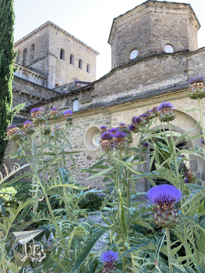
We decided to try to find the co-cathedral of St Peter Concatedral de San Pedro. Dating back from the 12th century, on the outside, it just looks like yet another Romanesque church, but that changes when you enter. When it is illuminated, the church seems to glow.

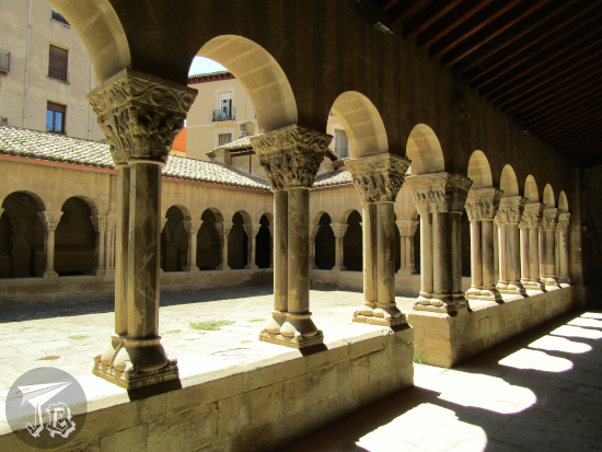
Furthermore, you can access the cloister of the former collegiate, which was also built in the 12th century as part of a now-disappeared monastery.

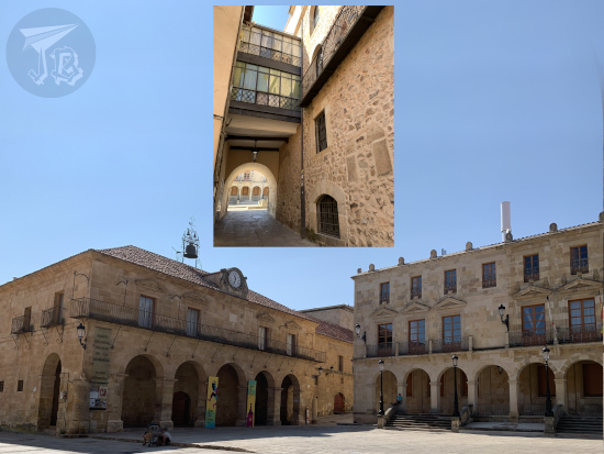
We walked back to the centre of the town. We left the main square Plaza Mayor de Soria, which I accessed through a tiny archway delimited by coloured windows, named Arco del Cuerno.

We ended up at main park Alameda de Cervantes.

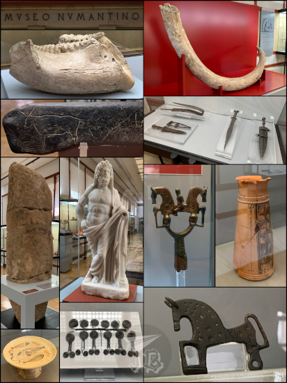
However, we were more interested in seeing the archaeological museum Museo Numantino, which was open by then – it holds a few ancient straight-Tusked elephant (Elephas antiquus), Pehistoric art, and most of the artefacts that have been found in Numantia, both Roman and Celtiberian, including Roman statues, Celtiberian weapons and drinking jars and the most famous relic of all: a tiny horse-shaped fibula (brooch) that has been adopted as the symbol of Soria.

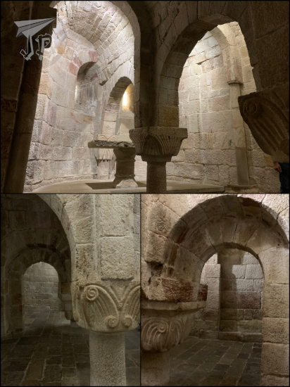
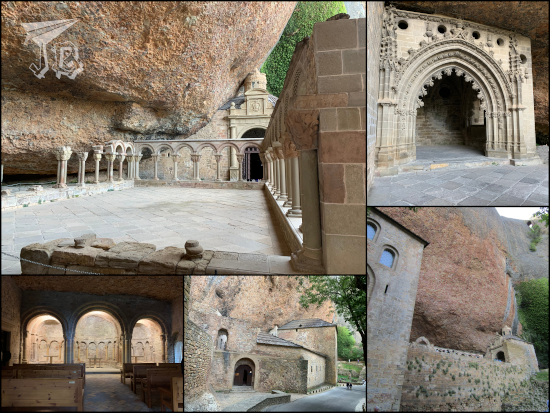
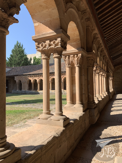
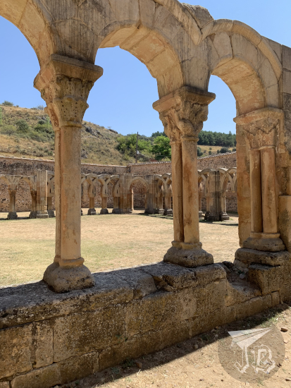
Finally, on our way out, we stopped at the ruins of the monastery of Saint John of the Douro, commonly just referred to as “archway” and not monastery Arcos de San Juan de Duero, a very cool cloister with different arc styles – a typical Romanesque one from the 13th century, and a second one that might have had Arab influence.

And with this, we drove back home for around 170 km after walking for 6.57 km. Fingers crossed for the next adventure working out!

21st August 2021: Fossil tracks and Roman ruins {Spain, summer 2021}

Enciso is a couple of hours away from Sos del Rey Católico, but to be honest it is barely even on the map. It is a tiny little village in the area of La Rioja that I had not even heard of a year ago. But at some point during this year I became aware of it – and its palaeontological importance as it is the reference point for a dozen or so sites where ichnites have been found. Ichnites or fossil tracks are marks left by dinosaurs and other prehistoric animals on the mud that eventually become fossilised. In this little village in the middle of nowhere there are around 1,400 dinosaur foot tracks. When we were in Albarracín, we saw a bunch of fossils from the time Spain was submerged under the ocean. During the Mesozoic, the area of La Rioja, and the neighbouring Soria (Castilla y León), were somewhat swampy, which lead to a lot of mud. When dinosaurs and other animals moved through the mud, they left trails that sometimes became fossilised.

Our first stop in the village was the palaeontological museum Centro Paleontológico de Enciso . This one we could have skipped – it has next to no original pieces, and it basically just has a few infographics and reproductions of different types of dinosaur legs, but we had to start somewhere.

We visited two fossil track sites. The first one was a long strip of rock called Yacimiento de Valdecevillo . In this site, there are tracks of theropods (carnivores with three fingers, usually bipeds that left clawy marks), ornithopods (herbivores with three fingers, also bipeds, that left somewhat more rounded tracks), and sauropods (four-legged dinosaurs with less-defined fingers). Some of the tracks are very easy to identify (especially the ones fenced off), others are chalked on, and sometimes they even cross each other.

Next to the rock formation, a few reproductions have been built, in order to illustrate what dinosaurs roamed the area. A family of iguanodon has been clearly identified. The sauropod looks like a generic brachiosaurus, but it could have been a turiasaurus, even. I have to say though that the carnivore theropod needs a bit of an update – but it looked adorably like those that they drew when I was a kid back in the 80s. Oh, and we also saw a real-life present-day minisaurus (aka lizard, maaaaaaaybe Spanish psammodromus Psammodromus hispanicus).

It was too hot to walk around the trail, so we hopped onto the car and drove off to the other site, Yacimiento de la Virgen del Campo.
In this formation you can “feel” the mud – the rock has ripples (water marks), and here is even a small mud collapse from an earthquake. Here we saw foot tracks again, marks of skin, and even tail trails left by ancient crocodiles. In this site there are indications of a carnivore attacking a herbivore, represented by 1:1 sculptures (maybe a ceratosaurus and an iguanodon).

Around 13:00 we got back on the car and drove off to the town of Garray for lunch and a rest near the river…s. Río Tera, a smaller current, joins one of the most important rivers in Spain, Río Duero (Douro River) under the unnamed stone bridge.

We managed to have lunch in one of the few restaurants in town, in front of the municipal fountain and the church of Saint John the Baptist Iglesia San Juan Bautista. After lunch we stayed at the river bank for a while before we moved towards our next stop.

The archaeological site of Numantia Yacimiento arqueológico de Numancia holds the remains of a Roman town, built upon an earlier Celtiberian settlement. The Celtiberian town was the centre of a number of hostilities against the Romans in the second century BCE – the Numantine War, the third of the Celtiberian Wars broke out in 143 BCE. After a decade, the Romans sent one of the heroes of the Third Punic war to suffocate the rebellion. The general cut down all the trees in the area and built a barrier around the settlement, in what has been called the Siege of Numantia, in 133 BCE. The town was completely cut off the rest of the world and after eight months of siege, the inhabitants set the town on fire. Most of them committed suicide in order to avoid being taken as slaves.

After the Roman conquerors levelled the ruins, a new town emerged, and a Roman settlement existed in the area between the first and fourth centuries CE. The last remains date back from the sixth century before the town vanished from existence and memory until it was located in the late 19th century.

Today, the site holds remains and patterns for several houses, and it has a reconstructed Roman house, an Iberian house and two pieces of the wall. The most visual building is a Roman house of the later period which still keeps a couple of columns. Unfortunately, this was 16:30 and the guided visit was long and full of useless and dull information – guess who got a sunburnt, even under an umbrella?

When we were done with Numantia, we decided to skip the complementary exhibition in Garray and drove off towards Soria, where we would be staying the night.

The Parador de Soria, our hotel, is the first modern Parador I’ve stayed in, though it stands on the mountain where the castle used to be, and the views were astonishing (I also almost forgot my stamp!!). We had dinner in the parador, which included some freshly-fried torreznos de Soria. Torreznos are a pork-based snack especially typical in the area. The pork belly is marinated with salt and paprika, cured or smoked, and finally fried – delicious but for sure a “sometimes food”. After dinner, we went to our rooms to compare the day-view with the night-view and admire the moon.

Total driven distance: 196 km. Total walking distance: 6.57 km.

20th August 2021: A Monastery and a Castle… again {Spain, summer 2021}

Sos del Rey Católico, formerly just Sos, is a small town still in the province of Zaragoza in Aragón. Its historical centre is so historical that it has been around since the 1400s. In 1452, the infante Fernando, who would go on to become the Catholic King, was born there. Back in the Middle Ages, the Kingdoms of Aragón and Castille became intertwined when Queen Isabel I of Castille and Fernando II of Aragón got married, earning the moniker of Catholic Monarchs due to their relentless fight against the Muslim Caliphates that had conquered the country long before. The trick of their marriage was that both of them remained the king / queen of their own kingdom in a very delicate equilibrium that sometimes was referred to as tanto monta.

A walk through the town yields to viewing a lot of Medieval buildings and palaces – too many to keep tack of. The wall is still standing in several places, built around the natural rock in order to make the most of the natural defences. There are a number of palaces that have been repurposed with new functions – the town hall, a school, and so on, and you can see them all in a short stroll, which we of course took. We left the hotel at around 9 in the morning because our breakfast turn was from 8:00 to 8:30 and there was not much else to do anyway.

The second reason why Sos del Rey Católico became known was the filming of an absurd Spanish comedy back in 1985. Thus, the village erected a sculpture to the director, Luis García Berlanga, Estatua a Berlanga.

The sculpture lies at the feet of the church of Saint Stephen Parroquia de San Esteban, which we could not enter, unfortunately, due to a scheduling conflict. The church has a Romanesque-style entrance carved in the 12th century, but protected from the elements by an outer portico from the 16th century. The church has an interesting shape, which tunnels and stairs, owning to the actual relief of the area.

Beyond the church stands the remains of the castle Castillo de Sos del Rey Católico, out of which the keep and a little turret still stand, albeit heavily restored. The old town was a frontier fortified area between the kingdoms of Navarra and Aragón, and it was a strategic point in Medieval times. This is why Fernando II’s mother fled there when the war started and why Fernando was born there.

The short climb yields to being able to survey the surroundings.

The whole “Fernando the Catholic King” was born here reaches its peak in the old palace called Palacio de Sada, where the King was born. Today they have turned it into an “interpretation museum” and holds some panels, an audiovisual, and reproductions of both the Catholic Monarch’s Last Will and Testament. The highlight of the palace is the Romanesque chapel and former Church of Saint Martin, Iglesia de San Martín de Tours, which still shows the painting and polychrome on the altar walls.

Shortly after 11 we went back to the car to drive to the other side of the Aragón – Navarra border, both the old kingdoms and the current areas. We had a booking for the monastery of Leyre Monasterio de Leyre at 12:30 and considering how much our Sat-Nav was trolling us we wanted to give ourself an hour of leeway. The device behaved itself and we arrived there at the right time.

Leyre is a still-active Benedictine monastery has been rebuilt and renovated, but at its core stands the church of Leyre. Standing in the middle of the mountains, it used to be a fortified monastery.

The church is based on an early Romanesque “crypt” whose goal was to flatten the terrain in order for the church to be built above it. It is an amazing engineering work, and not at all usual.

The original Romanesque church was consecrated in 1057, and it is one of the most impressive and highest Romanesque buildings I’ve ever seen. The main nave is also Romanesque, but the dome is already Gothic. There is a beautiful sculpture of the Virgin of Leyre. The entrance of the church is magnificent, carved in the 12th century with dozens of carving in stone.

We were lucky enough to have timed the visit with the monks’ Sext prayer, in Latin and Spanish, and mostly sung in the Gregorian style. Ah, and this was also a burial point for the Monarchs, but this time of Navarra… then again, eventually the Kingdoms of Navarra and Aragón became one so…

After Leyre, we got onto the car again and crossed over to the other side of the highway to the Castle of Xavier Castillo de Javier. We had lunch around the castle before we even approached the building, under Saint Francis Xavier’s glance.

The castle was the birthplace and childhood home of this Catholic saint (born 1506), famous for trying to spread Christianity in India, South-East Asia and Japan. He was a co-founder of the Jesuit order, which owns the castle now. The building has been turned into a museum about the saint.

The origins of the castle date from the 10th century, though most of its current appearance can be traced to the 11th and 13th century. Later the towers were destroyed, and in the 19th century they were re-erected, and the adjacent basilica was built. There is also a reconstructed little church were the saint was christened.

The inside of the castle holds some items from Francis Xavier’s times – real or not – some Japanese paintings and scrolls, trinkets that were brought from Asia during the preaching missions, and a bunch of dioramas. You can climb up to the keep and look at the surrounding area. Unfortunately, the guide was horrid and he just regurgitated facts that were dubious or plain wrong – for example, he claimed that a diorama that looks like a Hindu temple represented the Emperor of Japan.

One of the most interesting artefacts in the castle is a late-Gothic oak carving of Christ on the cross, which sports a faint smile. The piece is located in a tiny chapel decorated with dancing skeletons referring to the Latin expression “Carpe Diem” (seize the day).

After the castle we drove over the “border” back to Sos del Rey Católico, and after a shower and a drink, I decided to explore de historical building of our hotel, Parador de Sos del Rey Católico, and the gardens.

Driven distance: 56 km. Walking distance: 6.17 km.

19th August 2021: A Monastery and a Castle {Spain, summer 2021}

We packed up and in the morning, we continued out trip, heading generally westward towards our next destination, which was about an hour and twenty minutes away. Unfortunately, we got on a slight disagreement with the Sat-Nav again – it sent us through the secondary road and in the end we took two hours going through the curves. Thus, around 10 am we managed to get our tickets to the “royal” monastery Real Monasterio de San Juan de la Peña – which is in the middle of nowhere but technically belongs to Jaca.

The monastery is actually two (or three, depending on how you look at it). The old monastery, Monasterio Viejo de San Juan de la Peña was built in the Romanesque style, and dates back from the tenth century. Its origins, however, seem to be more obscure, related to Iberian and pagan rituals. It is excavated into / built onto the vertical wall of a natural cove occurring in a bare-rock hill or crag in the middle of the forest. It held a convent, a church, and a cloister on the first floor. From the time it was built till the time it was confiscated by the government in the 19th century, it became one of the burial points for the monarchs of the old Kingdom of Aragón and Navarra, thus the “royal” eponym.

One of the many legends regarding the monastery is that it was home to the Holy Grail between the 11th and the 14th century. Later, in the 17th century, there was a fire, and it was decided to build a new monastery. Here is what is weird – there is a building there now, the so-called new monastery Monasterio Nuevo de San Juan de la Peña. Some of the buildings have survived, but most of it is an archaeological museum / excavation of what was there, again until the liberal confiscation.

Issues: You can only visit the old monastery after buying your tickets at the new monastery. And to get from one monastery to the other, you need to take the shuttle, again, awesome during Covid times. Furthermore, there was no control of the number of people there, which resulted in an overcrowding that would have been uncomfortable in normal times, much more during the pandemic. While the bus makes sense due to the fact that there is literally no way to park around the old monastery, some crowd managing would have been necessary.

After visiting both monasteries, we went back to the awful road. I don’t know if it was the curves, the heat, that I had overdone it the day before, or all of the above but I was not feeling well. Thankfully after some food and a stop at the water reservoir Embalse de la Peña, I felt better.

We continued our way and made a stop to look at an interesting geological feature called Mallos de Riglos, which are several almost-detached vertical walls of conglomerate rock left behind by erosive processes that dragged away what used to be around them. They stand up to 275 metres high over the river Río Gállego.

This was a short stop from a viewpoint, but we soon drove on towards the next destination – after one of the most important buildings in religious Romanesque architecture, we were going to see a civil counterpart, the (self-reportedly) best-preserved Romanesque castle in the world: Castillo de Loarre. The truth is that, from afar it looks awesomely cool, though once you are inside, it loses a bit of its appeal as there is no perspective. Besides, it was too hot to hike down the hill for good views.

The keep is built on a rocky hill, and the surrounding buildings are connected to it by a number of doors and haphazard stairs and arcs. Both the main towers and the fortified wall were erected around 1287, in a strategic point between the Muslim and the Christian kingdoms battling over the place. As the Christians expanded their influence, the Muslim tribes retreated towards the Mediterranean, leaving the castle “jobless” in a way, and the castle decayed until it was restored (twice) in the 20th century.

After the castle, we went back to the car, and from there I fought the Sat-Nav (I was not the driver). When I saw that it wanted to send us through another god-forsaken secondary road full of curves for over a hundred kilometres, I advocated for 123 km of main roads and highways. I won (^◇^)y, and around half past seven we arrived in our next destination Sos del Rey Católico, where we would be staying at the Parador for two nights (of course, I got my stamp there). A great improvement from the hotel in Torla-Ordesa, and a welcome one, with awesome sunset views to go with it.

Total driven distance: 272 km. Maybe around five hours and a bit? Some of the roads felt eternal.
Total walked distance: 5.23 km.

18th August 2021: Hiking the Pyrenees: Ruta de la Cola de Caballo (Ordesa y Monte Perdido) {Spain, summer 2021}

The Parque Nacional de Ordesa y Monte Perdido was the second national park to be formalised in Spain, in 1918, and expanded in 1982. The area has been considered a Unesco World Heritage Site and Biosphere Reserve since 1997. The park is located in the southern area of the mid-Pyrenees range. The mountain called Monte Perdido, the “Lost Mountain” is the highest calcareous mountain in the world, which also has one of the few glaciers of Spain, and the different mountains around it create the U-shaped Ordesa Valley Valle de Ordesa. It is home to a wide variety of flora – pines, firs and beeches – and fauna – vultures, chamois and stoats among others.

Well, the plan was clear – wake up early, drive to the entrance of the national park Parque Nacional de Ordesa y Monte Perdido and hike the easy route to the final waterfall, Ruta de la Cola de Caballo. For that reason, we chose the hotel which was closest to the entrance of the park.

Then, upon arrival, we learnt that we could not drive, and had to ride the bus. In normal times, urgh, but in Covid-times, even urgh-er. Furthermore, the bus stop at the visitor centre was dead right on the other side of the village, which was not far… But in-between there was a little one-way tunnel that buses had preference for, and zero visibility when you approached from the hotel side.

Anyway, we had been fortunate enough that at least we could buy bus tickets at the hotel (because what is more Spanish than making something compulsory, then charging for it?), we had set the alarm and went to sleep… And the alarm clock did not go off. We got up a little after seven, got ready in a hurry, then drove off to the bus stop, which fortunately had a parking lot to ditch the car. By the time we arrived a few buses had already left, and there was a queue worth almost four buses worth of people before us – well, we got on the fourth bus a bit before eight. That was at least lucky, because there’s supposedly only a bus every half-hour at that time, and we were on our way just before 8 o’clock.

After a short journey we arrived at the start of the route, the valley called Pradera de Ordesa, where we had coffee and a toast to get going. Then we started walking. The problem was that my group did not really realise the difference between a walk and a hike – which ended up being exhausting.

The route Ruta de la Cola de Caballo runs through a Unesco Heritage area. It is an easy, return trail that starts at the Pradera and trails up parallel to the river Río Arazas to the high valley at the feet of Monte Perdido, called Circo del Soaso. You basically walk up and down the same route, around 18 km in six hours. If you remember, I took a bit under two and a half hours to hike the whole Cascada del Aljibe three-hour trail. This… was not like that time. By the time we had been walking for 4.5 hours, we had only reached the two-hour mark. That was the time when my group got cold feet and I continued alone, covered the remaining hour and back, and caught up with them as they walked down, in an hour and a half.

We started off at the Pradera de Ordesa, the area where the bus left us and we had our breakfast. The trail is easy to follow, marked with abundant signs, and, going straight you leave the river Río Arazas to the right. As you walk up the trail, the forest opens around you, and the trail is continuously upwards.

From the trail you can sometimes climb down to the riverbed and even stand on the boulders in the river.

As the sun came up, in the clearings of the way you could look up above the tree line at the peaks, with two distinctive colours: greys – calcites, quartz and slates – and reddish-brown – sandstone and red clays. Both these types of rocks tell that over 250 million years ago, the area was covered by the ocean.

The first milestone we reached was the waterfall Cascada de Arripas from the viewpoint Mirador de los Bucardos.

Around us, the forest stood tall and straight, seemingly holding the ground at points – mostly pines and breeches at this height.

The next spot was a second waterfall, I think Cascada del Estrecho.

As time passed and we walked, the day became brighter and the trees more scarce, giving the area a brighter look.

Eventually we ended up at the tree line for our valley – while there were still trees on other slopes, we were under the sun until we reached the next group of waterfall Gradas del Soaso – the river finds a fracture area and falls in a number of waterfalls that look like stands (gradas).

From here, the route became steeper and more arduous and my group decided to call it a day, at a quarter to one. Given the option to continue and able to do so faster, I went on and we agreed to meet back at the parking lot. I popped my headphones in, then hiked up for about thirty minutes through some stairs half carved, half built into the rocks and I eventually reached the upper valley at the feet of Monte Perdido, the cirque Circo del Soaso. A cirque is a bowl-shaped valley created by ancient glaciers.

The trail there becomes… paved for a while, which was a bit bizarre. The valley opens in front of you with Monte Perdido in front of you towards the left, and the Pyrenees stand all around you.

As I walked into the valley I spotted a small hill and behind it finally stood the end of the trail and the beginning of the valley – the biggest waterfall of the area Cascada de la Cola de Caballo (Horsetail Waterfall), which was packed!

I did not walk to the foot of the waterfall, so after hanging around for a little, I turned back, had something to drink and hiked downwards. I put the camera away as I came down in order to protect it, and picked up the pace. Around half past two I caught up with the group. I am not made for sprints but I am like an ox – once I find my rhythm I can go on forever.

On our return way, we deviated to another route to walk back, and stopped by another waterfall, Cascada de la Cueva.

Once again the pace was slow, and we eventually reached the lower valley to catch a bus around half past four, but I swear the last half hour felt eternal. By the time we reached the hotel we were too tired to explore the village, though I would have liked that. But there was ice-cream, which was nice. In the end the total walked distance clocked at 20.11 km – though the official legth of the trail is around 18 km.

17th August 2021: Towards the Pyrenees, via the cathedrals {Spain, summer 2021}

The total driven distance today was around 450 km, but we did that in three legs with with two visits in-between.

The first stop was Huesca, in the province of the same name, in Aragón. After ditching the car (and having our first Sat-nav disagreement for the trip), we walked towards the city centre. The first thing we peered into was a little grocer’s shop Ultramarinos La Confianza, which dates back to 1871 and is reported to be the longest-running grocer’s in Spain. Unfortunately, due to Covid restrictions there was a queue outside and we could only see it from the outside.

We proceeded to the cathedral of the Lord’s Transfiguration Catedral de la Transfiguración del Señor, a Gothic-style building that stands in the centre of the town, just in front of the council hall. The cathedral has only one tower which used to be crowned by a spire, but that was lost during the civil war. The main gate is decorated with carvings of the Apostles.

However, we did not enter through the main gate, but the lateral one which gave us access to the religious museum of the cathedral Museo Diocesano de Huesca. The museum has several art pieces from different periods, and gives access to the Gothic cloister of the cathedral, and to older structures, among them, a peek into the original Romanesque cloister.

Adjacent to the cathedral stands the Bishop’s palace, also part of the museum. The most impressive part is the hall called Salón del Tanto Monta , which sports a Mudejar wooden ceiling carved and polychrome in 1478, restored twice since then. The wording “Tanto Monta” refer to the Catholic King Fernando, indicating that he had as much importance in his wife’s kingdom as she did – I’ll get into that history titbit another day though.

We finally walked into the cathedral itself, which is presided by the high altar made from alabaster and sculpted in the 16th century by Damián Forment, the most important sculptor at the time.

Again due to Covid, we could not visit the council hall and see the painting that illustrates a rather sordid legend – the king Ramiro II called upon some treacherous noblemen under the excuse to show them “the greatest bell in the kingdom” and beheaded all of them. Some of the legends add that he used one of the severed heads as a clapper. The town hall hosts a painting by José Casado del Alisal depicting this side of the legend, even though it has been long debunked. What was open was the little church in the convent Monasterio de Nuestra Señora de la Asunción, though the most interesting part of the monastery is the building itself, in a very characteristic style using bricks that reminds of the Mudejar style.

The next stop was another monastery San Pedro el Viejo, one of the oldest Romanesque buildings in Spain. The church was used as Royal Pantheon and some of the old Monarchs of the former Kingdom of Aragón are buried there. Though it has been completed and renovated in different styles, the cloister dates back to 1140 – albeit some of the capitals have been “cloned” in restoration.

The inside of the church has been populated by Baroque chapels (urgh). However, some of the original polychromy can still be seen.

These are the main sights for the town of Huesca, so we decided to go on. We tried to find a place to have lunch, but most places were closed as the local festival had just finished. Searching, we ended up passing by and underneath the Porches de Galicia, a covered street considered a historical landmark, but there is no actual information on it that I could find.

On our way out, we walked past the fountain Fuente de las Musas, representing the Greek Muses.

The second leg of the journey took us to Jaca, where we visited the cathedral and the Diocesan museum. The cathedral of St. Peter Catedral de San Pedro Apóstol, a predominantly Romanesque building (with, of course, Baroque decoration), although the wooden ceilings have been replaced. The building itself was completed around the year 1130. The altar holds the organ and is richly decorated with frescoes.

The adjacent museum Museo Diocesano de Huesca, also called the Romanesque Museum, which contains a large number of Romanesque paintings that have been collected from the different churches around the area, and sculptures from the period. It also yields entrance to the cloister, which has a small garden populated with roses, bright purple thistles, and tiny shy lizards that ran away as I peered in.

It was a little too late to enter and walk around the old fortress Ciudadela de Jaca, the military museum, so I just walked around it. Unfortunately, the star shape is not appreciated from the ground, so take my word for it – it is star-shaped. Due to droughts, however, the moat is devoid of water, and it has been turned into a… deer park.

So after this we drove off to the final destination of the day, the small village of Torla-Ordesa, which is the entryway to the Pyrenees area on the Huesca province, particularly the nearby national park Parque Nacional de Ordesa y Monte Perdido.

We had a bit of an organisation issue here. Because the park is a National one, there is zero reliable information from the administration itself – it turns out that to reach the park you need to take the bus from the visitor’s centre in Torla-Ordesa, you cannot get there on your own (lovely for Covid times, don’t you think?). Furthermore, the park has top capacity which is measured by the buses that depart from the centre – around 30 buses, which is usually reached around 10 am in summer. This made us change all our plans. So we set the alarm for 6:30 am to get an early start, and went to bed.

As mentioned before, driven distance was around 450 km. Total walking distance: 7.5 km.