22nd June 2024: Roman ruins in the Cuenca region (Spain)

This was actually the second try for this road trip. We (read: my parents) chickened out the first time because there was a slight storm chance. Since they were organising the day, I did not complain either time. I just stayed home when it was cancelled, and happily tagged along when it was carried out.

My parent’s curiosity was piqued upon learning that a bunch of archaeological sites were free until the end of 2024. I might have been responsible for that information, but to be honest I thought nothing of it at first. They randomly asked if I knew Recópolis, and I mentioned having visited it as it was free for the year. Thus, on the 22nd of June – a few weeks later, and on the second try – with a forecast temperature at noon of 31 °C and sunny, we set off around 7:30 towards the Roman villa Villa Romana de Noheda. The villa belongs to the hamlet Villar de Domingo García, and it was discovered in agricultural land by sheer chance, as it often happens. The complex was a farm and noble residence in use between the 1st century BCE and the 4th century CE, but it had been abandoned by the 6th. While most of the villa is gone, and not even half-excavated, the floor of the main house has been dug-up. It is covered by what is said to be the largest figurative Roman mosaic in the world, and it can only be visited with a guided tour.

The mosaic would have been in the room used to receive guests, the atrium. Right in front of the main door, the mosaic tells the story of Pelops and Hippodamia. In this mythological tale, the oracle told King Oenomaus that he would be killed by his son-in-law. Thus, whenever a suitor came to ask for his daughter Hippodamia’s hand in marriage, he would challenge them to a chariot race. If they lost, they would die – this happened 18 times until Pelops came along and Hippodamia fell in love with him. For his race, Pelops received a chariot drawn by winged horses from the god Poseidon. He then offered Oenomaus’ charioteer, Myrtilus, half of the kingdom, and a night with the princess, in exchange for his help to win the challenge. Myrtilus sabotaged Oenomaus’ chariot, and the king was killed during the race. When Myrtilus tried to collect, Pelops threw him off a cliff, and before dying, Myrtilus cursed the couple’s lineage. Several of their descendants were protagonists in myths of disgrace, madness and war – such as Agamemnon, Menelaus and Orestes.

Noheda mosaic

In the middle of the room there would have been a fountain or a pool, and the mosaic surrounding it has water fauna motifs. To the sides, there are representations of male and female actors of charades. On the final side there’s a double mosaic, meaning there was a refurbishing project and a new layer of tiles was laid over a previous one, both showing different geometrical designs. There is also a parade of gods and goddesses, and the representation of the myth of Paris. Paris was chosen to judge who among the goddesses Hera, Aphrodite or Athena was the most beautiful by giving her the Apple of Discord. Each goddess promised him a reward, and he chose Aphrodite, who offered him the most beautiful mortal woman: Helen of Sparta, King Menelaus’s wife. Paris and Helen ran away, Menelaus tried to recover his wife, and the whole episode lead to the Trojan War – Menelaus was one of Pelops and Hippodamia’s descendants, so one could say that Myrtilus’ curse was at work, and the mosaic was in continuity.

Noheda Mosaic

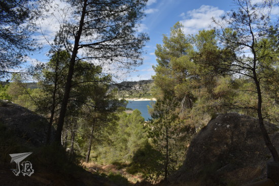
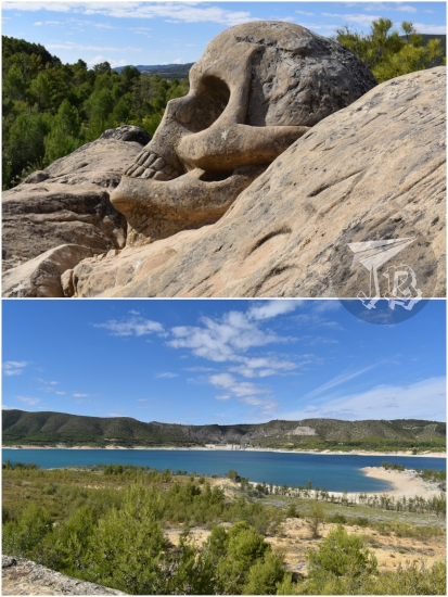
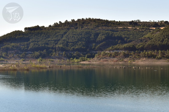
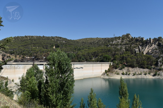
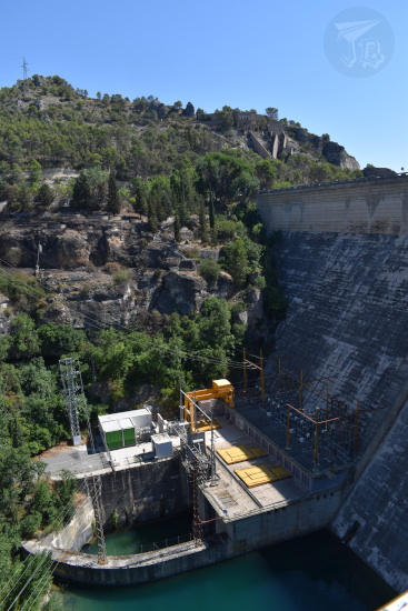
The villa really has nothing to see besides the mosaic, so we moved on. The trip to the next spot should have been around 20 minutes, but I do not know whether we got lost, or the Sat-Nav really, really overestimated the quality of the roads. Almost an hour later, we finally made it to Ercávica, a former Roman city in the tiny municipality of Cañaveruelas that overlooks the reservoir Pantano de Buendía. It clicked then that I had been thinking about getting there before but eventually dropped it in favour of other plans.

Before the tour through the ruins, we were shown a cave where a hermit-abbot, Donato ‘The African’, lived and died, and some graves excavated in the rock. The abbot lived in the 6th century, and after he died, his followers wanted to be buried around him. He actually managed to build a monastery, but everything is gone – and excavations cannot be carried out as it is in private property.

Ercavica cemetery

The Roman city of Ercávica was built around the year 179 BCE, as a new settlement after the Romans defeated the Celtiberian tribes in the area. The new dwellers were granted citizenship of the Empire, which made the city grow as neighbouring towns were abandoned and people moved there. The city reached its greatest splendour during the 1st and 2nd centuries CE, but it declined after the 3rd until it was abandoned in the 5th century CE.

There is not much left of the city but its foundations, a few centimetres of wall above ground, and some of the underground structures, such as cisterns and a small sauna – where a number of bats had made its home. The guided visit took about two hours, from noon to 14:00. It was hot and sunny, and besides the layout of the town, there was not much to appreciate – or did I get too picky after Pompeii? There were some remains of painting left, which was cool until the guide said they were printed reproductions glued on top the real ones. Bummer.

Snapshots of Ercávica ruins

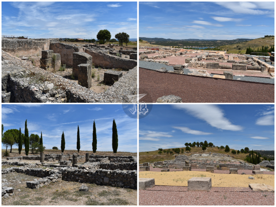
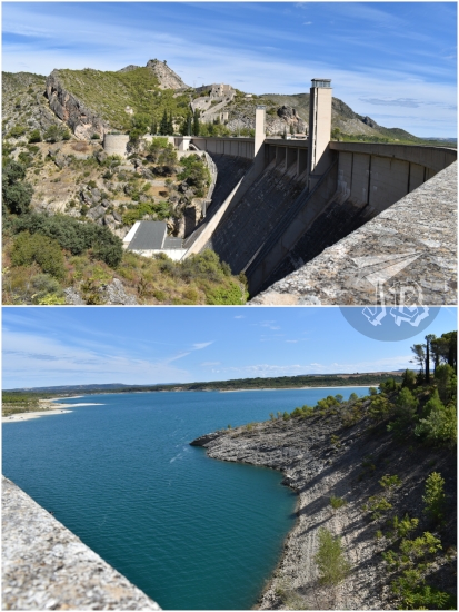
There is what they call a volumetric reconstruction of one of the houses, to give you an idea of how big it would have been, and a lot of walking around up and down the hill. There are also some good views of the reservoir. Nice seeing the whole thing at least once, but I would not put it on my to-repeat-when-possible list. I could have done without the sunburn though.

Buendía Reservoir from Ercavica forum

However, my parent had planned the road trip this way because it could be combined with lunch in a famous restaurant, Casa Goyo in the village of Alcocer. It is not a particularly good place, but it has made a name for itself by serving enormous portions. The most famous dish is the sanjacobo – a type of schnitzel cordon bleu with two fillets of pork wrapped around slices of cheese and Spanish ham, then breaded and fried. It is actually better than it sounds. Casa Goyo’s sanjacobo is 2.5 kg of meat. Quite a lot. I tried to tell my parent that combining it with a salad was too much, but they did not want to listen – which in the end it meant that I came back home with about half of the sanjacobo to consume at a later time. Unfortunately, that meant cutting the time to explore Alcocer short – to none. It was probably too hot anyway.

Sanjacobo at Casa Goyo

All in all, three experiences unlocked that I don’t think I ever need to repeat again. The best one was the mosaic, but I do not think Ercávica was worth the heat nor the roads. Nevertheless, I am glad that I could see both Roman ruins at least once. I however stand behind the idea that the cloudy day would have been better…

25th September 2022: Ruta de las Caras (Buendía, Spain)

As I had a visitor, I proposed a hiking route I had heard about as a silly adventure. The area around the reservoir Pantano de Buendía is home to an… interesting hiking route.

In the early 1990s, a couple of friends called Eulogio Reguillo and Jorge Juan Maldonado, a builder and a pottery maker, got the idea to create a sculpture on the rock. That, which in other circumstances could have be just been considered “defiling nature” became a Land art project – the two “artists” have carved gigantic faces into the sandstone, and the route has become a tourist spot – the Route of the Faces or Ruta de las Caras.

The route has been on my radar for a while (but I’d been feeling lazy about the drive) and I thought it would be a fun bizarre thing we could do together. It did not disappoint. You can do the complete route from the nearby village of Buendía, which is around 9 km, or drive up to the beginning of the route at the edge of the reservoir and hike around 2 km. We decided to do this, as the complete route did not offer much else to do / see.

The route features a lot of official and unofficial sculptures, along with graffiti on the rocks. It is circular and runs through a pine forest which makes it suitable for both warm and cold weather – as long as the roads to get to the village are not frozen. Though temperature had plopped down compared to the previous day, it was still mostly over 20 ºC, so nice enough to be out in a sweatshirt.

Pine trees with a bit of water in the background - the reservoir

The rock carvings vary in size, style and elaboration. There are some religious motives, such a couple of Christian Virgin Marys, and some figures from Indian (Hindu and Buddhist) inspiration, but the ideas are so all over the place that they probably just let the artists do whatever they felt like. While the first carvings date from the 1990s, the route is still being carved, and we missed one of the faces as it is in a “new” area which is still not signalled. Some of the sculptures we did see include:

  • Moneda de Vida – The Coin of Life
  • Cruz Templaria – Templar Cross
  • Krishna (Hindu deity)
  • Maitreya (future Buddha in Buddhist eschatology)
  • Arjuna (a character in one of the Hindu epics)
  • Espiral del brujo – The Male Witch’s Spiral
  • Chemary (short for the name “José María”, Joseph Mary)
  • Sin nombre – Unnamed (and unfinished)
  • La monja – The nun
  • Chamán – Shamman
  • Beethoven (the composer, yes)
  • Duende de la grieta – Goblin in the Crack
  • Dama del pantano – Lady of the Reservoir
  • Virgen de la flor de Lis – Virgin of the Fleur-de-lis
  • Virgen de las caras – Virgin of the Faces

Different faces and shapes carved in sandstone

Different faces and shapes carved in sandstone

Our favourite was the skull overlooking the reservoir, called De muerte – Deadly – which one could actually climb – noooot absolutely sure it was “legal”, but the rules only said “do not carve or alter the rocks” and the sculptures are coated in a protective liquid. And after all, this started as a random art-vandalism thing.

Large skull carving (top) + the look from the viewpoint - the reservoir is pretty depleted, there is a lot of sand, but also some green trees (bottom)

On the way back we stopped at the dam that closes off the Reservoir Presa del Pantano de Buendía, where we played with the echo.

Massive concrete dam, and the water behind it, a rich azure. The water looks cool.

Then, we moved on and once again stopped at the dam in the Entrepeñas reservoir Presa del Pantano de Entrepeñas – and I got the exit wrong again afterwards, exactly like the previous time. We saw a flock of vultures, and as they were circling in search for prey, they were a ‘kettle’.

The silhouette of two vultures circling

To end the day with befor my friend was off to the airport, we headed back and stopped to have lunch at a tiny Mexican place in the shopping centre on our way. And there I discovered that yes, there is such a thing as too much cheese on nachos. In the end, we walked around 4.11 km (6464 steps), so I think we were allowed to deal with the junk-y food.

Nachos + tacos. Everything looks a bit greasy.

10th July 2022: Reservoirs (Buendía & Entrepeñas, Spain)

I tried going for a hike because I was feeling cooped up, and tried to make the most out of the draught Spain is going through. The centre of Spain is sprinkled with large reservoirs, a lot of them built during Franco’s dictatorship as part of the efforts to get the country to recover from the war. The reservoir Embalse de Buendía is fed by the river Guadiela and it was finished in the year 1958. Before that, there used to be a bathing complex used by the royals, along with a village there. I have wanted to get there for a while, but it is tricky because the trail is reported to be in bad condition. So I decided to walk down the trail Camino de La Isabela to gauge whether my small city car would make it. Thus, think about this as a recognisance mission.

I parked the car at the beginning of the trail around 8:10 in the morning and started walking. I saw a small lizard which had shed off its tail, and some footprints – birds, canid, and I’m pretty sure a deer.

Close-up of a brown lizard which is growing its tail back.

Collage of animal footprints: paws, tallons and hooves

The temperature was nice at that time and I walked for about an hour until I got to the shore of the reservoir, then another 20 minutes or so until I got to see the derelict settlement. The water was still too high so I decided not to walk there.

A view of the reservoir. The sun is shining and there are some green / yellow plants ashore.

The reservoir. On one of the inlets you can guess the ruins, along with some columns that peek over the water.

I just hung out at the shore and found a bunch of dragonflies (I think Sympetrum fonscolombii red-veined darters (female and male)). Then I started walking back, because the temperature was rising fast.

A yellow and a red dragonfly.

I made it back to the car around 11:00 and drove off towards a second reservoir in the area, Embalse de Entrepeñas. I have driven by more than a few times, and I would always be drawn to a little side road that seemed to overlook the reservoir. It is actually the beginning of a hiking trail, but it was already too hot to keep going. Instead, I peered around the actual dam and hydroelectric station.

A white-grey dam closes the reservoir. There are trees in the foregrond and the water looks almost turquoise.

The electricity power-plant that is fed by the water behind the dam. There are a lot of wires coming out at different heights.

It was too hot to do anything, the beginning of the heat wave, so I just drove off and made a stop to see some friends on the way. I’ll keep an eye on the water level of the reservoir Embalse de Buendía in case I can come back to the area, now that I’ve figured out how far I can reach with the car.

Walking distance: 16846 steps / 11.76 km