18th – 20th February 2022: Extremadura, the not-at-all-wild west of Spain

With everything that keeps going on in the world, my little travel gig seems insignificant. Here it is, anyway, for the sake of completion.

18th February 2022: Jam and Ham

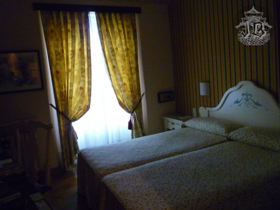
After a crazy crazy period, and within a just-slightly-less-crazy period, we made space for a mini escapade – just under 48 hours, but it was an interesting mental reset. We took the car and drove off to Cáceres after I finished work in the afternoon. The trip should have taken a little over 3 hours and 15 minutes, but we spent about 70 minutes caught in several traffic jams – or just a very long jam with different instalments.

Sunset from the road. The orange light zigzags through the grey and blue clouds

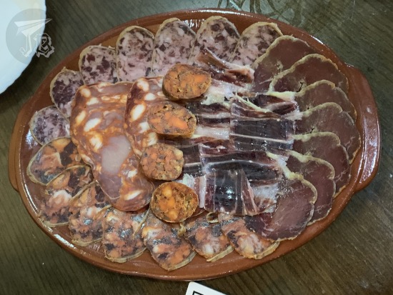
Cáceres is located in the autonomous community of Extremadura, which is famous because of its particular grassland with dwarf trees called a dehesa. The typical animal farmed in the area is the native Black Iberian pig – a traditional breed of the domestic pig (Sus scrofa domesticus). Through breeding with wild boars and millennia of adaptation, the Iberian pig has grown accustomed to eating oak acorns, and thus it has become a key part of the ecosystem. Furthermore, the breed has great tendency to accumulate intra-muscular fat. This means that its meat is delicious, especially as sausage. The most famous treat is the “Black label” (Etiqueta Negra or Dehesa de Extremadura) ham: a pig raised in the dehesa, fed acorns and natural grass, and whose meat has been cured for at least 20 months.

The area of Cáceres is also known for its sheep-milk cheese, Torta del Casar. It is a strong-flavoured creamy cheese that comes from controlled sheep, also raised in the dehesa. The cheese is especially curded with rennet made from cardoon (Cynara cardunculus). Another typical food from the area is the local paprika Pimentón de la Vera, which is made from smoked local red peppers. All three – ham, cheese and paprika – hold European Protected Designation of Origin certificates.

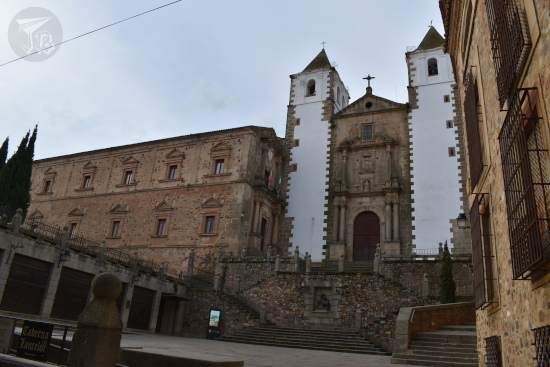
Of course, not everything is food in Cáceres. After we checked into our hotel near the historical centre, we headed off to the Main Square Plaza Mayor de Cáceres, which features the town hall, the former wall gate called Arco de la Estrella (Star Arch), and one of the watch towers Torre de Bujaco.

The medieval square of Caceres by night. It looks like a castle, with arches, battlements. The sky is completely black.

We found a place inside to grab a bite, and we tried the sausages for dinner before turning in – acorn-fed pork ham, loin, chorizo, morcón (similar to chorizo), salchichón, and patatera (pork mixed with potato and paprika in sausage form).

A plate of sausage slices and ham

Walked distance: 1.79 km (2838 steps)

19th February 2022: The Old Town of Cáceres

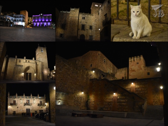
The Old or Walled Town of Cáceres, Ciudad Vieja de Cáceres was declared a Unesco World Heritage Site in 1986, and it is easy to see why. It is a small knot of streets between the ancient city walls and the gorge where cars can barely drive, sprinkled with Medieval and Renaissance palaces and manors. After finding an open café, we had breakfast, then headed off to explore that. Since it was a bit before 9 am, most everything was closed – but it was also empty, which was good. We crossed the Arco de la Estrella next to the Torre de Bujaco and walked into the walled area.

The medieval square of Caceres by daylight. It looks like a castle, with arches, battlements, and irregular bricks making up the walls.

We walked past the co-cathedral – to which we would come back later and several palaces, and we ended up at a two-level square called Plaza de San Jorge (St. George Square), towered over by the peculiar-looking church Iglesia de San Francisco Javier – note the white-painted towers.

A church with two twin bell towers, both in white. Between them, the body of the church, in grey rock. In order to access it, you have to climb a staircase, which has a small sculpture of St George attacking the dragon

There was a small palace to the left, and while the building was closed off, the gardens Jardines de Doña Cristina de Ulloa were open, albeit as it was early February, still in winter mode but for some berries and roses.

Wintery garden with bare tree. There are also evergreen bushes and trees, stairs, and benches.

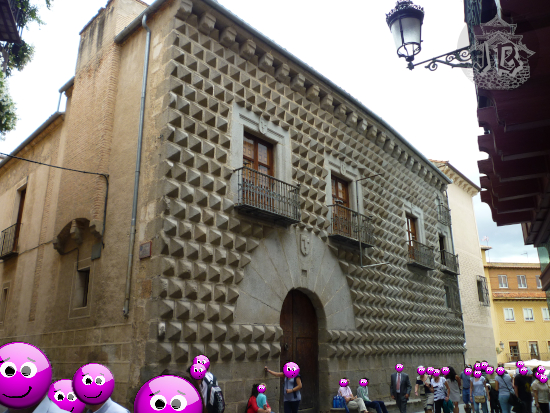
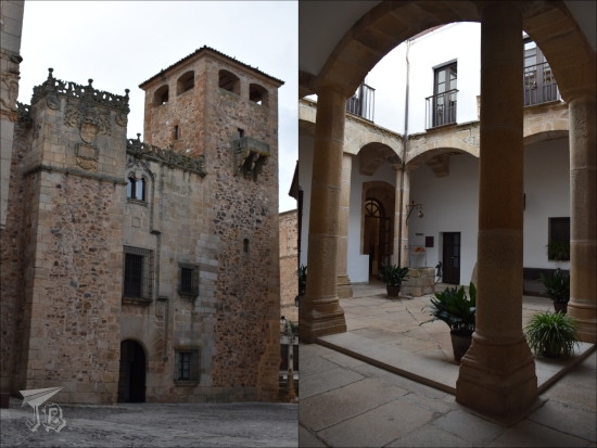
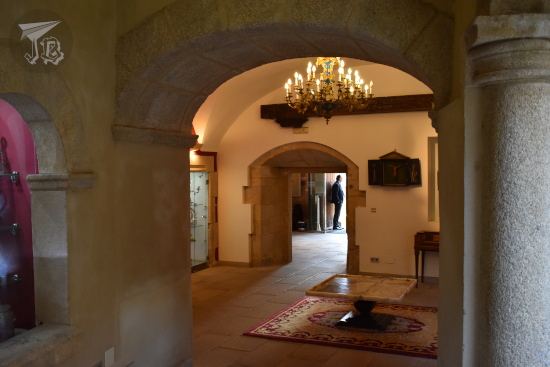
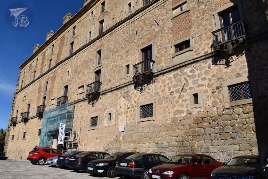
We wandered around for a while, the headed off to a visit we had booked in advance – the manor / palace of the Lower Golfines Palacio de los Golfines de Abajo, which has nothing to do with their position in the social scale, but literally the position within the city hill – in the lower part. The family is known to have owned the palace from the time of the Catholic Monarchs, in the 15th century, till the death of the last descendant in 2012. This woman willed all the heirloom to a foundation that today manages the palace. The foundation got the palace renovated and brought some of the furniture from other properties belonging to the family – among them a glass lamp way too big for the room it was set in, and a sofa which was identical to the one that used to be in my great-aunt’s living room… The lower floor holds the recreated rooms – with more or less success and taste – and a smaller area decorated with Medieval paintings which were discovered by accident. The upper floor holds a small ethnography museum and some documents from the family’s library. Unfortunately, the foundation takes itself a little too seriously and won’t allow you to roam freely in the palace or take pictures, except for the inner Castilian patio.

Gothic palace, with an ornate roof and a small cloister or patio.

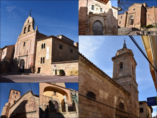
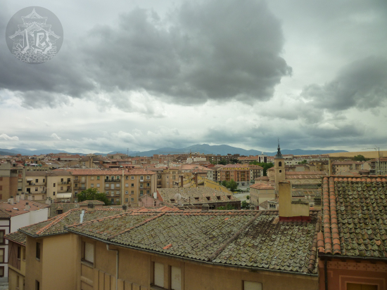
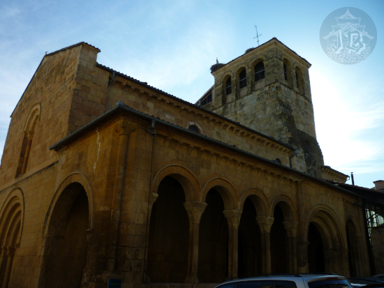
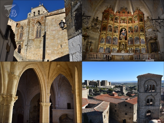
After the palace, we walked a whole minute and a half for the co-cathedral Santa Iglesia Concatedral de Santa María. It is the oldest church in town, built around the 15th century, in a Romanesque-going-Gothic style. Outside the church, at the base of the tower, there is a sculpture of Saint Peter of Alcántara. Inside, the altarpiece was carved between 1547 and 1551, in unpainted pine and cedar. The tower can be climbed, and I decided that I wanted to do that, despite not being what I usually do. It was empty enough that I felt comfortable doing so, and I was treated to some nice views.

Collage: a gothic church with a bell tower; the inside showing a bare-wood altarpiece; the sea of columns from above, and a view from the belltower, showing another church and the roofs of some low houses.

By the time we went out, the city had already been taken over by walking tours and guided visits. There were so many companies that the guides put stickers on their tourists so they could herd them round. We backtracked to the Baroque church with the white towers Iglesia de San Francisco Javier (also known as Iglesia de la Preciosa Sangre), where there is no worship today. Instead, there is a huge collection of nativities (hundreds of them, literally). In order to visit the nativities you have to go up a perilous metal staircase. Once on the second floor – after having survived the peril – I decided to continue on the relatively safer stone staircase to one of the towers – only one, I did not climb up both of them. The lower floor holds two last nativities, a classical one and a hilarious set up made out of Playmobil, a German company that makes plastic figure toys.

Collage: The interior of a church with a baroque golden altarpiece, and a collection of Nativities.

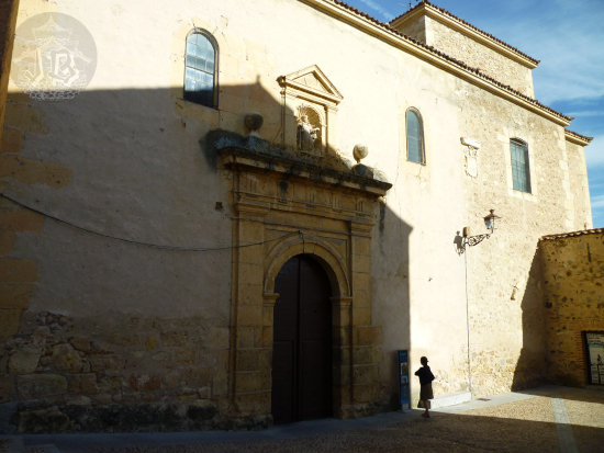
We moved onto the following manor, to the side of the square, Casa Palacio Becerra, which shows some antique elements, and the house structure.

Inside a Renaissance palace, with a low arch, a glass lamp and a red carpet that try to look eclectic and end up looking bizarre

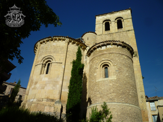
Later, we walked to Stork Square Plaza de las Cigüeñas. European white storks (Ciconia ciconia ciconia) are typical birds in Extremadura, and one wonders how they have not decided to make food out of them. In the tower stands one of the few towers that has kept its merlons, as the Catholic Monarchs were very into tearing tower tops down when they conquered a site. The adjacent manor, Casa de las Cigüeñas, hosts the military museum Museo de Armas Aula Militar.

A building with a tower. The inside is a museum, and there are some swords, firearms and Moorish decoration

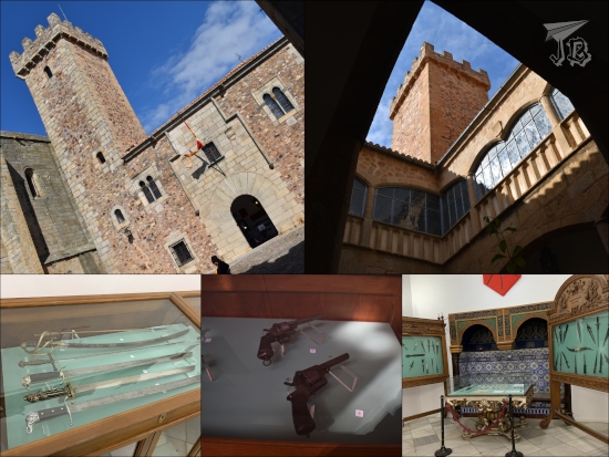
At the end of the square, in yet another palace – two of them, actually – lies the Museo de Cáceres, the local museum. The part in the Casa de Las Veletasis a regular archaeological museum, with the kind of things you would expect – prehistoric, Roman and Celtic remains, more modern artefacts. The other area, Casa de Los Caballos, hosts the modern art gallery.

Gothic building turned into a museum. The pieces shown are funerary stelae, prehistoric animal representations - bulls or pigs - and jewells, a boat, and Roman emblems

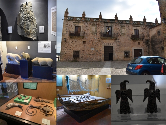
However, the palace was erected on top of the local Arab cistern or aljibe. It is the best preserved in Spain and it has been gathering the rainfall water since the 10th century. Pretty impressive piece of engineering if you ask me.

The aljibe: a moorish basement filled with water. The columns sustain horseshoe shaped arches

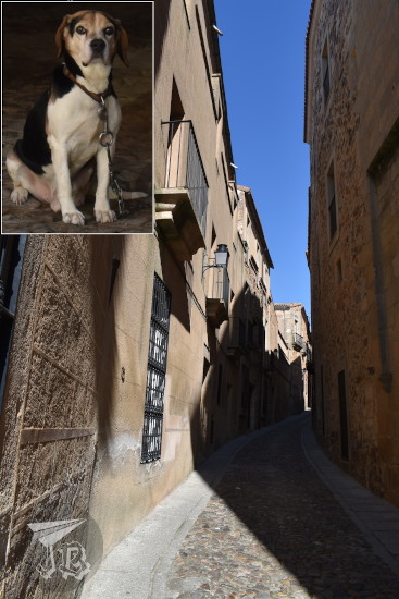
Afterwards we still had some time to kill until it was time for lunch, so we wandered around the area of the Jewish quarters or Judería, under the watchful gaze of the local Cerberus.

Narrow streets, and a guarding dog looking suspicious

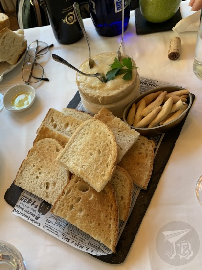
We had lunch in the local Parador de Cáceres, so I of course got my stamp. As a started we ordered the famous local cheese Torta del Casar cheese.

A tray with bread slices and breadsticks, and a cream cheese with spoons to be spread on the bread

In the afternoon we had a look at another church Iglesia de Santiago de los Caballeros. The church of St. James of the Knights was built in the 14th century over an older temple dating back from the 12th century. The altarpiece was carved and coloured by one of the most important sculptors of the Spanish Mannerism, Alonso Berruguete (1490 – 1561). This time I did not climb the tower – which had been happily colonised by a couple of storks.

Gothic church with a golden altarpiece. A stork snoozes on one of the towers.

After a little while, after sunset, I decided to skid around and have a walk through the old city at night. The artificial light made it look eery and romantic in the most… historical sense of the word. I came across some cats begging for food from a bunch of schoolgirls, and one of them very indignant because the girls would not beg it to take the food!

Different buildings of Cáceres at night. The are lit wit strategic lamps to give a mysterious feeling. There is also a white fluffy cat sitting and expecting food

Walked distance: 9.04 km (14766 steps)

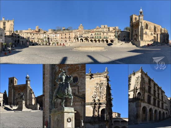
20th February 2022: Trujillo & Oropesa (Toledo)

On this day I managed two more Paradores stamps. Trujillo is a town a meagre 30 minutes away from Cáceres. It also has a traditional / Medieval city centre, set around the main Square Plaza Mayor de Trujillo. It was the birthplace of one of the so-called conquerors during the colonisation of South America, Francisco Pizarro, whose equestrian statue, Estatua ecuestre de Francisco Pizarro (by American sculptor Charles Cary Rumsey). Other highlights in main square include the corner balcony in the “Conquest Manor” Palacio de la Conquista.

The large Reinassance square of Trujillo with decorated palaces and a sculpture of Hernan Cortez on his horse

One of the most interesting churches in the area is Iglesia de Santa María la Mayor. Its tower dates back from the 13th century, but was almost completely rebuilt in the 16th century. Inside the richly painted altarpiece was erected around 1490. Apparently, my newly-discovered activity of climbing towers yielded to a new adventure, as for a few minutes I ended up locked down in the bell tower – I guess I’m a Disney Princess now (≧▽≦).

Gothic church with gothic golden altarpiece.

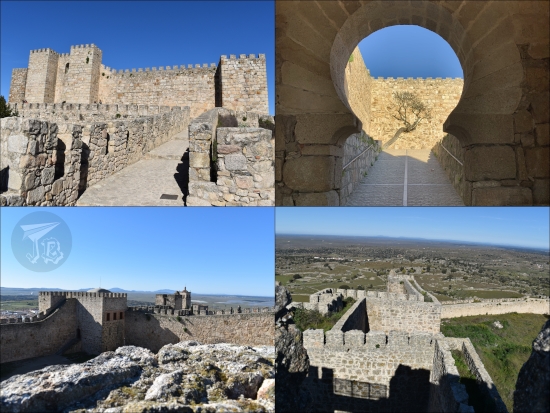
I got an hour and a little to wander round the town, so I climbed up to see the Muslim fortress Alcazaba de Trujillo (also called castle). Built between the 9th and the 12th century, it is a huge building with a defensive wall, an aljibe or cistern, several towers and a Christian chapel.

Moorish castle, from the outside and the inside. The walls and the battlements are amazingly well-preserved. It seems that the castle is built around the natural rocks defending the area

Then I hurried towards the other edge of the city to get my Parador de Trujillo stamp (only cheating slightly. I was there, after all). On my way I happened upon the Torre del Alfiler, with a family of storks happily clattering away the late morning.

Storks on top of a bell tower

I backtracked to the Plaza Mayor and I had twenty minutes before our rendezvous time, so I decked into the church Iglesia de San Martín. Its origins date from the 14th century, but it was not finished till the 16th century – which makes it so that the thick Romanesque walls are mixed with Gothic and Renaissance elements. No tower this time, but the second floor holds a religious museum.

Romanesque turning Gothic church. The inside is plastered in white and the celing above the altar and the nave retains the original decorated stone ceilings

After getting a general idea of the Medieval town of Trujillo, but it being a “working Sunday”, we moved on rather quickly, and drove off until we made it for lunch in Oropesa (Toledo) which also holds a Parador – Parador Museo de Oropesa, the first monumental Parador opened in 1930. That makes three stamps in two days, I’m almost impressed with myself!

Plain building with ornate balconies, and cars parked on a row in front of it.

The Parador is adjoined to the castle Castillo de Oropesa, which was unfortunately closed, but I shall put in on my list of “to re-explore”. It was built by the Arabs during the 12th – 13th century, probably on a former Roman fortress. Today, the Old Castle is joined to the New Palace and both belong to Paradores.

Classical Romanesque castle with towers and turrets. It looks heavily restored.

After that, we drove back home, and as we got a couple of wrong turns, we ended up avoiding the traffic jam we had found on our way to Extremadura, which was convenient!

Walked distance: 5.57 km (8836 steps)

1st January 2022: Barranco de la Hoz & some towns around (Spain)

I found myself socially free on the first so I decided to kick off the year by improvising a hike – and when I arrived at the parking lot I realised I was crazy person #3 to have the same plan. To be honest I kind of went along the flow for half of the day trip, with just a faint idea of what to do.

My first stop was an area in the natural park Parque Natural del Alto Tajo. One of the tributaries, the River Gallo, has eroded a deep valley in the sandstone and calcareous rockbed – Barranco de la Hoz, which translates to something akin to “Gorge Ravine” (though technically it could also be “Sickle Ravine”). The gorge is located in the north of the province of Guadalajara. Two hundred million years ago (Early Triassic period), the area was covered by the same sea that gave way to all the fossils that can be found in Albarracín and reached the muddy areas where dinosaurs left their footprints in Enciso.

When the sea level receded, it left behind different layers of rock, that have been painstakingly excavated by the river Río Gallo for the last two million years or so (Quaternary period). There are conglomerates at the very base of the gorge, and red sandstone, calcite and dolomite in the upper parts. The vertical wall is around 115 metres high. At the base there is also a small hermit church. According to the legend, during the Middle Ages, the Virgin Mary appeared to one of the shepherds in the area – that is the reason why the area is also called Barranco de la Virgen de la Hoz. Next to the sanctuary there is a restaurant / hotel, and a parking lot. Along the river bank there are several tables for picnics and so.

Being the insomniac I am, waking up after the New Year celebration was not excessively hard. As mentioned though, as I was not sure I would be free until the previous evening, I just went along the flow of the day. I drove off and reached the gorge at around 11:00. The the car measured a temperature of -1 ºC. I was wearing five layers anyway so I was all right. Just before reaching the parking area, I had to yield to a sounder of wild boars.

The sanctuary is the starting point of a path of around 400 steps carved and sculpted onto the vertical wall, ascending over 110 metres. The climb was not as hard as I expected, especially as the sun shone on the steps. I reached the mid-viewpoint in less than 15 minutes and sprawled on the stone ground for a little to bask in the sun. As I continued upwards, I encountered a small lizard doing the same sun-basking routine – Iberian wall lizard Podarcis hispanicus (maybe?). I finally reached the top of the gorge and I was the first on the upper viewpoint area for a while. Throughout the hike up, the strata can be clearly seen, along with fossilised ripples, fracture lines and the hints of some folds. The steps and viewpoints are protected by markers and verandas (helpful at points).

Halfway up a reddish sandstone wall. The picture faces the rising sun, and at the bottom of the ravine is the river, with the evergreen trees around.

Close up of a lizard hidden amonng leaves

Although you are technically supposed to stay on the trail, I honestly wanted to explore the upper edge of the gorge, so I went towards the rocky cliffs to the east. I came across marks caused by of boars, and European wildcat (Felis silvestris) paw prints, I also saw some birds of prey (very maybe a golden eagle, Aquila chrysaetos) , but not the right time to see much fauna – probably because around noon people started arriving with dogs. Also, it was stupidly warm for a first of January… Good thing I was using the good-old technique of having a lot of layers and shedding / putting them on as I felt warmer or colder.

A panoramic view of a rabine, with the river at the bottom.

A panoramic view of the top of a ravine, with the cut-off walls dropping from sight

A view of the vertical sandstone walls that create the ravine

A flying bird of prey and some animal tracks: a paw print and removed ground from a boar digging for acorns.

After an hour or so, I made my way downwards and I visited the church now that it was empty and walked into the area where the legend says the Virgin appared.

A hermit church built against / into the vertical wall of the ravine

Then I walked around the river bed for a while. The river bank was covered in frosted leaves, and the water was quite cold. I layered up again…

The wall of the ravine from the riverbank

Ivy and fallen leaves on the ground. The rims are white with frost and ice

At around 13:15 I decided to head over to Molina de Aragón. It was New Year’s Day, so I did not expect anything to be open, so I just wanted to wander round for a while. Though the town is considered one of the coldest places in the area, when I parked it was warm. I found the castle Castillo de Molina and wandered around for a bit. The castle has three distinctive parts – the walled fortress, the lone watchtower Torre de Aragón, and the back area, which was cordoned off, but not walled, Prao de los Judíos. The first Arab castle or alcázar was built the 10th century, over an older Celtiberian hill fort. In the 12th century, it was conquered by the Christians and rebuilt in the Romanesque style. Out of the eight towers that the castle had, four of them have survived, along the ruins of two more.

A rectangular castle with quite a few towers and battlements on top. Around half of it is reconstructed, the rest is in ruins

Afterwards, I took a stroll down the town. There are many churches dating to the Medieval times, most of them Romanesque style, some already showing hints of Gothic: Parroquia de San Felipe, Iglesia de Santa Clara, Iglesia de San Pedro, Iglesia de San Martín, Iglesia de Santa María la Mayor de San Gil. There were also some mansions and palaces.

Buildings in Molina. They all look reddish due to the characteristic rocks used to build them

I tried to locate a bridge I had seen trying to find a parking spot, and it only took a couple of wrong turns to do so. The bridge is Puente Viejo, the old Romanesque bridge, built in the reddish calcites that are characteristic of the area. From there I also peeked onto Monasterio de San Francisco, originally from the 13th Century, though the current building dates from the 18th century.

A reddish stone bridge over the river. It has three arches, but today only the left arch is over the river, the other two are over grass.

A church with an angel on top of the belltower

It was already late afternoon, and I had a couple of options. In the end I decided to head back in order not to drive through the sunset – at this time of the year, the sun’s glare would hit me square in the eyes in the highway. However, on my way towards the gorge, I had driven through a tiny village, Rillo de Gallo, where, for some reason, there is a Modernist-style house, called, more or less formally, El Capricho Rillano (The Folly in Rillo), as a lot of Modernist buildings have the “whim” name in them. It was apparently erected by a builder who apparently liked the aesthetics, without an architect being involved. It was… interesting, though the village was tiny and it was difficult to get into it and find a place to leave the car without blocking a street.

Bizarre modernist house. The construction looks wavy, with snakes and twisted columns. The balcony is held out by gigantic hands.

That was the whole day in the end, I drove back home, and did not have much trouble with sunset. As a whole, I drove around 300 km, and walked just a little over 10 km. And it was way warmer than expected for a first of January! Here’s to hoping that it was a promising start to 2022…

27th & 28th July 2013: Segovia (Spain)

27th July 2013: Echoes of a Roman Past

We took the train early on Saturday and arrived in Segovia in mid-morning. Segovia is a Spanish city of the Inner Plateau, located in the autonomous community of Castilla León. It has gained fame because of its many monuments and landmarks, the main being the Roma aqueduct in almost perfect condition, the cathedral and the castle (which may have served to inspire certain mouse-company for the Cinderella Castle). The city centre has been a world Heritage site from 1985 and the aqueduct received the title of International Historic Civil Engineering Landmark in 1999.

We checked into the hotel, which was dead in the centre of the Main Square and then we visited the Catedral de la Virgen María, the cathedral. The building was constructed between 1525 and 1577 in a late Gothic style that had already phased out in the rest of Europe. We saw the cloister, the chapels and the apse.

Then we moved onto the Iglesia de San Martín, St Martin’s church, built in the 12th century in the Romanesque style, with a Romanesque-Mudejar tower bell.

We then took a walk around the city centre, and we came across the Palacio de Cascales, a 15th century palace that belonged to the Alpuente Count.

We passed by the Casa de los Picos, the “House of Peaks”, also built in the 15th century.

We somehow ended having these nice views of the rooftops of the city, too.

And passed by a very interesting house.

We finally got to the main event, the Aqueducto, the aqueduct. An aqueduct is a “water bridge”, a construction designed to carry water from one side of a valley or a ravine to the other. The Aqueducto was built by the Romans in the late first or early second century. It once transported water from the Frio River into the city, and it ran for a whooping 15 kilometres. It is one of the best preserved aqueducts in the world, as it was reconstructed several times through history, and it was working to get water to the city up to the 19th century.

We passed by the Casa de Ejercicios del Seminario one of the buildings of the Seminary.

We reached the Main Square, the Plaza Mayor again.

And saw the Romanesque Iglesia de San Andrés, St Andrew’s church, with a particularly nice bell tower.

After this we decided to take a break and have the typical pork meat lunch. Then we moved on towards the Alcázar. An alcázar is a type of castle or fortress built during the Muslim rule in Spain and Portugal. The Alcázar of Segovia has been through several redesigns and renovations, but it is a pretty impressive building. The current form was reached during the reign of King Alfonso VIII, so it dates from the 13th century, but it was retweaked by several kings and queens after that. It was the royal residency until the Spanish court moved to Madrid in 1561.

On the way we could see some views and the Iglesia de la Vera Cruz, the True Cross Church.

The Alcázar is quite an impressive building, in Herrerian style, with impressive towers. Part of it is a history museum the other part is a military museum.

It also offers nice views of the cathedral from the other side.

We walked back to the city centre and along the aqueduct again.

This trip was in July, and scorching hot back home, so we had not considered much of a temperature change. Unfortunately, Segovia in the late afternoon became more than chilly and we had to walk into a random shop to buy a thin jacket, then headed off to the Plaza Mayor.

Funnily, when we were having dinner there, someone warned us that the shop assistant had left the alarm tag on my jacket! That was amusing. We called it a day heading off to the hotel, and being duly impressed by the illumination put in place for the cathedral.

28th July 2013: Churches while the city sleeps

On Sunday morning, most everything was closed, so we took a strolling tor if the Medieval area, and saw a bunch of churches from the tenth and eleventh centuries:

Iglesia de la Trinidad (Trinity Church).

Convento de las Carmelitas Descalzas (Barefoot Carmelite Monastery).

Iglesia de San Nicolas (St. Nicholas’ Church)

Iglesia de San Quirce (St. Quirce’s Church)

Iglesia de San Esteban (St. Stephen’s Church)

We also had yet a different view of the Cathedral.

And we could see the Alcázar in all its glory.

Then we returned to the city centre, where we caught a glimpse of the Iglesia de los Santos Justo y Pastor (St. Just and St. Pastor’s Church).

We had lunch and said one last good-bye to the Aqueduct before we headed back to the train station.