Weather warnings, work, and a nasty stomach bug seemed to conspire against me for a lousy start of the year, and what I had originally planned for the 2nd of January had to be delayed a couple of weeks until I caught a break from everything. Eventually, the plan just became a “grab the backpack and go” when the stars aligned – and actually, I just required one star and the only thing it needed to do was shine. Whilst I’ve been around the reservoir Embalse de Entrepeñas before, I had never been aware of the not-so-hidden hiking route that departs from the parking lot, heading downstream. I found its description in a book about walking routes in the province, it was not a difficult drive, and the route could be expanded to include a couple of spots the guide did not consider.
Spain has long had a complicated relationship with freshwater. Despite being a majorly dry country, it has developed a wide net of water-intensive agricultural hubs. The cyclic droughts and low-quality soils in the centre do not help – the areas with a nice temperate climate and good soils don’t have water. Thus, once the technology was readily available (the first dams date back from the late 19th century), the first Hydrological Plan (Plan Hidrológico Nacional) was developed during the years of Franco’s Dictatorship. The government designed and built an extensive network of reservoirs in order to, well, store freshwater. Water transfers were designed to feed the eastern orchards. Of course, these were controversial on several fronts. First, the environmental one. Second, the social one – once a dam is built and the water rises, it swallows everything that had previously grown on the riverbanks, be it healthy ecosystems, entire villages, or historical buildings. And third, of course, the moral one – dictatorships are not good, so well-meaning people have to oppose anything such a system devises.
In addition, the reservoir Embalse de Entrepeñas has a bit of a bad reputation. During the 1980s it became popularised as an inland sea, along other reservoirs in the Spanish central plateau, as what became known as the Castilian Sea – El Mar de Castilla. However, despite the extensive security network decades of beach tourism had impulsed along the coast, inland water bodies were left unattended. I grew up on reports of people drowning in Entrepeñas. Everybody seemed to know someone who died there. Adult perspective says most people knew the same victim, or they were just repeating hearsay. As a kid, I really believed that the reservoir might actually been an evil entity feeding on swimmers.
The reservoir Embalse de Entrepeñas was built between 1946 and 1952, during Franco’s Dictatorship, but the plan dated back from 1902. The goal was to regulate the flow of River Tagus to keep drinking and agricultural water in storage, along with producing electricity. During the mid-1960s, the 813 square hectometres of water became a holiday spot. However, soon a “ghost” hovered over the reservoir, the dreaded Tagus-Segura Water Transfer, Trasvase Tajo-Segura. The Segura River is used to water the orchards in the east of Spain, but its flow cannot cope with the demand. Thus, water is carried from the Tagus to one of the tributaries of the Segura, in an engineering feat that was built between 1968 and 1971. The transfer established the region of Murcia as a strategic agricultural area. However, it dried up the Tagus reservoirs, killing off the water-tourism, not even mentioning the environmental consequences of the whole project.
However, as tourism dwindled, something else happened. Entrepeñas became a hotspot of conservation success when threatened griffon vultures (Gyps fulvus) started nesting in the rocky walls. Child-me was very concerned about birds of prey going extinct but had no idea about ecology, so I was halfway worried about vultures disappearing, halfway low-key worried they would make a meal out of me. Considering that during a couple of hikes I’ve actually had raptors circling me, child-me might have been onto something.
Back to the present, though. I woke up and even before pulling up the blinds, I looked at the weather app. Being January, the day was going to be cold, but the temperature would not go below zero, and the sky would be clear. To be honest, I was desperate to do basically anything, but at the same time, there was this wave of exhaustion going through me. I kicked myself into gear and got onto the car. I filled up the tank and set on my merry way towards the parking lot / viewpoint that the guidebook described as being “on the right, before the tunnel”. Dear book, there are two tunnels. You mean the second one. If you go right before the first one you end up… somewhere else. Yes, talking from experience. You can turn around in one of the parking lots on the side of the road. If you dare, of course.
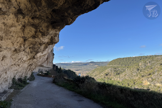
I dared, else I would have had to drive an extra 9 km. I found the almost empty parking lot, parked the car, and set off onto a closed-road-turned-trail. It was around 11:00, the air was crisp and the sun was shining. When I thought in November that hiking season was over, I had not realised there are routes recommended for winter, and this is one of them, as the trees being devoid of leaves allows for a great view of the Romanesque bridge downstream.
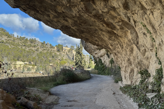
The first part of the hike runs between the river Tagus Río Tajo and a vertical wall, eroded at trail level to form a rock shelter. The vultures were already active, treating me to some nice flights. The trail was slightly downwards, and it did not take long to catch a glimpse of the so-called Roman Bridge – actually Romanesque Puente Románico. This area of Spain tends to confuse Roman and Romanesque. The original bridge was erected in the 14th century, but it was rebuilt in the 19th, and that is the structure which remains today.
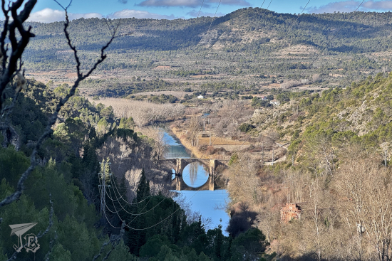
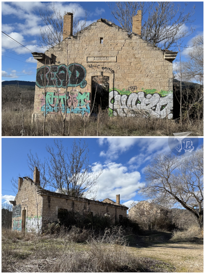
Near the bridge stands the original hydroelectrical station Central Hidroeléctrica de Guadalajara, but it was harder to see it across the river. It was not long before I reached the bridge itself, and the route said to turn right then. Instead, I crossed over and continued downstream, as I had seen that there was an abandoned train station nearby, Antigua Estación de Ferrocarril de Auñón. The original building was part of the former railway network Ferrocarril del Tajuña, a line that was originally designed to join Madrid and Aragón in order to transport people and freight, However, it was eventually dismantled since it was too expensive to maintain and yielded to too little revenue. The station was in use between 1919 and 1953. After 1946, due to the works on the reservoir, Auñón became the terminus. Today, the actual rail is gone, and there are only ruins of the passenger and warehouse buildings, and the loading docks. Unfortunately, the whole thing was covered in graffiti, and the vegetation rather overgrown.
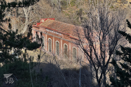
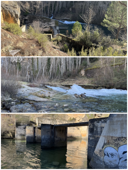
I backtracked and headed upstream. It did not take long to reach the former hydrological station Central Hidroeléctrica de Guadalajara, a brick building erected in 1909. Not much further, I found the remains of the original dam over the Tagus, with a rather impressive water sprout remaining – and a makeshift bridge over the water, made with wooden logs, that I looked, photographed, and no way in hell I was going to try to step on.
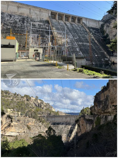
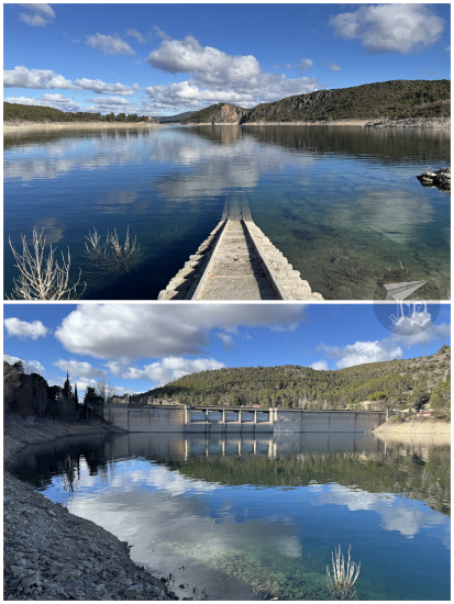
I continued upstream until I reached the modern gravity dam Presa de Buendía, a huge structure made of reinforced concrete that holds back the water. It’s a very different sensation when you look at the dam from this perspective, upwards, from the “empty” side than what I had always experienced – from the top.
I turned back towards the bridge, which I had to cross to return to the parking lot. I still had a bit of time, so I wandered towards the actual reservoir area. There’s a structure there that fascinates me… a small building with remains of a railway that goes right into the water. I have never been able to figure out what it was made for.
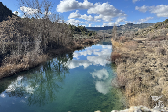
And that was it for the day trip, a short hike I dragged for about three hours during the one good weather day we had for a bit and that turned out to be my first outing of 2026. Afterwards, it was just a matter of hopping onto the car and heading back home, feeling recharged.

