1st July 2021: Manatees are Zen (Faunia, Madrid, Spain)

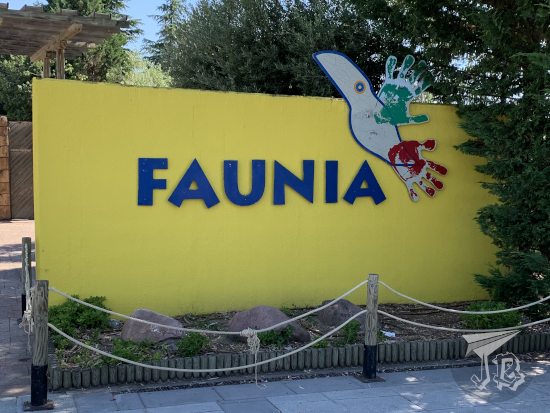
Madrid has two zoos, the traditional one which can be traced back to 1770, and a second one which opened in 2001. They actually belong to the same business group anyway so probably the whole point is just to charge more – and to expand the installations. They operate as independent entities. On the first of July, due to a number of circumstances coming together, I visited Faunia, the newer installation. The standard price for a ticket is around 28€ – but there are plenty of different discounts. I paid 18.90€ for a random Thursday discount that they’ve got.

Though it promotes itself as a “Nature Theme park”, Faunia is little more than a modern standard zoo. Of course, it is much better than the old zoos, and the animals are well-kept, an organisation in ecosystems or areas is not that much of a novelty any more. There are different areas: farm / petting zoo, night, lake, jungle, temperate forest, African forest, Australia…

Komodo dragon (Varanus komodoensis), the largest lizard in the world, endemic to some Indonesian islands. They are venomous.
Tufted capuchin (Sapajus apella), an omnivorous primate from South America.
Red panda (Ailurus fulgens), an animal that is so different from everything else that it has its own family name all by itself. It is native to the Himalayas and the south west of China.
American flamingoes (Phoenicopterus ruber), long-legged wading birds famous for their pink colour that tend to live in flocks.
Ring-tailed lemurs (Lemur catta), a group-forming species endemic to Madagascar. They are attitude-laden and fear-lacking little fellas who love to sunbathe.

Fennec fox (Vulpes zerda): a small fox with large ears which lives in the Sahara and the Sinai Peninsula.
Southern tamandua or lesser anteater (Tamandua tetradactyla), a species of anteater from the forests of South America and the Caribbean, which feeds on ants, termites and bees.
Kangaroo Rat (genus Dipodomys), tiny nocturnal rodents from North America that can jump over two metres
Butterflies – don’t expect me to be able to ID them, but my money is on Antiochus Longwing, a south American small butterfly
Nile crocodile (Crocodylus niloticus), a found in marshes, rivers and lakes in throughout sub-Saharan Africa. They are opportunistic and aggressive predators which ambush their prey in or near the water. And they can gallop. Look that up.

Arapaima (Sudis gigas), a giant fish native to the Amazon. They eat smaller fish, crustaceans, fruits, seeds, insects and any small land animal that they can catch on shore. Furthermore, this is an air-breather. It is a top predator that can become invasive if placed somewhere else.
Redtail catfish (Phractocephalus hemioliopterus), another carnivorous fish from the Amazon. Never trust a catfish, they can literally eat you by accident (or on purpose).
Caiman (family Alligatoridae), reptile predators originating in South America. They are large and aggressive, but they tend to hut fish. Did you know that
Penguins (family Spheniscidae) are a group of aquatic flightless birds. Most live in the Southern Hemisphere, and they feed on krill, fish, squid and so on that they catch underwater. Contrary to the myth, not all penguins live in the cold, a lot of them live in temperate climates.
Coral reef, with clownfish (family Pomacentridae) and sea anemones (order Actiniaria) living in symbiosis.

Meerkat (Suricata suricatta) aka Timon from the Lion King.
Red-necked wallaby (Macropus rufogriseus), similar to but smaller than a kangaroo, and also friendlier. They, of course, originate from Australia. The Faunia webpage says that you can go into the pen and walk among them, but I didn’t try.
Yellow-banded poison dart frog (Dendrobates leucomelas). It is an amphibian which lives in the humid areas in the north of South American. They secrete toxins from their skin. Do not pet, much less lick.
Blue viper of the white-lipped island pit viper (Trimeresurus insularis). Beautiful, venomous, aggressive and feisty, this snake is originary from Indonesian islands.
Gaboon viper (Bitis gabonica), it is really there. It is another venomous snake, and it has the longest fangs among snakes. And yes, it is really there.

White-cheeked turaco (Menelikornis leucotis), originary from forest in the highland regions of Eastern Africa.
Grey crowned crane (Balearica regulorum), a large bird from Sub-Saharan Africa.
Roseate spoonbill (Platalea ajaja), a wading bird from South America, with a very characteristic beak, hence the name
Macaws (genus Ara), endemic to Central and South America. They are “seed predators” which means they destroy the seeds to eat them
Scarlet ibises (Eudocimus ruber), another colourful bird whose original habitat is the coastal areas of South America. They use their long beaks to prove for food in mud or under plants – they eat a lot of small crustaceans, which gives them their particular colour

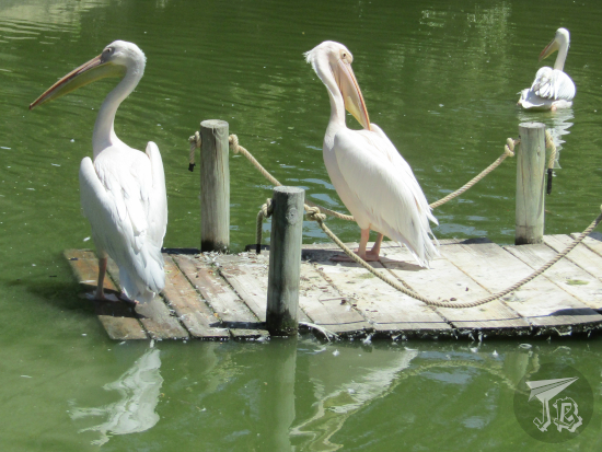
I guess it is worth a visit, but that’s just about it, if you consider it from a shallow point of view – because when you start getting deep into things, everything gets ridiculously expensive. Because the thing that does differentiate Faunia from other zoos is the fact that it offers “hands-on experiences.” Some of these are about 5 or 6€ and include a short talk inside one of the pens – such as “meeting” the pelicans or the penguins.

For example, the Pelican interaction consists in walking into the pen and seeing the birds from afar sitting on a bench while one caretaker explains basic biology facts and the other tries to get a pelican to eat trouts for a bit of a close-up “feeling”. Pelicans are large water birds spread all through the world but Antarctica. Their most important characteristic is the large throat pouch under their long beak, that they use to “fish” – they fill their pouch with a billful of water and keep whatever they can digest. Faunia has pink-backed pelicans (Pelecanus rufescens) great white pelicans (Pelecanus onocrotalus)

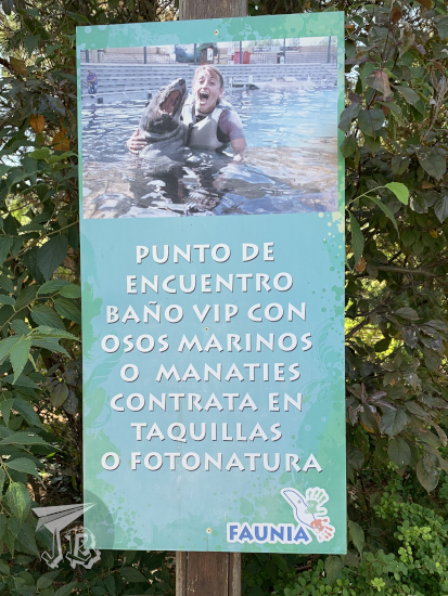
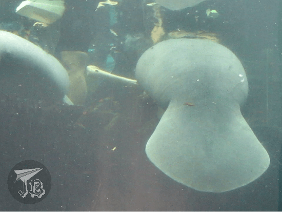
There are however other more expensive interactions, on the range of 40 to 50€, and one of them is the one I did – the interaction with the Manatees. Faunia has three West Indian manatees of the Antillean subspecies (Trichechus manatus manatus). Manatees are aquatic mammals – they breathe air and they spend all of their lives in the water, either salt or freshwater in South America. They don’t have natural predators, so they lack predator-avoidance responses, which makes them very tame and friendly. Unfortunately, they are critically endangered in the wild, mostly due to human-related deaths: hunting, habitat destruction and collision with ships. As they are herbivorous, they eat fresh and saltwater algae and plants, they are sometimes called “sea cows”, and eat plants and algae – males are called bulls, females cows and babies calves. They are sturdy and they can weigh between 400 and 550 kg, measuring up to 3 m in length. They have a long spine with pectoral flippers that have five fingers, but no rear flippers. Their body ends in a paddle-shaped tail. The neck is not visible and the head is stocky. They don’t have ears, their eyes are small and their snout is short, with nostrils that can be closed when they are underwater. They have a prehensile lip that they use to gather food and for social communication and interaction.

And they are adorable.

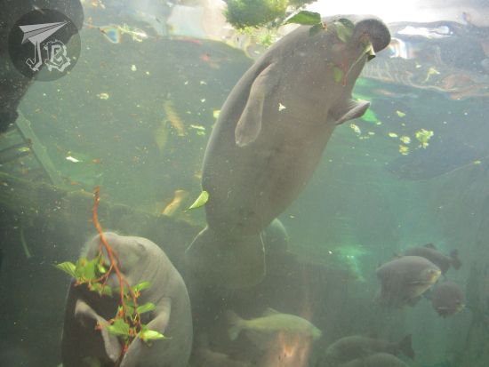
The manatees in Faunia are named Bruno, Fiona and Pelusa (“Dustbunny”), with the latter being the two-year-old daughter of the other two, born in the park. They live in the tank located in “The Jungle” area (La Jungla), sharing their space with catfish, arapaima and pirapitinga (the good-rep fish in the piranha family). For the interaction, you are asked to bring your bathing suit, towel and pool flip-flops. I arrived at the meeting point early and waited eagerly for the staff to come pick me up. Then I was guided into the inner area of the Jungle building, up a metal staircase and I changed into the neoprene suit.

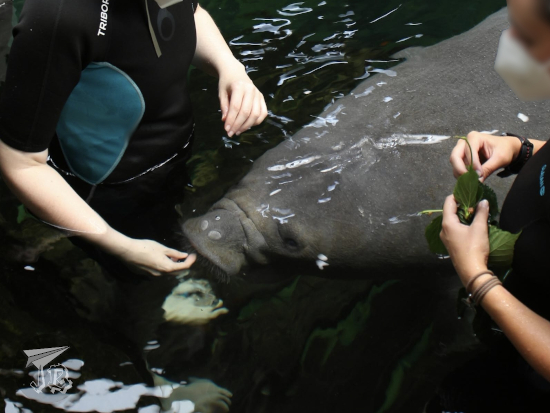
As we waited for the other people to be collected, I saw the manatees swimming around, already anticipating the food. They had mulberry leaves, endives, and banana pieces for treats, and lettuce of different kinds as their main meals. The interaction itself is a kind of training for the animals. The trainers go in with an acoustic signal, and the animals recognise their own names, and each goes to the trainer assigned to them – you also get assigned a trainer so you don’t mess up.

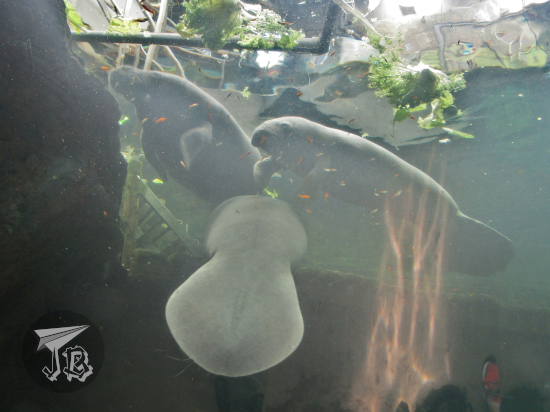
There are two parts of the interaction. First, you get to feed “your” manatee whatever you are given. Normally, there are two people per manatee, but as this was in the middle of the week, even if in summer, we were lucky enough to only be three visitors – which meant your own personal manatee. Mine was Pelusa, the baby, and she was way more interested in the mulberry than the endives. During this part you keep your FFP mask on.

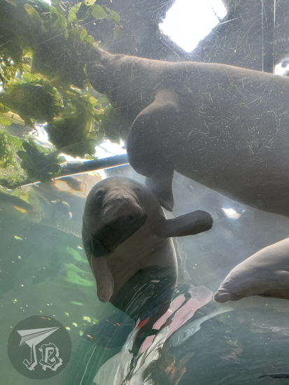
For the second part you “go down” with a snorkelling mask and even if you’re still on the platform you get to feed “whomever comes to you”, seeing the interaction from within the water. To finish up, you give your manatee a small branch for them to eat and play with, and they are released, you change back into your clothes and leave. My interaction took about one hour, and I was lucky enough that I had an “infiltrate” who took pictures from the “underwater tunnel” that crosses the tank. I also bought myself one of the official pictures that the resident photographer takes, because I really, really wanted a good picture.

All in all, it was awesome, and it even felt that the manatees came to wave bye-bye as I left through the tunnel.

As a zoo, as I mentioned, Faunia is a very standard one, with very few things that would make it special if not for the interactions. It could do with some more shades, because just after lunchtime it became really hot. Most food kiosk were closed due to COVID measures, and there were several vending machines. There were a lot of kids doing “urban camp” activities, and I got ran over twice – one of them pretty painfully to be honest.

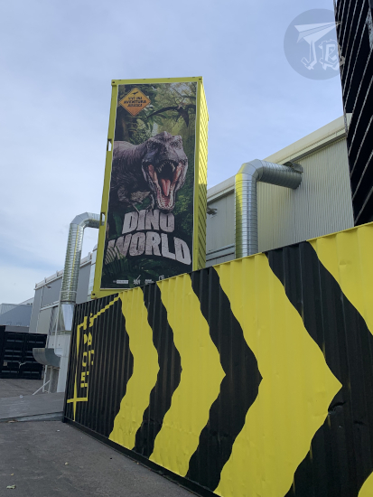
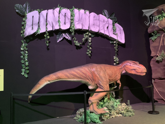
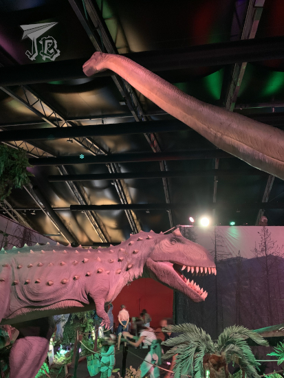
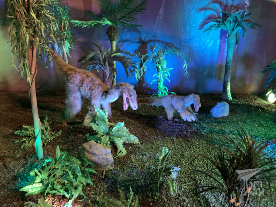
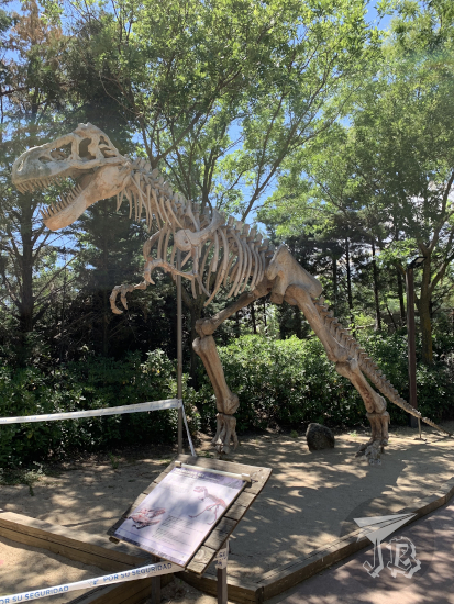
Aside from the animals, there is a roller-coaster, also down due to COVID and a “dinosaur canyon” with dummies and animatronics that have really seen better days.

T-rex skeleton reconstruction

Furthermore, queuing to go in because the VIP entrance is blocked for… no really VIPs as there were none, and waiting forever at the entrance kiosk to get the Experience passes and then for the photos, were a drag. As a conclusion, going once in your lifetime, getting to do an interaction or two might be a good idea, but this is not somewhere I’m dying to come back to – though I am open to explore other parks from the same owner, such as the traditional zoo or the aquarium.

I mean, some of animals, such as this goose, had a very clear opinion about the park, too.

Goose attacking one of the Faunia signs

Walked distance: 12954 steps / 8.06 km

Pricing: Ticket: 18.90€ + Manatee experience 38.90€ + Pelican experience 5€ + Professional picture 11.90€ + digital upgrade (three-month access) 1€ = 75.70€. Way too much to plan another expedition any time soon.
Saved: We parked outside so we saved up the 5.50 € for the parking lot, and we took our own food.

19th June 2021: Dino World Expo in Madrid (Spain)

Upon finding that the exhibit Dino World Expo was opening in Madrid on the 18th, I decided to book myself a ticket for the first pass on Saturday morning, 10 AM. I guessed that it would not be too full since it was the first weekend, early, and before school was out for the summer and all the reviews popped up so everyone found about it and brought their kids.

The exhibit was held in Madrid’s fair grounds, IFEMA Espacio 5.1, a short drive away, and aside a small mishap with setting the Sat-Nav. When I arrived, about 15 minutes later there were about ten families with little kids. I walked around for a little and came back when the doors opened. There were several types of tickets, the basic one was 13.50€. The exhibit included an extra “Virtual Reality experience for 3€” (it was 4€ if you bought it during the exhibit itself), so I decided to get the “premium entry ticket” which for 23.50€ included entry, a printed picture (10€ otherwise), the VR experience, a lanyard and a poster – both of which have been distributed around kids who might have want them.

When my ticket was scanned, the system roared and I was given my “VIP lanyard”, and told that I just had to show it around. Then again, let me tell you that I almost called this post “normalise people doing stuff alone” but that would go into the ranting territory and I did not want to do that – it is enough to say that from the beginning to the end of this exhibit, every staff member gaped at me for being in a dinosaur exhibition alone / without kids.

Upon entrance I got my picture taken, then had to wait a little with a couple of families before me until the first room cleared. We got an explanation about the audio-guide app and the exhibit rules. The exhibition itself was composed mostly of animatronics that moved and roared – when they had remembered to turn them on, some of them were still asleep. Aside from the life-sized animatronics, there was a CGI film and at the end of it, the VR experience which… was okay I guess. I learnt that I am not a VR person, as I got more than a bit queasy from the “flying” with the pterodactyl, swimming with a few anachronic species, and then following the T-Rex hunting.

From the shop I got my picture and the promised poster, although I had to show my ticket, not only the pass, in order to do so. All in all it was a cute little experience, but not really worth a detour if you are not in the area – one day I’ll learn that “for all the family” means “kid-oriented”, but that day was not today. On the way back the Sat-Nav got me confused and I took the wrong exit (“stay left on exit 9A” is not the same as “take exit 9A and then 9B to the left” in my books), but I was home by noon, and of course I took a lot of pictures.

Approach

Entrance

dinosaur animatronics: diplodocus

dinosaur animatronics: carnotasaurus and brontosaurus

dinosaur animatronics: pteranodoon

dinosaur animatronics: iguanodoon and Eustreptospondylus

dinosaur animatronics: feathered dinos

dinosaur animatronics: T-rex and triceratops

3rd June 2021: Hike to the Aljibe Waterfalls (Spain)

The Ayllón Mountain Range or Sierra de Ayllón is the of the chains that conforms the Spanish Central System Sistema Central, on its easternmost edge.

The Central System was formed during the early Cenozoic Era (the current geological era) in a process called the Alpine orogeny – when the African tectonic plate crashed against the Eurasian plate, a geological event that gave way to the main European and Asian mountain ranges, from Spain in the west to Java in the east.

It rests on a granite base that became first folded, then fractured during the formation of the system. As the rocks eroded, the sediments deposited and formed new sedimentary socks. Other processes that influenced the formation and shape of the ranges have been the action of glaciers and rivers and the subsequent weathering of the exposed rock.

The most common rocks in the Ayllón Range are granite, as expected, gneiss, and slates, some of the latest mixed with clays. For centuries, the villages of the area have been known as “black villages” (pueblos negros) as slate has been extracted to build them. One of such villages is Campillo de Ranas, which translates to something akin to “Little Field of Frogs”, and one of the neighbourhoods adjoined to them is Roblelacasa (literally Oak-the-House).

Roblelacasa happens to be the start of a hiking route to one of the highlights of the range – the Pozas del Aljibe (Aljibe Pools), with Aljibe being a word of Arab origin that means “cistern” or “well”, so not that original a name, I guess. I had been wanting to see these pools – also called a waterfall – for a while, so I decided to drive off and hike the route to see the Aljibe, which is considered one of the most beautiful in the centre of Spain. The hike is about 3.3 km each way – but guess what? I ended up taking a detour or two (≧▽≦). The pools are formed by the Soto Creek, Arroyo del Soto, a tributary to the river Jarama which in turn flows into the river Tagus.

Off I went. The drive took about an hour and twenty minutes. I left home around 8.20 and arrived in Roblelacasa around 9:40. The drive went well, most of the road was a nice national road, and as it was a local holiday traffic was scarce. Some people were in a great hurry though, ignoring speed limits. This was my first time driving on my own with the Sat-Nav, and it went all right. However, as I drove towards the range, there was a dark cloud I did not like one bit.

Just after reaching the “village”, I found a parking spot right behind the panels, as the expected parking lot was closed off. I had packed some frozen water, biscuits, the camera and my cap – but I had forgotten the umbrella, and it was a bit grey. I decided to leave taking pictures of the village for later, and I started walking just behind a couple who had arrived virtually at the same time, but I passed them as they stopped to take pictures.

Information

Roblelacasa

The route is officially named “PR-GU 09: Sendero de los pozos del Aljibe” and it is part of the natural park Parque Natural de la Sierra Norte de Guadalajara. Upon leaving Roblelacasa, the first couple of hundred metres crossed fractured and weathered rock before crossing a symbolic gate that marks official the beginning of the trail with a white and yellow double-line. Then, I walked onto a gravel path flanked by the remains of old fences. To the left opens a valley, and looking back I could see the village, in black.

Start of the route

Old slate fences

Valley

Valley and village

The route widens into a dirt track that is obviously travelled by car sometimes, as the range peaks stand in front of you. There are no trees but a lot of bushes and aromatic herbs, and as you walk the scent is very pleasant. Then there is a small forest and a second barrier, which marks the turn where you are going to start climbing a new hill – slowly, the terrain rises to your left while it lowers on your right, giving way to the creek’s valley. Just before reaching this I passed a family who had started walking before me.

Mountain Range in front

Mountain Range around

Eventually, you reach a fork in the trail, with the choices of going left towards the waterfall or right down the valley to see a former dam-turned-bridge. I went to the waterfalls, figuring out that I could always go down to the dam on my way back. The track became narrower and rocks started popping up again.

Fork on the way

Valley

Creek in the valley

Geological formations

I wandered off the trail (you can see the markings on the upper picture) a couple of times because the views were neat, but a few minutes later I crossed a little bridge to get access to the waterfalls viewpoint on the left-hand-side bank… which was closed. Believe it or not, the actual waterfall area had quite a few “do not walk, falling risk” signs that… okay, I have to be honest… I pretended not to see. I hiked up to the viewpoint and sneaked a little to the side to see both waterfalls. As it has been storming, there was a good amount of water flowing, so the view was pretty cool.

Wooden Bridge

First waterfall

The upper waterfall is about three metres high, and the easier one to see, without needing to ignore any warning sings. When I walked up to the viewpoint I got an amazing view of both the upper and lower waterfalls, the latter being about 7 metres high. It is easy to see how they are called either waterfalls or pools.

Both waterfalls from the left bank

Both waterfalls from the right bank

Remember that I said that I passed a family on my way up? This is kind of important because it means that I was basically alone in the waterfall area for about ten minutes, enough to take a good bunch of pictures from both banks of the creek without having to edit people out. I was however very cautious about cracks and faults. I think most of the rocks in the area are quartzes but my geology skills are a bit rusty.

Cracks on the rock

As I decided to turn around, the family arrived, and so did the couple I had first passed and another group that must have started behind me. That was okay because I was done, and on my way back I could stop for a lot of pictures that I had not taken before. Here you can see the difference between the quartz /gneiss (surrounding the flowers) and the slate (in the middle).

Flowers growing from the rock

Also, at some point before I started my return hike, it cleared up. All of a sudden it was hot so first I shed off my sweatshirt and when I reached the crossroads again I really needed a drink and some shade – but I had packed water and the cap, so everything was fine, and I could divert to see the old dam, Presa de Matallana over the creek Soto – from both sides. This must have been around 11 am.

Valley on the way back

Presa de Matallana from the left bank

Presa de Matallana from the right bank

I turned back towards Roblelacasa and I noticed that the wide track was a bit more “upwards” than I had noticed the “downwards”. I had a bit of a tired moment as I adjusted to hiking up in the heat – why is it that normal hills tire me more than uneven paths? But it was over in five minutes and I was back in the village a bit before twelve. On the way now I stopped to take pictures of the flowers and bushes around, and of the valley that Roblelacasa overlooks – and ran into four or five more groups / couples who must have started walking around 11, so it was a good call to get there early.

The track back

Roblelacasa from the outskirts

Flowers on the way

This is how the village looks in the light of day, just before I took the car and drove back around noon. I decided that I would go back to the area some other time to explore other villages around, mainly Tamajón, which is reported to have an interesting geological area, and some other black villages.

The village

Oh, and a the pictureless anecdote of the trip, for obvious reasons. There were a lot, and I mean a lot of “caution wildlife” traffic signals, and on the drive there I thought that I had very rarely encountered any wildlife crossing the road. I had also not come across any wild (or domestic) on the trail, aside from some little lizards and a few pet dogs with their owners. Well, good thing I was driving a good 10 kph under the speed limit, because on the drive back I had to yield to a wild boar! Live and learn (to drive slowly in wildlife areas)!

Driven distance: around 130 km (2h 30min)
Hiked distance: 6.7 km / 11,106 steps (2h 20min)

29th & 30th May 2021: The Walls (and churches) of Ávila (Spain)

There was a little-talked about consequence of the Industrial Revolution in Spain. While it is widely known that it drew a large number of people to the cities and towns, few stop to think of the subsequent steps that had to be adopted. More people in town required housing, and thus a number of projects denominated ensanches or “widenings” were projected and carried out. Even though such a thing makes sense, here lies the problem – in order to enlarge the urban area, many Spanish cities and towns tore down their Roman and Medieval walls, leaving either bare traces or nothing at all.

Legend has it that the town of Ávila lacked the money to demolish the wall. In retrospect, that was a good thing, because today, the walls that surround Ávila, Murallas de Ávila are among the most impressive Europe, some say that even better preserved than Carcassonne (France).

Ávila is a couple of hours away by car, so we drove off on Saturday morning at around 8 am and were there just before 10 am. We entered the city through one of the city wall gates, Puerta del Carmen.

Approach to the walls

We parked (100% ditched the car) at the hotel and checked in – even if it was quite early, they told us that one of the rooms was already prepared and gave us the keys. Unfortunately, it was not, and since the blunder was a Covid-protcol blunder, they upgraded us as an apology. The hotel, Parador de Ávila, belongs to the Spanish network of Paradores, and it is located in a 16th century palace, Palacio de Piedras Albas. We booked late-check-out for the following day, which can be done “for free” booking lunch in the restaurant (which is obviously not free).

Parador

Our first stop was the tourist office, but not the one that is clearly signalled in the middle of the town – the one that is located outside the wall and you have to turn around and around to find. But we needed it to buy the 48-hour pass to the monuments. Then we stuck around to wait for the nearby church to open, which gave way to observing the wall for the first time.

The Muralla de Ávila has been a Unesco World Heritage site since 1985. The structure is clearly defensive and it was built towards the end of the 11th century, quite probably as extension or reinforcement of a previous one, either Roman or Arab – though the Roman theory is the most credible as some pieces used in the original wall seem to come from a now-lost Roman cemetery, and there are documents about a Roman camp with similar shape. The wall has been restored in several occasions, and after surviving the ensanche risk, it was declared national monument and cleared of attached houses. Today most of the wall belongs to the Spanish government, and it is managed by the town hall, though there are some private parts, such as the ones that are part of the cathedral. The walls close off all the historical centre. They have a perimeter of 2,515 metres, with around 2,500 merlons, almost 90 turrets, and nine gates. Our second gate was Puerta de San Vicente.

Puerta de San Vicente

The first monument we stopped by, as soon as it opened since we were already there, was the basilica church Basílica de San Vicente (officially Basílica de los Santos Hermanos Mártires, Vicente, Sabina y Cristeta, three Christian siblings who were martyred nearby). It is one of the most important Romanesque buildings in the whole country, built between the 12th and the 14th century. It is protected as part of the World Heritage Site declaration. One of its characteristics is the golden rock in which it is built – sandstone-looking granite.

Iglesia de San Vicente

The inside of the basilica is, in the typical way, a mix of more modern styles. The grave of the martyr siblings is Pre-gothic, and the large altarpiece is Baroque. In the crypt there are proto-Christian pieces and a Romanesque Virgin which we did not get to see and which is the patron of the town.

Iglesia de San Vicente

Afterwards we headed off to the cathedral Catedral de Cristo Salvador, which is considered the first gothic cathedral in Spain (something that other people say about Cuenca), with clear French influences. It was designed as a fortress church as its abse dubs as one of the turrets of the city wall.

Catedral de Cristo Salvador

In later years, a choir was added, along with a Baroque altarpiece. The walls are also sandstone-looking granite, but some elements inside are limestone and wood.

Catedral de Cristo Salvador

To the side of the cathedral stands the cloister, which holds the grave to the first modern president of Spain, Adolfo Suárez, and the entrance to the cathedral’s museum. It yields to views of the tower and… the storks that squat there.

We headed off towards the Museum of Ávila. First we stopped at the former church Iglesia de Santo Tomé, which today is a warehouse for the museum, but can be visited anyway. When I was young, I studied the statues / sculptures called verracos, built around the 5th century BCE by the Vettones, a Celtic pre-Roman civilisation that faded upon the arrival of the Romans. The verracos are crude statues that represent four-legged animals – bulls, boars or pigs. At the time, I had only heard about a number of them, and was somehow under the impression that there were two or three around. I was quite wrong, apparently they pop up from the snow like daisies or something. In the church-turned-warehouse there were like twenty, one outside, there was one at the hotel garden… so no, apparently they are quite common. Other artefacts in the building include some carriages, Roman sculptures and mosaic, Muslim funerary artefacts and roof boards…

Iglesia de Santo Tomé

Then we moved onto the museum itself, Museo de Ávila, with a beautiful patio and a number of archaeological and ethnological items which represent the history and folklore of the town.

Museo de Ávila

It was almost time for lunch, so we headed off towards the restaurant where we had booked. Before, we made a small stop at an old palace Palacio del Rey Niño, built in the 12th century, today turned into the Post office and the public library, with a patio closed off by the Walls themselves.

Palacio del Rey Niño

Then we walked by the modern marketplace.

mercado

Which happened to be right in front of the restaurant, named La Lumbre. Aside from its walls, Ávila is famous for its cattle, a particular breed called Raza Avileña – Negra Ibérica, and of course the meat the animals produce, especially the matured and grilled meat from older oxen. After the animal has been sacrificed, the meat is matured in a traditional process called “dry maturation” for six weeks before it is grilled. We ordered the rib steak, chuletón to share, along with some grilled vegetables, a “tomato salad” that was a… one-tomato with dressing. And then there were desserts, aside from chocolate cake, we ordered yemas de Ávila – a typical confectionery made with egg yolks, lemon juice, cinnamon, and caster sugar. Lots of typical stuff, as you can see!

lunch

Our next stop was the main square, called “little market square”, Plaza del Mercado Chico, along with the town hall or Ayuntamiento. The square was rebuilt in the 19th century and is flanked by arcades. The town hall was built in 1862.

Plaza del Mercado Chico

Plaza del Mercado Chico: Ayuntamiento

After a brief stop at the Parador for some rest, we headed off to find a convent / monastery on the other side of town. On the way we came across some ruins that I assume are the church Iglesia de San Jerónimo, as they sit in the square of the same name.

Ruinas de San Jerónimo

We reached the convent Convento de San José, a reconstruction of a previous monastery and church, the first founded by Santa Teresa de Jesús (Saint Teresa of Ávila), a Christian “doctor of the church” and mystic Carmelite nun, known for her ‘raptures’, her reforms, and her literature work. More on her later though. The convent and church were a little… underwhelming, even if is a World Heritage building.

Contento de San José

Then we walked back towards the historical centre, and walked past the church Iglesia de San Pedro, a 13th-century building with a great rose window, but which was closed (reforms).

Iglesia de San Pedro

On the other side of the square, Plaza del Mercado Grande (Big Market Square) stands another of the wall gates, Puerta del Alcázar, and a monument to Saint Teresa Monumento a Santa Teresa: La Palomilla.

Puerta del Alcázar

Next we separated and I went off to climb the walls Murallas de Ávila. Well, to walk on the parapet. Due to Covid, there is only one access, next to the Cathedral and its gate Puerta de la Catedral. The walkable area is around 1.4 km, including walking over some of the gates and up and down more than a few turrets. It allows for some amazing views of the town and its outskirts…

Views from the walls

… but also of the wall itself, both the original walls and the add-ons from later eras (and a magpie).

When I reached the end of the walk, I went down and crossed the bridge gate Puerta del Puente, named that way because it overlooks the bridge over the Adaja river. I could not take a picture of it because the traffic police was checking cars at the roundabout in front of the gate. Thus, I headed off to the pedestrian bridge to cross over towards the tiny hermit popularly known as “the four posts”, Los Cuatro Postes, which yield to an impressive view of the town and its walls.

Cuatro Postes

Views on the wall

Avila and View

I walked back to see the walls from the base. Then I crossed the gate we had driven through in the morning, Puerta del Carmen, and I headed back to the hotel for a drink.

At the feet of the walls

Puerta del Carmen

After a while we headed off for dinner and tried another of the typical dishes in Ávila, patatas revolconas – mashed potatoes with paprika and pork rashers, and waited for the sun to go down so the city lit up.

Patatas revolconas

A walk around the town yielded to views of the Iglesia de San Vicente and Puerta de San Vicente, some of the inner streets leading to the town hall Ayuntamiento, the longer area of the Muralla and the Puerta del Carmen.

Night view

And then I had a very, very long shower and went to bed.

In the morning, breakfast was had – not a fan of the “we can’t have a buffet so we prepared this and this is what you get” plate, but whatever. I mentioned Santa Teresa before, let’s get into that a bit further. She was a 16th-century nun born near Ávila, canonized in the 17th century, and elevated to doctor of the church in the 20th century. She is conisdered one of the great mystics and religious women in the Roman Catholic church, author of a number of spiritual classics, and the reformer of the Carmelite nun order into the Discalced Carmelites. She founded convents all over Spain and was known for her mystics raptures which may have been messages from God or epileptic attacks. She is one of Ávila’s most important historical figures and wherever you go there are traces of her. In the place where her house stood now there is a convent, a church, a reliquary room and an interpretation museum, with really strange hours on Sundays. We could see the convent / church Convento de Santa Teresa de Jesús / Iglesia de la Santa and the reliquary room where no pictures were allowed Sala de Reliquias between services.

Iglesia de la Santa

On the way, however, I found some interesting ruins – the gate to the former hospital Hospital de Santa Escolástica, and we walked past a bunch of palaces.

Portada de Santa Eulalia

Then we moved onto a long walk to the 16th- century Gothic monastery Real Monasterio de Santo Tomás, which we could see due to lucky timing as there was a First Holy Communion Mass happening and the local little old ladies were not to keen on cultural visits of the church.

The monastery has a church, three cloisters and two adjacent museums. The church has an impressive Gothic altarpiece (by Pedro Berrugete, one of the key painters riding the wave between Gothic and Renaissance arts), and hosts the grave to the Catholic Monarch’s only male son.

Santo Tomás

The three cloisters: Claustro del Noviciado, Claustro del Silencio, and Claustro de los Reyes Católicos (Novitiate, Silence and Catholic Monarchs).

Santo Tomás Cloisters

The Museum of Natural Sciences Museo de Ciencias Naturales, an occupational therapy project could… be better, and sets the expectation bar rather low for the next one.

Museo de Ciencias Naturales

However, the Museum of Eastern Arts Museo de Arte Oriental is pretty impressive. It contains pieces and artefacts that the Dominican missioners brought from China, Japan, Vietnam and the Philippines.

Museo de Arte Oriental

And in the end, that was it for the weekend. We walked back, decided to give the museum of Saint Teresa a miss, had a drink, had lunch and went back on our merry way – with a a view of the train tracks over the dam of the reservoir Embalse de Fuentes Claras.

Train tracks over Embalse de Fuentes Claras

Walked distance (Saturday): around 12.5 km
Walked distance (Sunday): around 6 km
Total distance driven (both days): around 340 km

23rd & 24th April 2021: Mental Reset Half-weekend: Cuenca (Spain)

With everything going on, travelling is almost impossible, but the stars aligned for a tiinny bit longer than day trip – from Friday to early Sunday morning, with every precaution possible, of course. We ran away to Cuenca for a day and a fifth. As days are becoming a bit longer, when we arrived there were still a couple of hours of light left. We checked in and dropped off the car at the Parador de Cuenca. The Parador hotel chain might be more expensive than standard accommodation, but truth be told, it is upholding the strictest hygiene protocols, even though their hand disinfectants give me allergies. Truth be told, it was spectacular.

The Parador stands in a repurposed monastery, the old convent of Saint Paul, just at the edge of the historical centre of Cuenca. The hotel has a covered cloister and a newer building, and the adjoint church has been turned into an art centre.

Parador

Room

Gorge

The core of the town stands between two rivers, River Júcar and River Huécar. As the area is rich in karst – calcite rocks, which dissolve in water – the rivers have dug parallel gorges around the historical dwellings. The walled city has been declared a Unesco World Heritage Site and one of the keymost point is the hanging houses, Casas Colgadas (now home to the Museum of Abstract Art). While the houses are now rather unique, they used to be the norm in the 15th century. In order to cross the Huécar gorge Hoz del Huécar, there is a(n also) hanging bridge. The bridge of Saint Paul, Puente de San Pablo, was built at the beginning of the 20th century in the typical cast-iron architecture of the time.

Puente de San Pablo

Looking back to the other side of the bridge, you see deceivingly high hill, Cerro del Socorro, carved out of karst. I say deceiving because when you actually look at it, you’re half-way up, and you can look down to the bottom of the gorge. At the top of the hill stands a religious pillar to the Catholic Sacred Heart, Monumento al Sagrado Corazón.

Cerro del Socorro

Monumento al Sagrado Corazón

Casas Colgadas

We went on walking towards Main Square and the Cathedral of Our Lady of Grace and Saint Julian – Catedral de Santa María y San Julián de Cuenca. The cathedral is one of the earliest Gothic buildings in Spain (although the main façade has been rebuilt in style). However, it is not the typical Spanish Gothic style, but it is more similar to the Norman buildings in the north of Europe. It was unfortunately not open for visiting though (it’s the third time I’ve been to Cuenca and I’ve never been able to walk in (≧▽≦) ).

Catedral de Cuenca

There also stands the Ayuntamiento de Cuenca or town hall, a three-arched Baroque building erected around 1760 after the designs of the architect Jaime Bort. The building closes off the square and is the gateway to a maze of chaotic traffic of one-way streets and directing traffic lights.

Ayuntamiento de Cuenca

We turned towards the gorge, Hoz del Júcar on the other side of the town for a view of the sunset, but the clouds seemed to be hiding it.

Hoz del Jucar

As we continued on, we stopped by a nun convent Convento de las Esclavas. This Catholic nun congregation leads a contemplative life and they are perpetually praying to the Eucharist – at least some of them, as apparently they bake and sell confectionery to sustain themselves. You can see a nun praying in the church, and to be honest for a second I did not realise she was there, it felt like there was a ghost all of a sudden. The building was erected between the 15th and 16th centuries.

Convento de las Esclavas

Convento de las Esclavas

We found the monument to a medieval king Monumento a Alfonso VIII. During the Christian and Muslim wars, the king was the one to conquer Cuenca for the Christians, and assimilated it into the Castilla crown.

Monumento a Alfonso VIII

Another sculpture we found was, conversely, erected to honour the traditional shepherd from one of the old streets in town, a bronze statue named Monumento al pastor de las Huesas del Vasallo and located next to the bridge.

Monumento al Pastor

We also got treated to some nice views as the sun came out the second we turned out backs on it.

Sunset

After dinner – a really good club sandwich in my case, I walked out to take some pictures of the bridge and the hanging houses after dark, expecting them to be lit up… Which they were. I mean, I was really not expecting the green colours.

Night

Casas Colgadas

In the morning we had breakfast at the old dining room of the convent, the refrectorium, which still keeps its old allure.

Refrectorium

Later, we headed out to the local palaeontological museum Museo de Paleontología de Castilla-La Mancha. The museum was inaugurated in 2005, recycling, so to speak, a previous building that overlooks the city of Cuenca. The museum has an inner area with some reproductions and pieces from the different palaeontological sites around the area, and several models of the animals, organised in eras.

MUPA

MUPA

The outer part also holds replicas, and it gives a very Jurassic World feeling for a second, when you take the view with the dinosaurs. We had booked first thing in the morning, so we were leaving when the kid-crowd started to arrive, in order to see both the extinct and the extant dinosaurs (a.m., we found a mallard minding his own business at one of the ponds).

MUPA

We drove back, and unfortunately the Sat-Nav got us lost. However, we dropped the car safely off a the hotel and decided to take the plunge and walk into the museum of Spanish abstract art Museo de arte abstracto Español, home to a number of… works… by Spanish artists from the 1950s and 60s in the Hanging Houses / Casas Colgadas. I… have to admit I am not the biggest fan of abstract art, so I was not terribly impressed – I mean I had been there before and it had not imprinted on me, like at all (≧▽≦).

Museo arte abstracto

After the museum we headed back to the Parador for lunch and some rest – and I have to say that the curd I had tried the last time was nowhere to be found any more. Sad.

cuajada

But not to be deterred, we soon moved to the city museum Museo de Cuenca, which highlights the Roman origins of the city. There are displays from Prehistory to the Middle Ages, but there is either a surprising lack of Muslim artefacts, or they were in the closed-off rooms.

Museo de Cuenca

After this, we wanted to check out one of the churches, and on the way we passed by a viewpoint towards the gorge Hoz del Huécar.

Hoz del Huécar

We also came across the “Christ in the Alleyway” or Cristo del Pasadizo, which is related to the legend of two lovers – he went to war, she stayed behind and moved on, and then everything ended in tears because how dare a woman in Christian Middle-Ages Spain try to be happy. Anyway, here’s the alleyway and the Christ figure.

Cristo del Pasadizo

After that we ended up at another museum of contemporary art, Fundación Antonio Pérez, located in another former convent built in the 17th century. Honestly? It was slightly interesting but mostly claustrophobic. The majority of rooms do not have windows whatsoever and the fact that there is a one-way itinerary due to Covid, and how dry the air was, made it stressing to an almost ridiculous level.

Arte contemporáneo

It was early evening when we came out, and the second we put a foot outside it started pouring, so we headed back – it also made for a few spectacular pictures.

Rain

Rain

Some cool ones were also taken on Sunday morning just before we drove off early because there was stuff to be done throughout the day.

Casas Colgadas + Puente de San Pablo

8th & 9th January 2021: Guadalajara & Filomena (Spain)

Since 2017, Spain (alongside Portugal and France) has taken up the custom of naming bad storms, and this season we are up to ‘F’, the 6th bad storm. In this case, the storm, named Filomena, entered Spain from the south west and collided with a polar air mass that happened to be coming from the north. The result – snow. Lot’s of it, with low temperatures and snow-heights not seen in a very long time. Some call it “the snowfall of a lifetime”.

As Covid-19 has made travelling impossible – or at least pretty unsafe / irresponsible (choose your pick), plans have been pushed back again, and plain cancelled. While truth be told I still hold tickets for the Saint Seiya event in Paris in late May, I have no hope I will be able to attend. Even if the Covid crisis fades away, there’s the extra issue of the economic blow 2020 caused.

Anyway, back to Filomena – it brought something that is rarely seen in these parts. Snow. Lots of it. So before everything went to hell, I just decided to ignore the stay at home recommendation and took a couple of walks around Guadalajara for a rare sight – the monuments covered with snow. Furthermore, as the snow is expected to freeze into ice plates, I had to go out when the snow was still fresh.

I took two different walks. On the eight of January, Friday, as soon as I got out of wok I put on my snow boots (perks from the time living in Scotland) and winter coat, then threw my raincoat over it – it was a tricky movement, but I managed not to dislocate my shoulder doing so. By this time there was a coverage of a few centimetres, and I decided to head out to the outer area of town where I could sneakily take my mask off if my glasses fogged too much, which I had to do when I crossed the road, because there’s no actual crossing.

There was a surprising amount of people around! Fortunately I was able to keep my distance, especially at the times when I tried to breathe – even if I went out with the smaller glasses, at points I had to take them and the mask off to be able to breathe and see anything.

I walked up to the Toro de Osborne a winery-billboard-turned-item-of-cultural-and-visual-interest which as you can see is shaped as a bull – representing the species used in bred for bullfighting, because the Osborne winery is located in an area also famous for the livestock. It is made of metal and measures around 14 metres high, one of the 91 that remain around Spain. It stands in an area that was supposed to become urbanised but never did, so it has several unfinished alleys and corners. There has been a statue there since 1975, called El Abrazo, (The Hug), which has always reminded me of a decomposing DNA strand. It was erected by Francisco Sobrino, the most famous sculptor from the town.

I went back right before sundown, and the roads were already difficult. It continued snowing throughout the night, and when I woke up on Saturday morning, no cars could run, there were no buses, trains had been stopped and some trees had collapsed under the weight of the strongest snowfall in decades. But… temptation won. I only wanted to peek around the corner a little, but then I decided that as there was a good chance I would run into people, I could not cheat on mask policy – so I put my contacts on. That warranted for a longer walk as those are disposable, and… not cheap (≧▽≦).

First I walked down the Avenida del Ejército, one of the main arteries in town, which had already been somewhat cleaned of snow, which was good, because… well, there was a bit more of a cover than the day before

I reached the park built after the ancient Arab structure, Parque de la Huerta de San Antonio. To the left stands one of the towers of the old walls, Torreón de Alvar Fáñez.

I saw the snowed Palacio del Infantado. This palace was built in the late Renaissance style, designed by Juan Guas and commissioned by the Marquis of Santillana. Although the main construction happened between 1480 and 1497 but has been reformed in several occasions, even recently as it was turned from public library into monument and museum. Infantado is a name related to the concepts of infante or infanta, which are the Spanish terms that designate the children of monarchs who are not the direct heirs (so no the crown prince or princess). The most important feature is the main façade built with sand-coloured rocks and diamond protuberances as decoration. It was suspected to have suffered from aluminosis concrete a couple of years back, but after a small political struggle, it the palace was deemed healthy again. Magic, I guess.

Up the central street of the old town, I took a small detour to check the Iglesia de Santiago Apóstol to the left. The church, built in bricks, used to belong to a now-gone convent.

In front of the church stands the convent-turned-palace-turned-high-school Convento de la Piedad / Palacio de Antonio de Mendoza. The convent-palace represents the start of the Renaissance influence in Spain, especially the former grand entrance.

At the end of the street stands the main square and Ayuntamiento, the town hall, and main square, where the street turns into the main street, Calle Mayor. The town hall, built at the beginning of the 20th century, sports an interesting bell tower in iron.

The square Plaza del Jardinillo (square of the little garden) where the Baroque church Iglesia de San Nicolás el Real stands. You can’t really recognise him under all the snow, but there is a Neptune standing in the middle of the fountain in the square.

Main Street continues until the square Plaza de Santo Domingo. The square is half park-like, half built, and one of the trees that died in the park area was carved into a book-stash sculpture.

On the other side of the road stands another church, Iglesia de San Ginés, built in the 17th century with two towers and a Romanesque-looking entrance.

The police tape around the main town park, Parque de la Concordia, had been partially taken down and I interpreted (wrongly) by the sheer number of people inside that it was allowed to walk in. Only when I reached the other side I realised that the park was considered unsafe, and of course I did not risk any other trespassing. The park dates to mid-19th century, and hosts a gazebo-like structure built in brick and iron by Francisco Checa in 1915.

I went on to the Paseo de San Roque, only on the street area, as the more park-like one was taped off. This is one of the most diverse parks in town, and some say that it could / should have been considered a botanical garden.

I walked alongside, peeked into the park Parque de las Adoratrices, but it was packed, so I continued on. Although this park is rather recent, opened in 2009, the walls and fences were built a century earlier. The town festival used to be celebrated here, but it was moved away to the outskirts as the town grew.

At the end of the street stands the chapel Ermita de San Roque , which originally was outside the town when it was built in the 17th century, in the typical brick of the area.

I walked around the walled area of the Colegio de las Adoratrices, with some really cool views of the pantheon that stands there, Panteón de la Duquesa de Sevillano, the school building and the church Iglesia de Santa María Micaela. This whole area used to belong to the Duchess, who commissioned the architectural complex in the 19th century. The pantheon is a particular example of the eclectic architecture, with a purple dome. The church is a mixture of different styles, out of which maybe neo-Gothic would be the most prominent one.

The street I wanted to go along next was a) taped off and b) waaaay too steep for a safe climb-up, so I decided to turn towards another of the important squares in town, Plaza de Bejanque. You can guess the old fortress Fuerte de San Francisco behind it, but it was also full of people, so I walked fast.

One of the features of the square is the old gate from the walls, Puerta de Bejanque, one of the access gates through the 14th century wall. This used to be part of a house that was built around it, and it was unearthed, so to speak, in the 90s.

I went down towards the co-cathedral Concatedral de Santa María. Originally built in the 13th century, this catholic church has been redesigned and rebuilt in several styles. It is best characterised by the horse-shoe arches in the main façade.

And sneaked up towards the chapel Capilla de Luis de Lucena, a small and compact chapel built like a tiny fortress that used to be an oratory part of a larger church.

I walked past the old palatial house Palacio de la Cotilla, a palatial house from the 15th century.

The convent Convento de las Carmelitas de San José. This convent, where cloistered nuns still live (tradition says that couples that are going to marry should bring them eggs for sun on the day of the wedding) was built in 1625, and the inside is decorated in the Baroque style.

And finally reached the lookout over the park built within the old torrent, Parque del Barranco del Alamín.

I finally saw the former church Iglesia de los Remedios. Today it is used as the grand hall for the nearby university, but it was originally a Renaissance temple, with three characteristic arches guarding the entrance.

And turned back towards the Palacio del Infantado from the square Plaza de España.

It had started snowing more heavily by then and my legs were getting tired. The sloshy snow on the roads had become frozen so it was slippery, and when I was walking on the actual snow, it was up to my mid-shins, so I was feeling the strain in my legs and my back. Thus, I decided to go back home and not to return in the afternoon again because the trees had lost more and more branches under the weight of the snow. The temperature going down also meant that the snow was going to freeze and it would be more slippery as it became ice…

I mean, this is the tree that used to stand in front of my balcony… So better safe than sorry. But all in all, the snowfall of a lifetime in these latitudes!