23rd April 2026: A road trip of three villages (Spain)

After my car failed its technical inspection in February, I was a bit apprehensive about driving further than work and back. As I wanted to get over the feeling, I got myself to organise a short road trip, three villages with some stuff I wanted to see, and a total of around three or four hours behind the wheel.

On my way out, I calculated an hour and a half and added some buffer time, which turned out to be more than enough. I reached my first destination, Pinilla del Valle, a tiny village in the middle of a valley, where thousands of years ago giant hyenas and Neanderthals roamed the land. Today, one can find the palaeontological and archaeological site that has been called Valle de los Neandertales (Neanderthal Valley). The site has been open to visitors under some specific circumstances with a nominal price (2€) and the village has decided to capitalise on the tourists.

They have set up a “museum of jobs” Museo de los Oficios, a glasshouse where a bunch of not-that-old rural implements have been arranged to define the tasks that used to be carried out in the fields before the steam engine changed everything. They decided to add ironwork tasks, too. I however ended up more interested in a pair of storks nesting on a nearby tree.

It takes around four minutes to walk from one end of the village to the other. I strolled along and saw a very cheesy photocall-mural that someone had thought was a good idea to paint, cherry and lilac trees and a mother-cow who gave my camera and I the stink eye.

The tourist information office was locked down, and so was the museum Museo de los Neandertales, the building where they take all the archaeological discoveries and which will eventually open. The only thing I could actually do was climb the observation tower Torre Mirador, though I did not see much due to the trees all around. I also got myself an airport-priced Coke before the visit started at noon.

The guide picked us up and we started walking towards the site, which was a twenty-minute hike away, as to get there one has to border the reservoir Embalse de Pinilla. Once there, we got a lecture that… could have been given anywhere else, to be honest.

Between 400,000 and 30,000 years ago (Mid to Upper Pleistocene), there was a system of caves and rock shelters in the area. These refuges were first used by spotted hyenas – the website says Crocuta crocuta, but that is the extant one, so it might have been Pachycrocuta brevirostris. Later, another species used them for as hunting “bases” of sort – Homo neanderthalensis, the extinct human species known as Neanderthals.

The first humans with Neanderthal characteristics appeared in Europe around the beginning of the Middle Pleistocene, but the fossil record is spotty and theories disputed. They went extinct around 40,000 years ago, possibly replaced by current humans’ populations. One theory is that the Würm glaciation killed off the Neanderthals’ usual prey, and they starved to death because they needed a much larger calorie intake than Homo sapiens.

Though popular culture tends to present Neanderthals as brutish (my own textbooks used to do it too), they were advanced enough to have a complex society with division of labour, caring for the wounded and elder, and even a surprising knowledge of medicinal plants and their use. They hunted in the valley, but they did not live there – they went, hunted, worked the prey there and took back what they needed. On top of that, they created a sort of funerary chamber for a child, decorated with deer antlers. As time passed, the caves collapsed, preserving the archaeological remains inside. The whole valley thing might become a sight to behold eventually, but at the moment, with all the excavations covered by wooden beams, and the museum closed, it feels more like an attention-grab than anything else. Fortunately, the weather was nice enough and although it thundered, we had no rain.

I moved on. Hopping back onto the car, I drove off towards Patones, a village in the mountains divided into two neighbourhoods, with Patones de Arriba (Upper Patones), being the older one. It was established as far back as 1555, it is a “black architecture” village that has in recent years exploded in popularity. One of the reasons is that it cannot be accessed by car: there is only one small parking lot at the edge of the village and you have to walk from there. Since the village is on top of a mountain, it has become a bit of a “hold my beer” feat to find a parking spot nearby instead of hiking the “gorge path” to brag about having parked close-by.

However, I thought that walking the trail was part of the experience. Thus, I parked at the foot of the hill in the more modern Patones de Abajo (Lower Patones), and got ready for the “ecotrack” (whatever that means) Senda Ecológica del Barranco. The trail runs parallel to the local torrent, and it took around 20 minutes to walk it upwards. It was nice and warm, and I had stopped for a snack beforehand, so it didn’t take much effort.

Halfway through the hike there is a bit of an aqueduct, as the area is near the Lozoya infrastructure owned by Canal de Isabel II, which provides the city of Madrid with drinking water. When I arrived at the top, I had to walk a bit by the road – that should be better organised. If using the trail is the recommended way, the last stretch should not be that hazardous. I finally passed by the parking lot and stepped into the village.

Spanish black architecture arquitectura negra takes its name from the black slate that has traditionally been used to erect houses in the mountain range Sierra de Ayllón, where this metamorphic rock is quite abundant. Despite Spain having the reputation of being warm / hot, winters in the central plateau (the meseta) are cold, dry and unforgiving. Black rock absorbs what little sun the area gets, which has been often cited as a reason for the importance of the constructive style. The truth might be as simple as it was the only thing available, especially since slate was also used for fountains and bridges, which would need no heat.

You are supposed to visit the village at weekends, when everything is open and it is teeming with tourists. At 15:00 on an April weekday, there were a few people snooping around and most eateries and treat shops were closed. However, it suited me just fine to snoop around and avoid others for the most part. The village was charming, but I had expected something more after reading so much about it. It was nice with flowers decorating the streets and all, but in the end, just a small village with dark houses. Now that I think about it, though, it’s probably unbelievable for a city-dweller though.

There was a drinking fountain, a washing pond, and old animal enclosures, alongside the townspeople’s houses, which included ovens, though some structures had become abandoned and ruined. After an hour or so I had wandered all the streets and greeted all the stray cats, so I decided to make my way back down using the track. At that time, I was grateful for the couple of frozen-water bottles I had kept in the car.

I still had one more spot I wanted to check out. The nearby hamlet of Viñuelas had apparently rehabilitated a windmill Molino de Viñuelas a few years back in order to attract some tourists to the area. Apparently, it did not work out too well, because the blades fell, and nobody bothered to put them up again. Without the blades, the building is just a roundish-looking construction in the middle of nowhere. Never mind how much the town hall tried to pump out the cultural offer, the village only has a couple of religious buildings, both of them locked down. I had wanted to see the windmill for a while, since I found about its existence shortly after coming back from Consuegra. Pity about the blades.

I drove off and was back home by early evening. The day might have not been spectacular, but it cleared my head. It also convinced me that I needed to have my tyres replaced, as the car complained about skidding on a few curves on the secondary roads. It might be time to start thinking about getting a new vehicle instead. Oh, joy.

3rd June 2021: Hike to the Aljibe Waterfalls (Spain)

The Ayllón Mountain Range or Sierra de Ayllón is the of the chains that conforms the Spanish Central System Sistema Central, on its easternmost edge.

The Central System was formed during the early Cenozoic Era (the current geological era) in a process called the Alpine orogeny – when the African tectonic plate crashed against the Eurasian plate, a geological event that gave way to the main European and Asian mountain ranges, from Spain in the west to Java in the east.

It rests on a granite base that became first folded, then fractured during the formation of the system. As the rocks eroded, the sediments deposited and formed new sedimentary socks. Other processes that influenced the formation and shape of the ranges have been the action of glaciers and rivers and the subsequent weathering of the exposed rock.

The most common rocks in the Ayllón Range are granite, as expected, gneiss, and slates, some of the latest mixed with clays. For centuries, the villages of the area have been known as “black villages” (pueblos negros) as slate has been extracted to build them. One of such villages is Campillo de Ranas, which translates to something akin to “Little Field of Frogs”, and one of the neighbourhoods adjoined to them is Roblelacasa (literally Oak-the-House).

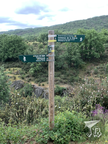
Roblelacasa happens to be the start of a hiking route to one of the highlights of the range – the Pozas del Aljibe (Aljibe Pools), with Aljibe being a word of Arab origin that means “cistern” or “well”, so not that original a name, I guess. I had been wanting to see these pools – also called a waterfall – for a while, so I decided to drive off and hike the route to see the Aljibe, which is considered one of the most beautiful in the centre of Spain. The hike is about 3.3 km each way – but guess what? I ended up taking a detour or two (≧▽≦). The pools are formed by the Soto Creek, Arroyo del Soto, a tributary to the river Jarama which in turn flows into the river Tagus.

Off I went. The drive took about an hour and twenty minutes. I left home around 8.20 and arrived in Roblelacasa around 9:40. The drive went well, most of the road was a nice national road, and as it was a local holiday traffic was scarce. Some people were in a great hurry though, ignoring speed limits. This was my first time driving on my own with the Sat-Nav, and it went all right. However, as I drove towards the range, there was a dark cloud I did not like one bit.

Just after reaching the “village”, I found a parking spot right behind the panels, as the expected parking lot was closed off. I had packed some frozen water, biscuits, the camera and my cap – but I had forgotten the umbrella, and it was a bit grey. I decided to leave taking pictures of the village for later, and I started walking just behind a couple who had arrived virtually at the same time, but I passed them as they stopped to take pictures.

Information

Roblelacasa

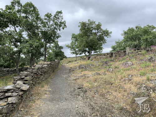
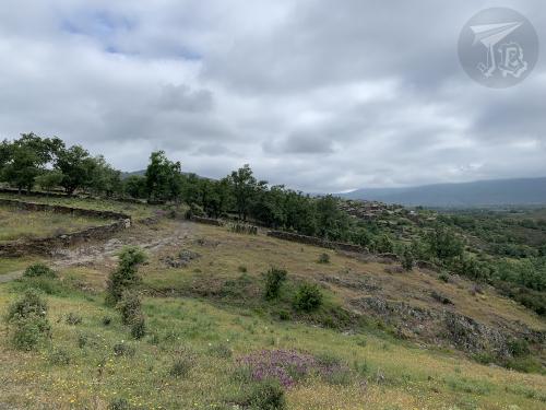
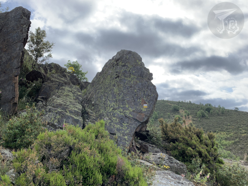
The route is officially named “PR-GU 09: Sendero de los pozos del Aljibe” and it is part of the natural park Parque Natural de la Sierra Norte de Guadalajara. Upon leaving Roblelacasa, the first couple of hundred metres crossed fractured and weathered rock before crossing a symbolic gate that marks official the beginning of the trail with a white and yellow double-line. Then, I walked onto a gravel path flanked by the remains of old fences. To the left opens a valley, and looking back I could see the village, in black.

Start of the route

Old slate fences

Valley

Valley and village

The route widens into a dirt track that is obviously travelled by car sometimes, as the range peaks stand in front of you. There are no trees but a lot of bushes and aromatic herbs, and as you walk the scent is very pleasant. Then there is a small forest and a second barrier, which marks the turn where you are going to start climbing a new hill – slowly, the terrain rises to your left while it lowers on your right, giving way to the creek’s valley. Just before reaching this I passed a family who had started walking before me.

Mountain Range in front

Mountain Range around

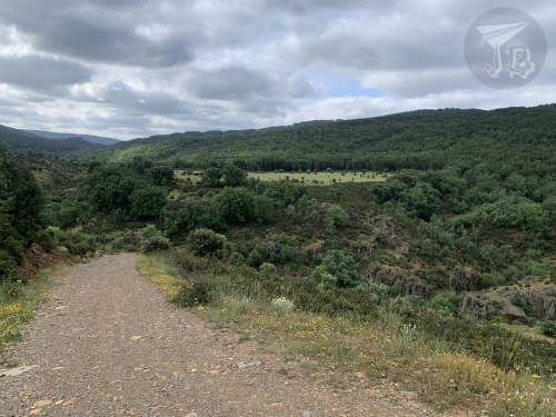
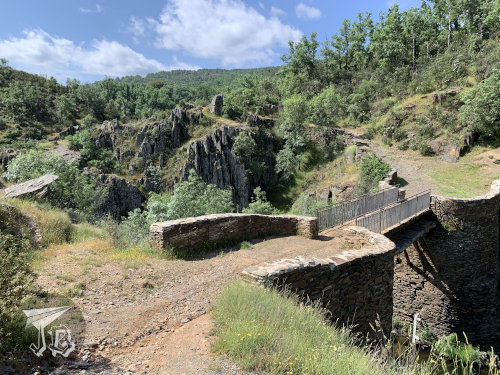
Eventually, you reach a fork in the trail, with the choices of going left towards the waterfall or right down the valley to see a former dam-turned-bridge. I went to the waterfalls, figuring out that I could always go down to the dam on my way back. The track became narrower and rocks started popping up again.

Fork on the way

Valley

Creek in the valley

Geological formations

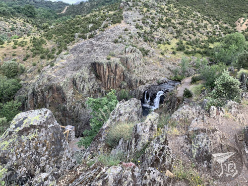
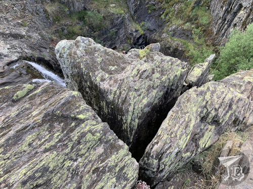
I wandered off the trail (you can see the markings on the upper picture) a couple of times because the views were neat, but a few minutes later I crossed a little bridge to get access to the waterfalls viewpoint on the left-hand-side bank… which was closed. Believe it or not, the actual waterfall area had quite a few “do not walk, falling risk” signs that… okay, I have to be honest… I pretended not to see. I hiked up to the viewpoint and sneaked a little to the side to see both waterfalls. As it has been storming, there was a good amount of water flowing, so the view was pretty cool.

Wooden Bridge

First waterfall

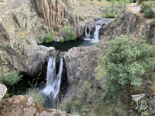
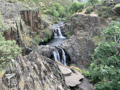
The upper waterfall is about three metres high, and the easier one to see, without needing to ignore any warning sings. When I walked up to the viewpoint I got an amazing view of both the upper and lower waterfalls, the latter being about 7 metres high. It is easy to see how they are called either waterfalls or pools.

Both waterfalls from the left bank

Both waterfalls from the right bank

Remember that I said that I passed a family on my way up? This is kind of important because it means that I was basically alone in the waterfall area for about ten minutes, enough to take a good bunch of pictures from both banks of the creek without having to edit people out. I was however very cautious about cracks and faults. I think most of the rocks in the area are quartzes but my geology skills are a bit rusty.

Cracks on the rock

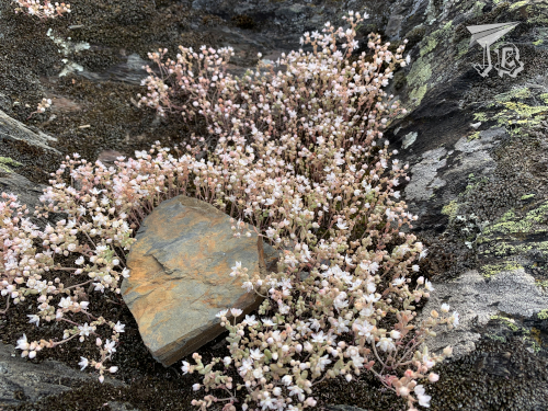
As I decided to turn around, the family arrived, and so did the couple I had first passed and another group that must have started behind me. That was okay because I was done, and on my way back I could stop for a lot of pictures that I had not taken before. Here you can see the difference between the quartz /gneiss (surrounding the flowers) and the slate (in the middle).

Flowers growing from the rock

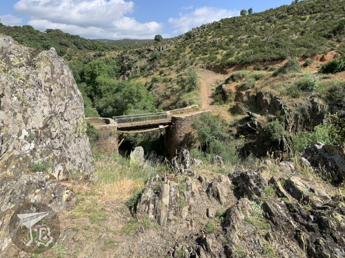
Also, at some point before I started my return hike, it cleared up. All of a sudden it was hot so first I shed off my sweatshirt and when I reached the crossroads again I really needed a drink and some shade – but I had packed water and the cap, so everything was fine, and I could divert to see the old dam, Presa de Matallana over the creek Soto – from both sides. This must have been around 11 am.

Valley on the way back

Presa de Matallana from the left bank

Presa de Matallana from the right bank

I turned back towards Roblelacasa and I noticed that the wide track was a bit more “upwards” than I had noticed the “downwards”. I had a bit of a tired moment as I adjusted to hiking up in the heat – why is it that normal hills tire me more than uneven paths? But it was over in five minutes and I was back in the village a bit before twelve. On the way now I stopped to take pictures of the flowers and bushes around, and of the valley that Roblelacasa overlooks – and ran into four or five more groups / couples who must have started walking around 11, so it was a good call to get there early.

The track back

Roblelacasa from the outskirts

Flowers on the way

This is how the village looks in the light of day, just before I took the car and drove back around noon. I decided that I would go back to the area some other time to explore other villages around, mainly Tamajón, which is reported to have an interesting geological area, and some other black villages.

The village

Oh, and a the pictureless anecdote of the trip, for obvious reasons. There were a lot, and I mean a lot of “caution wildlife” traffic signals, and on the drive there I thought that I had very rarely encountered any wildlife crossing the road. I had also not come across any wild (or domestic) on the trail, aside from some little lizards and a few pet dogs with their owners. Well, good thing I was driving a good 10 kph under the speed limit, because on the drive back I had to yield to a wild boar! Live and learn (to drive slowly in wildlife areas)!

Driven distance: around 130 km (2h 30min)
Hiked distance: 6.7 km / 11,106 steps (2h 20min)