I was awake at 6:40 to be ready for a half-day trip. However, the phone call that the tour guide had promised the day before never came. I was distressed because this gave way to two options. Either the tour guide had lied to me, or someone had forgotten that I existed. Neither was a happy thought. I tried to cheer myself up with a cup of Espresso from the room complimentary bar, and around 8:30 I went to have a quick breakfast. I was not hungry and to be honest quite upset. I had insisted five times about this beforehand.
A bit after 9:00 I tried to call the ground agency, Galaxia Tours, and I texted them through the website. But around 9:20 I said screw it. The hotel had a mini travel agency – I had noticed this because we had made an attempt to go see the light and sound show at Giza on the 30th, which the tour guide had walked around. Instead of telling us “you won’t have the time” he had deflected every question we asked about it.
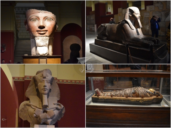
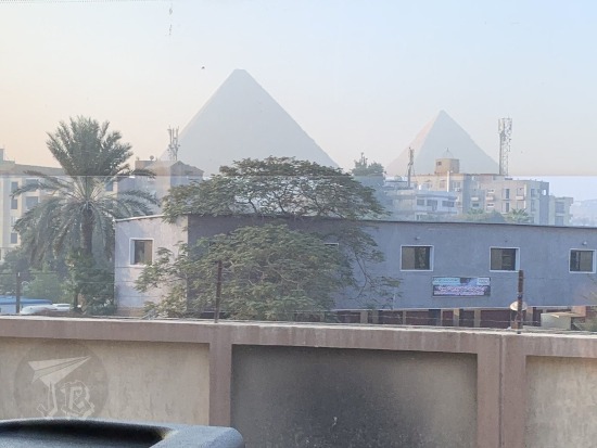
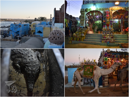
Had I had more time to organise things, I would have hired the mini-agency to take me back to the Egyptian Museum, the Museum of Egyptian Civilisation, or even the Valley of the Whales. However, since the tour guide had mislead me, I was out of time. Then again, the hotel was not in actual Cairo, but in Giza [الجيزة], and a nominal 20 minutes away from the Giza Plateau and thus the pyramids, so I hired a tour over there. And, believe it or not, I ended up… on a “camel” – actually a dromedary – for a few hours.
I had been resisting doing a dromedary ride of any kind out of concern for animal welfare, especially after seeing how they were treated at the Petra site in Jordan. However, this time it looked like it was the best option to spend my three hours around the pyramids, introducing Moses the dromedary (Camelus dromedarius).

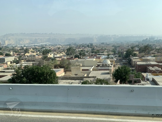
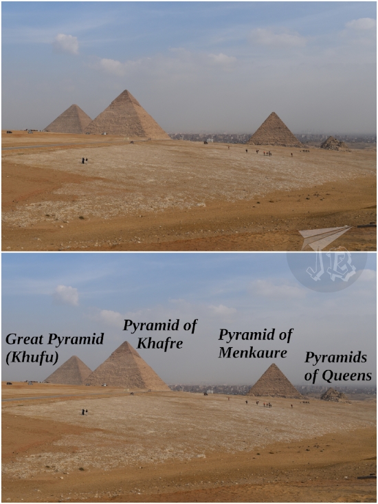
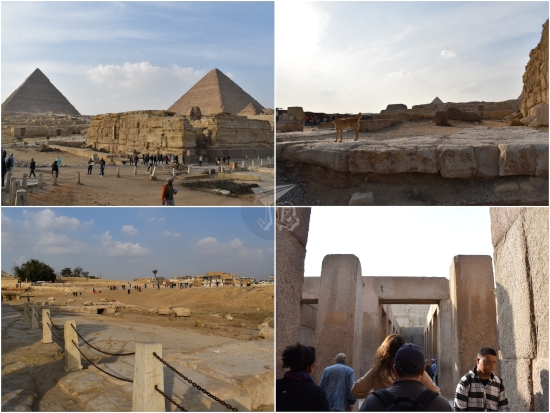
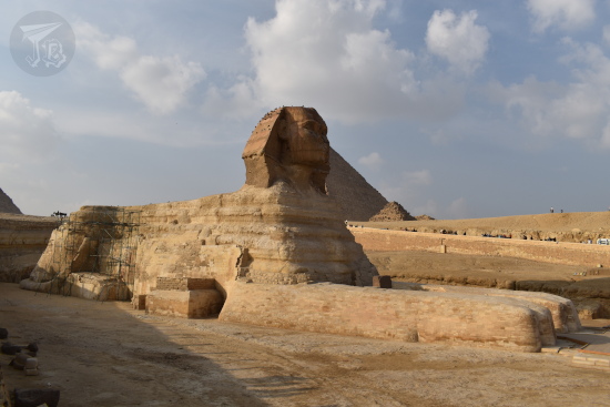
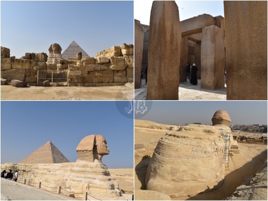
I checked out at the hotel, left my luggage at reception, and was driven towards the The Pyramids of Giza Archaeological Site [مجمع أهرامات الجيزة]. My driver was a bit creepy, so I tried to keep it light. We arrived at a backstreet next to the Great Sphinx [أبو الهول] entrance, from where I had a great view. This entrance was a bit different from the one we had used on the 31st next to the tourist bus parking lot. Most people using this entrance were Egyptians, and they were thoroughly patted down. Upon entry though, the view was astonishing – the Sphinx, and Pyramid of Khafre standing right behind it, the Pyramid of Khufu [هرم خفرع], the Pyramid of Menkaure, with the Pyramids of the Queens peeking to the side.

Riding the dromedary was easier than I thought. The trickiest part was managing his kneeling down and standing back up – I did get a cramp on the very first standing up – but it was mostly a matter of leaning forward and backwards. Through this new walk around the Giza Plateau I got to see the modern cemetery on the left, then we moved onto the archaeological site itself. From this side, I saw the path that joins the Great Sphinx with the Funerary Temple of Khafre and the Pyramid of Khafre. I also got to see the Tomb of Queen Khentkawes I [مقبرة الملکه خنتکاوس] and the Central Field of Mastabas and rock-cut tombs. It was weird, having such a vantage point of view! I got used to the rocking very quickly, so I got a few good pictures.

My guide – and Moses – took me to a a different Panoramic Point of the Pyramids, the picture perfect one, a few metres south of where we had been the previous day – this spot is not reachable from the bus, but I honestly cannot calculate if I would have had the time to get there and back the previous time – it’s hard to estimate distances in the desert, and the pyramids are too big to gauge good references.

We rode around the Pyramid of Menkaure, and actually passed between two of the Pyramids of the Queens.

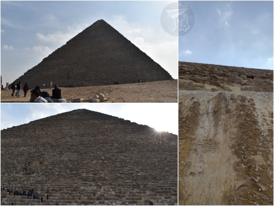
Then we moved on towards the Pyramid of Khafre. Coming closer was really cool, as I could see the granite blocks that would have made the pyramid smooth back in the day, along with the rest of some columns. Also, two sides of the pyramid are actually somewhat sunk in the ground, with a vertical wall of rock-cut tombs. I know I was paying for it, but being able to walk around the pyramid felt special, and allowed me to feel awed at the size and technology again, considering these were built about 4500 years ago.

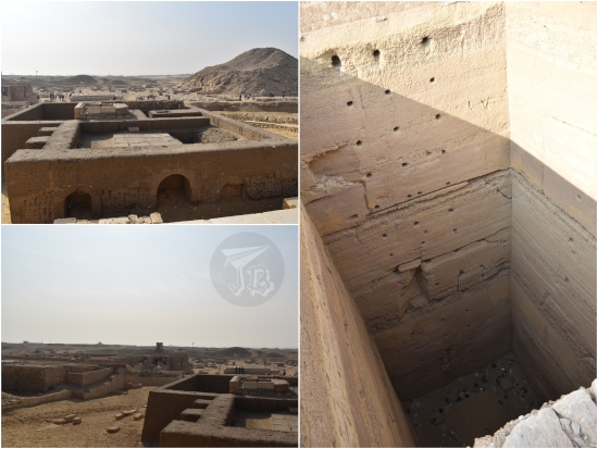
The Pyramid of Khufu stood to the left, and we continued our ride towards the Central Field of Mastabas and rock-cut tombs and the Tomb of Queen Khentkawes I.


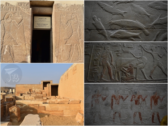
I dismounted again and walked into the Valley Temple of Khafre [معبد الوادي لخفرع]. This time, not running and with fewer people, I got to see the megalithic structures for real. I also could go to see the rump area of the Great Sphinx of Giza.
Afterwards, there was an “essence shop” experience, but as I told the lady I would not be buying anything, she dispatched me really fast. My driver got only creepier in the way back, so I tipped him and ran off to the reception of the hotel, where I sat down to wonder whether someone would pick me up from the hotel, or they would forget me like they had for the dray trip. Fortunately, I spotted some people I had seen during the New Year’s Eve party, and it turns out that they had the same pick up. That was good, because handling the transfer for Cairo Airport – and the airport itself – would have been more stress than I was willing to deal with. I actually think I was forgotten indeed, but this family was not – I did approach the representative they pointed out, and made him aware of my existence. Firmly.
At 14:05, we were off on the mini bus towards the airport, and it took a bit over an hour. Meanwhile, they gave me a questionnaire to fill in – I tried not to get personal, nor attack anyone, but I was very sincere about the things that had gone wrong. Being forgotten is not a nice feeling.
We reached the airport past 15:00. There were two security controls for luggage, and one pat down. In the second control, the guards got money to let a group go before me, and the guard actually gestured that money would make things go faster. However, waiting had an interesting consequence… I met the people who went on the day trip, to Saqqara again, and they entered other pyramids there. So there had been another day trip – and again, lied to, or forgotten about?
But I had had my own fun, so I did not let that rile me up. I checked in, dropped my luggage, got my exit visa and settled down to wait – I was now just destined to have to listen to We wish you a Merry Christmas on loop for as long as it took to board. I got myself a cheese sandwich for lunch – this was past 16:00 by now, I was a bit hungry after only a fast breakfast. Cairo Airport is anything but traveller-friendly. Half the shops were closed, but without signs, so they just yelled at you if you walked in. There are no sitting areas next to the gates, just the shops, and I did not want to sit on another floor and rely on their English to know when boarding was ready, so I just walked up and down “a few” times. I was lucky enough to be next to the gate when boarding started – with yet another X-ray control, getting separated by sex, and being frisked. And yet, you have to take off your shoes, but you are allowed water bottles on the plane… Weird.
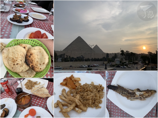
We finally took off around 19:30 for very uneventful five-hour flight. We got dinner on the way, which was unexpectedly nice, and I had a window seat, extra water, and got to see Cairo goodbye.

Overall balance: things were left unseen, and maybe one day I’d go back to see the rest of the Valley of the Kings, the Valley of the Queens, and the new Grand Egyptian Museum. Possibly the Valley of the Whales. But I don’t really feel I must come back any time soon. It was the adventure of a lifetime, and I am very grateful I got to live it. I do admit, however, that I dropped by my travel agent’s to make it known that someone had either forgotten me, or lied to me, and that I was not happy – similarly to what I had done with the questionnaire. I don’t know if I’ll ever get a reply, but I have to say the experience has left me not feeling up to trusting anyone with my travelling for a little while. Though I had to admit, my first solo experience with a group was all right… nice people all around, so I’ve been lucky in that department.