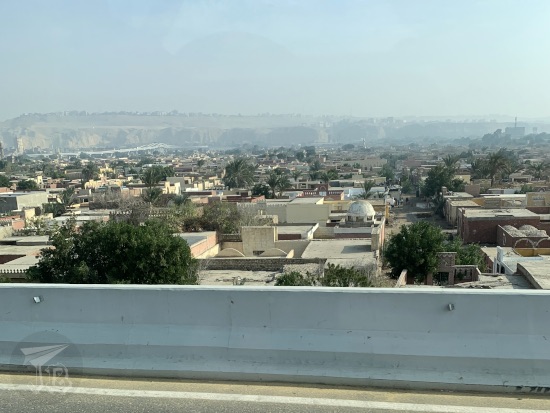
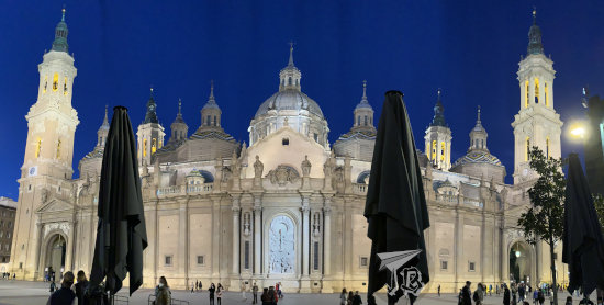
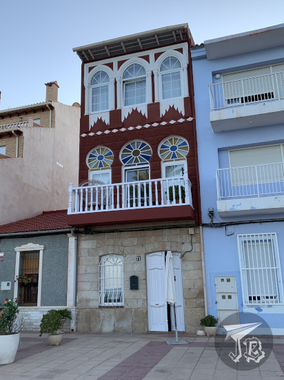
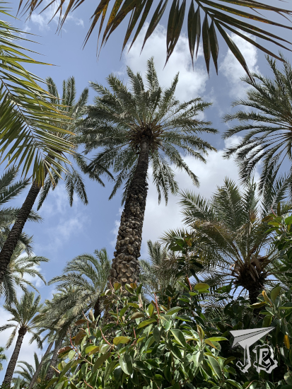
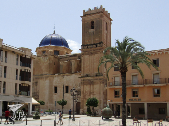
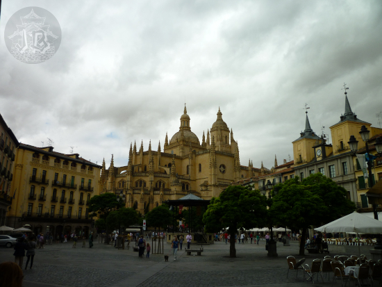
I woke up early – way before the alarm clock went off, so I decided to hit the road. I first topped up the fuel tank at the cheap petrol station near my place. Afterwards, I drove off to the motorway and the morning rush hour. As I was caught in the traffic jam, there was a pretty rainbow in front of me – no pictures, though, for obvious reasons. Traffic dwindled a lot when I left the A2 behind and merged onto M50. From there, I took a couple of hours to reach my first stop, the village of Consuegra. On the mountaintop of the so-called Cerro Calderico, in the outskirts of this ten-thousand inhabitant, stand some the best examples of restored traditional windmills.
During the Middle Ages, the area in central Spain known as La Mancha proved a challenging place for watermills, the dominant technology at the time. The rain regimes cause irregular river flow, with a lot of the currents drying up in summer. As demand for flour grew, windmills were built near but outside towns, on high ground. They provided clean flour, cheap enough to be affordable, without being subjected to draught or flood seasons changing. The windmills lived its golden age from the second half of the 16th century until almost the 20th. Towards the end of the 1800s, most of the cereal crops were exchanged for vines in order to supply wine to France, leading to the decay and progressive abandonment of wind-milling. The Industrial Revolution and the appearance of fossil fuels and electricity finished off whatever little remained in the early 20th century.
However, besides their practical function, there was something else about the La Mancha windmills. They had gone viral centuries before the Internet was a thing. In the year 1605, Miguel de Cervantes – considered the greatest writer in the Spanish language – wrote his masterpiece El Ingenioso Hidalgo Don Quijote de la Mancha, worldwide known as “Don Quixote”. The novel is amongst the most translated literary works in the world, and tells the tragic story of a minor nobleman, the title character, who goes crazy from reading too many chivalric romances. He decides to leave his home and become an errant knight, having great adventures in his mind, which are more misadventures in real life. He is accompanied by a farmer-turned-squire, Sancho Panza.
During one of his delusions, Don Quixote fights giants with long arms – which the reader knows, from Sancho’s warnings, that are in reality windmills. Of course, the madman is “defeated” by the blades, which shatter his spear on impact. It is one of the most famous passages of the book, even if it is barely a page or two in the eighth chapter. Throughout the novel, which starts “in a village of La Mancha, the name of which I have no desire to call to mind”, several locations are explicitly mentioned, others are implied, and some have completely imaginary names. Experts have placed this fictional encounter with windmills either in Consuegra or Campo de Criptana – which was not on my route.
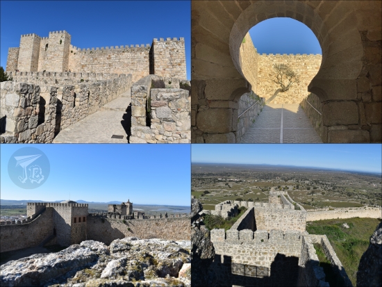
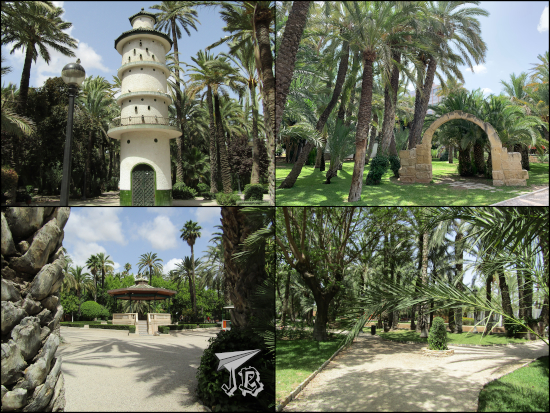
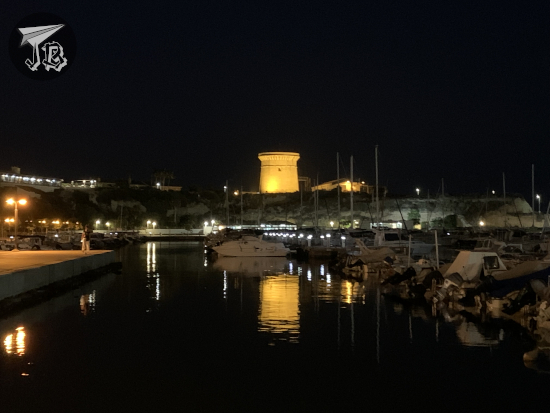
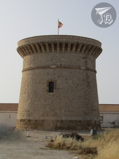
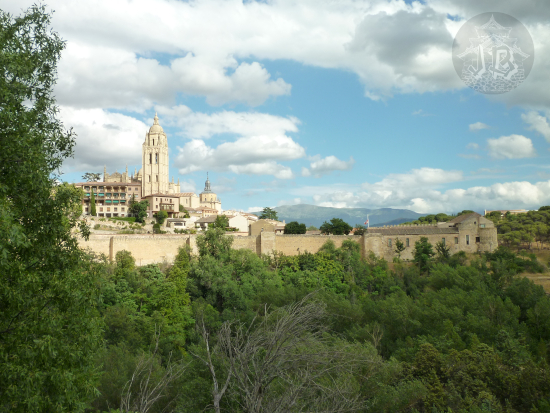
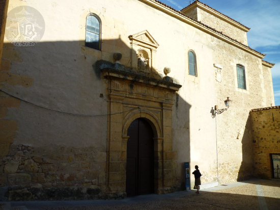
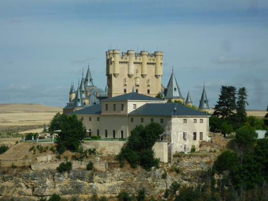
Thirteen windmills were built in the 19th century on the Cerro Calderico, and twelve have been restored and turned into tourist attractions – one even works. They stand in a row alongside the ridge and next to the local castle Castillo de la Muela (or Castillo de Consuegra). After all, both castles and windmills need the higher ground to be effective, in a way. The castle already existed in the 13th century, with roots in a 10th century previous fortress.
I parked at the foot of the hill and walked up to see the castle and the windmills. The castle was closed as it was a local holiday, and the fortress is managed by the town hall. I stayed around for an hour or so, walking from one end of the hill to the other. I had a snack as I snooped around, then I moved on.

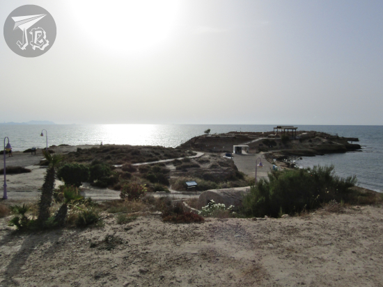
My next stop was the National Park Parque Nacional de las Tablas de Daimiel, a weird place. I call it weird because despite its status as a protected area, it has been on the brink of collapse for the last century or so. The wetlands have been drying out for decades.
The area is the literal last of its kind in Spain, a kind of wetland generated when rivers break their banks in their middle course on flat terrain. In the middle of the de facto Spanish Inner Plateau desert, it is formed by the rivers Guadiana (fresh water) and its tributary, the Cigüela (brackish water), and fed by a number of underwater aquifers. These have been exploited for farming, which seems to be the cause for the dessication. So out of what it should be, there is only one medium-sized pond, Laguna de Navaseca (usually referred to the “permanent pond” Laguna Permanente), where a number of birds, fish and amphibians live either seasonally or all year round. The area was designated a national park in 1973. Later, it received other protections, especially regarding the bird population.
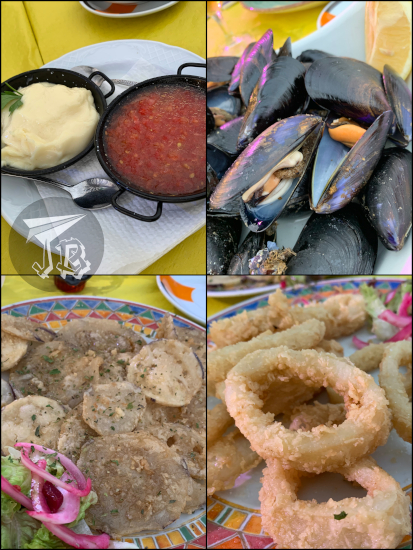
I parked in the allocated space and had a sandwich before I went in. The visitors’ centre was manned by a very disgruntled employee who explained the dessication to me as if I were personally responsible for it. I really felt like apologising. The truth is that the first place I visited was the pier, which has not seen water for at least a decade. I could do two of the three walking routes, but in the end I only did one and a half, as the second I tried was way hot and dry and I gave it up three-quarters in, as there was no water any more.
In the end, I stayed around the main pond Laguna de Navaseca, where wooden walkways have been built. I felt horribly guilty whenever the wood cracked under my feet and I scared the ducks away, but the local guides could be heard from across the whole pond. On the banks, there are bushes of common reed (Phragmites) and rushes (Juncus). The only tree in the area is the tamarix (Tamarix gallica), small and brime-resistant.
In the pond – and flying over it – I found a flock of greater flamingoes (Phoenicopterus roseus) – which are for some reason not listed anywhere that explains the park. I also saw herons, ducks, geese and I swear ibises – the latter are not mentioned either, but my bird identification book suggest a glossy ibis (Plegadis falcinellus). I was hoping that autumn had modulated the temperatures a bit, but it was extremely hot. It was also… stupidly dry for wetlands… That is why I gave up on the second route halfway.


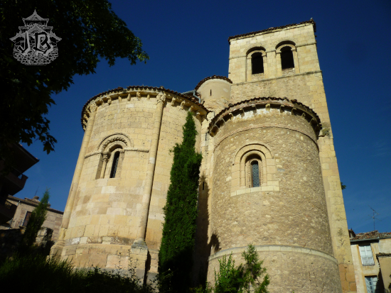
I went back to the car and drove to a small parking lot at the entrance of the park which allows you to see the watermill. It was closed, and again dry, but it was an interesting structure.
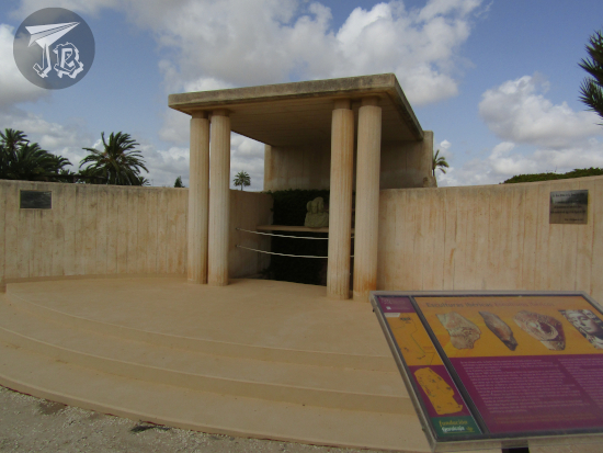
I continued on the road towards the archaeological site Yacimiento Visitable de Calatrava la Vieja in Carrión de Calatrava, which has a very nice and shaded parking area, where I had my second sandwich as I was there 30 minutes before schedule – read: they had not opened yet.
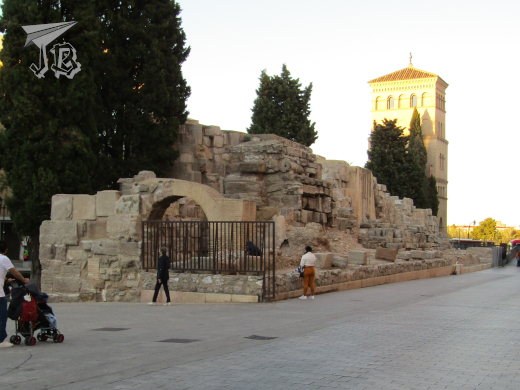
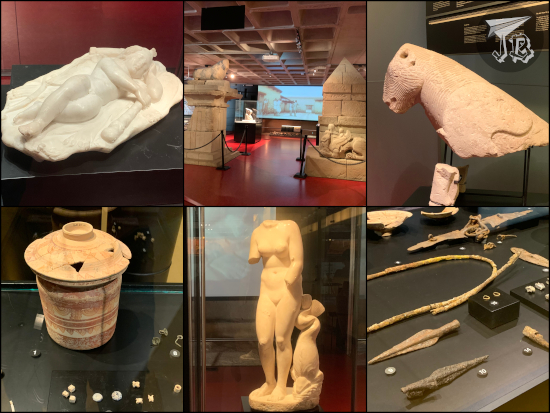
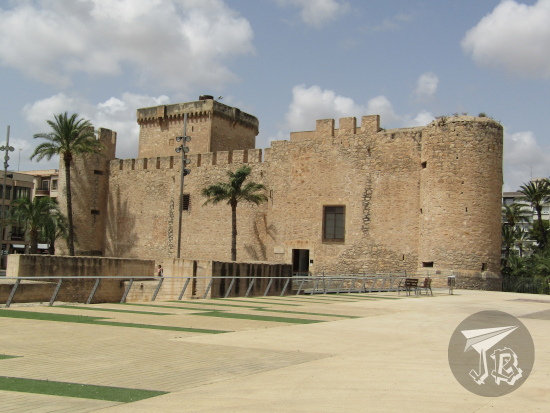
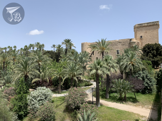
The archaeological site is considered one of the most important of Moorish origin in Spain – a city and a castle from that period, erected on older remains, probably Iberian. Back during the Arab vs Christian wars in Spain, the fortress was right in the middle on the way between Toledo and Córdoba, along with other important commercial routes, so it became a key defence point. It is known that the castle already existed before the 8th century, on the Guadiana riverbank. When it fell to the Christians around 1150, it became the first line of defence, and it was entrusted first to the Knights Templar and then to the Cistercians. It became the birthplace of the first Spanish military order, the Order of Calatrava Órden de Calatrava.

The castle was built on a plateau, defended by the river itself and the walling structure, which included at least 44 flanking towers. There were four fortified corridors (corachas) that protected access to the water. The entrances to the inner fortress had several turns to make them easier to protect. Between the inner core and the walls stood the medina, the Islamic city, and the alcázar rose as a sort of triangular keep, accessed through a triumphal arch. The inner castle itself is the best-preserved area, having even rebuilt furnaces to make clay. During the Templar times, part of the alcázar was repurposed into a budding church which was never finished. On one of the inside walls there are carved drawings of vessels.

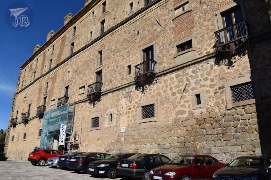
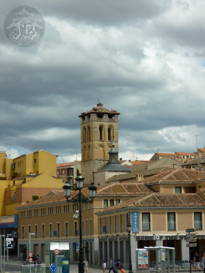
As I climbed the walls, clouds had started gathering and the wind had picked up. I decided to get going, trying to outdrive the storm. At first I thought I had been lucky, but about 20 minutes away from Almadén, the skies opened and there was a torrential downpour. I was lucky enough to find a parking spot where I hoped, down the corner from the hotel, and I have an umbrella in the car. A few minutes after parking, the storm stopped though, albeit the rain did nothing to cool down the evening. I checked in, and the hotel lady gave me a map with all the spots that have been inscribed as World Heritage Heritage of Mercury. Almadén and Idrija.
Mercury (chemical symbol Hg) is a native metallic element, the only one which is liquid under normal temperature and pressure conditions. In nature, it is usually found as cinnabar (mercury sulphide, HgS), a bright scarlet mineral. Its formation is linked to volcanic activity and alkaline hot springs (the area of Ciudad Real comprises the extinct volcanic field called Campo de Calatrava, which I drove through, but found no way to stop anywhere to explore). Liquid mercury, also called quicksilver, is extracted from cinnabar by heating it, as sulphur evaporates with heat.
Mercury is toxic to the nervous system, dissolves gold and silver, and has long been associated with “mystical” powers and sites – the first emperor of China was buried in a tomb with rivers of mercury, there is mercury under one of the Teotihuacan pyramids in Mexico, and in the end it carries the name of the Roman God of Messengers and Travellers. It has fascinated humans throughout history.
The name of the five-thousand-inhabitant town, Almadén, comes from the Arabic Al-maʻdin [المعدن], which means “The Mine”. The site was already exploited in times of the Romans – the extracted bright-red cinnabar was used to create vermilion paint for the walls of Pompeii and Complutum. When I was a child, my history book had some information on Almadén, and the accompanying photograph showed someone who had thrown a cannonball into a mercury pool, but the cannonball was floating on it. I have wanted to see the mine since then, even knowing that there was no way I would ever see that one pool any more, due to the legislations that have deemed mercury as “too toxic for anything”.
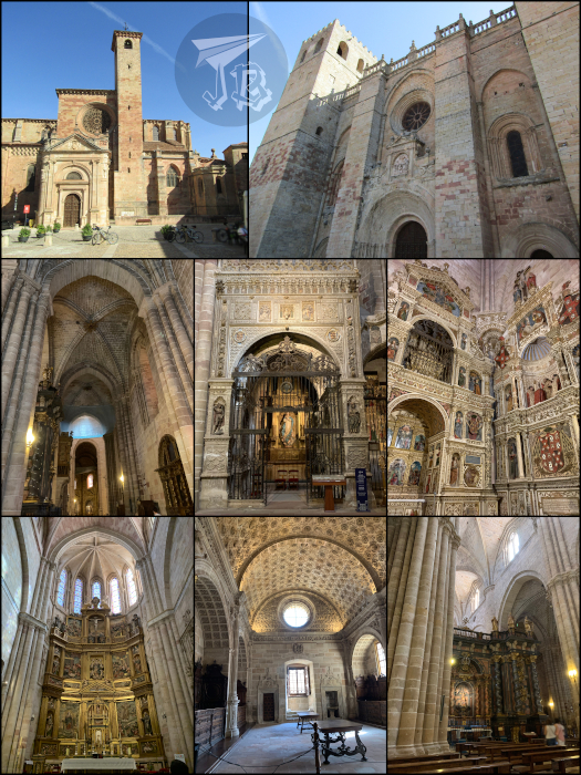
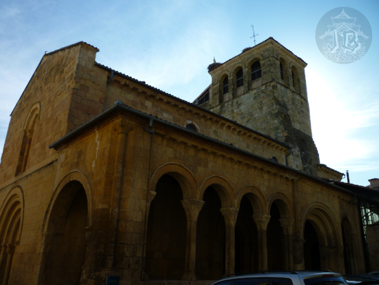
I went to have a look around town. It was dusk and everything was closed – not that many things would open the next day anyway. I did a small circular walking tour which included the main church Iglesia de Santa María de la Estrella, and down the main street the central square with the town hall Ayuntamiento de Almadén and the church Iglesia de San Juan. I continued on and found the the old mining school Antigua Escuela de Ingeniería de Minas. To the side of the street stands the former castle point Castillo de Retamar, where only a turret remains. Up a little, I reached the third church, Iglesia de San Sebastian and the ruins of the manor house Casa de la Superintendencia.
I undid my path and headed to the other side of town. In a secondary square there is a monument to miners Monumento al Minero, and across the street the bullfighting ring Plaza de Toros de Almadén. My final stop was the former hospital Real Hospital de Mineros de San Rafael. I had dinner at the hotel restaurant, which honestly was a little disappointing.

I headed back to the room to have a shower and some rest, and get ready for the following day – and try to digest dinner.