10th October 2025: Too early for autumn: Bosque de Valdenazar (Yebes, Spain)

A friend phoned me for a day out, and I gladly agreed. Their idea was to check out the small forest Bosque de Valdenazar, in Yebes. We were hopeful for some nice autumn colours, but as it turned out, we were a tad bit too early for them.

We both had done the route before, myself back in May. The forest is supposed to be astonishing in fall, with plenty of gold and red leaves. Unfortunately, weather in 2025 has been crazy, with summer-like temperatures right up to late October, so most trees were still green, and they would probably just lose their leaves before they could turn gold. I am not a fan of autumn weather, but the colours are pretty – I ended up taking another go later, even.

The route Ruta SPG-24 has recently gained traction as a pretty spot since the town hall fitted it around the neighbourhood called Ciudad Valdeluz. The population of the area has been steadily growing lately due to lower housing prices and an increase of services offered. But maybe, the biggest impulse that the Route had might have been that the local park has been quarantined due to an avian flu outbreak – everything was cordoned off.

During the walk, which takes less than an hour, we spotted some red squirrels (Sciurus vulgaris). These rodents live on trees and enjoy nuts. In Spain, it is said that they love acorns – or at least, hoard them in autumn so they can feed through the winter. As a good part of the forest is composed of oaks, these two have a good chance to survive. We thought they might be a couple, but it turns out that squirrels just mate sporadically when they’re in season, so they were just neighbours, as red squirrels are not territorial.

A view of an oak forest. Most of the trees are greyish green, but osme of them have started turning a bit yellow with autumn.

A path in an oak forest. The trees seem to arch over it. Some have started losing their leaves, which has carpeted the path with them. The trees have started showing yellow, brown and reddish colours, but the leaves on the ground are all brown-grey.

A red squirrel looks at the camera from a tree trunk.

A red squirrel peeks at the camera from behind a tree trunk, only its upper body is visible, but it seems to be smiling.

A red squirrel gathering acorns from a leaf-covered ground.

A path in an oak forest. The trees seem to arch over it. Some have started losing their leaves, which has carpeted the path with them.

We did not let the lack of autumn disappoint us, and grabbed the car to go back to town and enjoy some pancakes in a local café.

23rd August 2025: Cárcavas de Mingo Negro (Spain)

For all the solo exploring I do, I still second-guess my abilities when something I want to see involves a reported-as-difficult hike. However, I got tired of waiting for people who had expressed interest in tagging along for this small adventure. Thus, when the summer heatwave gave way to more bearable temperatures for a couple of days, I drove to the area. There is a convenient parking lot to leave the car without breaking any laws and since I reached it before 9:00, it was still reasonably empty, even if it was a weekend. I changed into my hiking boots and got on walking.

The spot I wanted to reach were the Mingo Negro Gullies Cárcavas de Mingo Negro, in the municipality of Alpedrete de la Sierra, within the nature reserve Parque Natural Sierra Norte de Guadalajara. Gullies are erosive landforms usually created by a combination of running water, especially torrential rains and floods, and small landslides as the sediment collapses. Gullies tend to be devoid of vegetation and generally quite vertical, as they commonly form on steep landscapes, often on sandstone or conglomerate soils. These particular gullies are the remains of an alluvial fan, an accumulation of sediments characteristic of mountain areas in semi-arid climates, which opens as it leaves a confined area, so when you look at it from above, it resembles a fan – hence the name. Gullies are common in badlands as the dry terrain is drained downwards and no vegetation holds it. They are considered to be unstable landscapes.

The Mingo Negro Gullies are on the left bank of the River Río Lozoya. A dam Presa del Pontón de la Oliva was built to contain the river in the 19th century, and though it is still standing, it could not be used as a reservoir. There is a kind of road / bridge that crosses the river and leads to the trail. It was rather easy to follow at first, but eventually I reached the steep part. Though there is technically a trail there, somewhere, the ascent is not easy to follow due to poor maintenance and water erosion. Hiking up the 370-metre slope took me about 20 minutes, and it was tiresome for but not as hard as I had pictured. To be fair though, I’ve recently bought a hiking pole and that was helpful. The terrain was a bit unstable and I kept my eyes on the ground, which is why I almost missed the first sight of the gullies (a later visit to the area revealed that I should have already seen them from right out of the parking lot, but the sun was in my eyes).

A landscape of reddish gullies in the far background

The trail is not well maintained, so plants are overgrown. If you actually want to see anything of the gullies you have to go past the “do not cross” signage, even at the viewpoints. However, you have to be very careful not to approach the border as the terrain is inherently unstable. While I was coming up, the sun masked the clay-red colour a little, which was a pity.

A landscape of reddish gullies

Though some of the online-sourced routes do so, it is also ill-advised to go into the actual gully, so I just stayed in the upper part along one of the marked trails. I did step beyond a couple of barriers, but made sure to stay a respectable distance from the border. I ventured through some of the secondary paths for pictures on my way down. However, I did not go down to the ravine, as cool as that must be, because there is a risk of collapse.

A landscape of reddish gullies with hills in the background

A landscape of reddish gullies

There are several trails that go to or around the Cárcavas de Mingo Negro, the most common of it circular. However, I did not feel like doing that one, which takes over four hours. I wanted to see the dramatic gullies, so once I was done around that area, I turned back using the same trail I had used to climb up. By that time it was around 11:00, and though I had seen nobody on my way there, now I started meeting people climbing. A family became quite indignant because I was not following the circular trail. Someone else had decided to tackle the hike in flip-flops. Some people are… peculiar.

There is a bar somewhere at the beginning of the route, and there were some buildings indeed. However, it was either closed – or I did not find it. I had thought I would stop for breakfast there, and then head to do something else.

I reached the Presa del Pontón de la Oliva dam again. The structure, in the municipality of Patones, belongs to Madrid’s Water Management system Canal de Isabel II and it is considered local heritage as it was the first dam built in the area. Madrid became the capital of Spain in 1561, and in the 19th century its population was growing fast. Water was obtained through fountains, whose waters came from underground water canals built 400 years prior. From the 18th century onward, architects started studying how to channel water from the nearby rivers into the city. Part of this program yielded to building the dam between 1851 and 1856 with the idea to create a reservoir. The structure is a gravity dam, with a height of almost 30 metres and a width of 72 metres at its longest. Two years after it was built, the rest of the project was completed, and water reached Madrid. However, the location had not been correctly chosen – water filtered through the rock walls to the sides and underneath the ashlar construction – and in 1904 the reservoir was closed down, so water flows freely through a tunnel under the construction.

I heeded the “flood plain, do not enter” warnings, but neither Sunday hikers nor free-range cows did. I remained on the upper area and explored a little of the area called “the balcony”, built alongside the dam to admire the structure. There is another hiking route, Ruta del Agua that starts there, but again, this was not something I wanted to tackle today, as it was my first day out after a long period at home. Had I found the bar open, I would have hiked further (the whole route is about four hours though, so it was probably good I did not).

Dam - Pontón de La Oliva with some cows grazing. Since the dam is no longer in use, the area around the dam is dry

In the end, I headed back to the car and drove off. I thought I might stop to see a windmill on the way, but I somehow missed the turn to the hamlet where it stands. I was almost surprised when I saw the road sign for the last village before home. All in all, I saw what I wanted to, and found a nice easy drive with further routes that can be taken and enjoyed in other circumstances. I think I can reasonably squeeze a couple other visits to the area.

19th July 2025: Highway → Murero → Highway → Home {Dinosaur Eggs Loarre & Zaragoza, July 2025}

While Zaragoza (Saragossa) is not a super-busy city, the noise from the large avenue the hotel was in woke me up early enough to be amongst the first customers at Pannitelli Original Bakery. I had a toast, orange juice, and a coffee, then set off to the not-so-easy task of retrieving my car, driving back to the hotel, getting my deposit returned, and going on my merry way. It took a while, but once that was taken care of I could drive off. Getting out of Zaragoza was easier than getting in had been, and there were few cars on the road. One of them was the traffic police, so every driver seemed on their best behaviour…

Once in the speedway, the first stop of the day was a petrol station, as there was no way I made it home with one quarter of a tank. Unfortunately, there were no low-cost fuelling points on my way, so I had to use a big-name one. Thirty euro don’t take you as far with branded fuel…

To be fair, I could have driven home the previous day, but I thought that after such a week, an extra night of sleep could only be beneficial. Staying also allowed me to see the Asian treasure exhibits in the Lonja and make a stop on the way. My first idea had been going downtown to see the Natural History Museum, but it closes at the weekend. That was why I asked about the visit during the course, and it turned out it was doable. Thus, in the end, I decided to make a stop in a small palaeontological site that I would not travel to otherwise. Furthermore, the site popped up during the course twice – the signage had been handled by Paleoymas and the Natural Science Museum had quite a few specimens from there.

View of a valley with a sign that reads 'Plaeontological site' in Spanish

The Yacimiento Paleontológico de Murero palaeontological site holds remains from the Cambrian Period, extremely important because there are around eight million years’ worth of fossils (511 to 503 million years ago) preserved in the strata. Palaeontologists have found about eighty species of trilobites, along with echinoderms which had not yet developed five-way symmetry, brachiopods, worms… It is mainly composed of shales which allow for soft-bodied organisms to be fossilised along the hard bits like shells or exoskeletons. The site is famous because it allowed researchers to identify sexual dimorphism in trilobites – they were able to describe two distinct types of animals within a same species, which are interpreted as male and female. What they don’t know is which animal is which sex.

I left Zaragoza using the A23, then turned to a national, smaller road (N234) that crossed over to the A2. The site and the municipality it technically belongs to, Murero, lie halfway through this road. As mentioned before, not somewhere I would purposely travel to, but since I was literally in the area, it was a convenient stop. The regional road was all right, but the local one was narrow and the curves were very sharp and steep. I was thankful that all of the cars I saw passed while I was hiking or taking photos of the site, and none while I was driving. I decided to only stop at the area which had a small parking lot so it was safe for me and any potential driver.

To be honest, I expected to see more in the palaeontological site. The signage has either weathered out or been vandalised and nothing is readable. It is a short walk up and down a hill where you can’t really see anything except for a box at the top where people leave what they find, but there was not a chance to see anything in situ. I guess the palaeontologists and the amateurs have taken out everything that is worth anything already – or left it well buried so it can’t be pillaged. I wouldn’t even consider it a nice hike because broken pieces of slates made the path extremely slippery (I forgot my hiking boots in the car…).

Walking upward to the site, among the pines. On the lft there is a rock with the number 6 painted on it with yellow paint.

Side of the mountain with pine trees

And oh, the temptation to steal a trilobite from the display box was strong! I resisted it though, and headed back to the car after an hour or so. I undid the path towards the N234 road and continued onto the A2. I made a stop in-between for some caffeine and a snack, but I was home for Spanish lunchtime. I have to admit I had pondered stopping somewhere along the way, maybe Daroca, Belchite or Calatayud, but considering that I still had to drive back, I decided to leave it for another time.

Cool crystal dendrite, which is not a fossil but still neat

Fossil equinoderms on a stone

Fossil trilobite, deformed by pressure and the pass of time

On my first solo road trip, I was surprised by the sheer amount of people who like driving at the same speed all the time. A bunch of drivers in the regional road, with limits of 90 kph, did 70 kph even when they drove through 50 kph towns. The same happened in the speedway – some people drove at 110 kph, both at the 120 kph or the 100 kph stretches. There were also those who liked aligning their cars with the markings that separate the lanes, effectively occupying both. The lorries were more manageable on the way back than towards Loarre, as it was a Saturday morning, and because the speedway feels more “downwards”.

Once home, it hit me how tired I was, so I guess it was a good thing that I had not made another stop. Checking Murero out was a good idea as it broke the trip in half and was a small hike that helped me keep alert, but more would have been overdoing it.

As a recap of my experience with the course Técnicas de restauración en paleontología a través de la preparación de los huevos de dinosaurio de Loarre: Palaeontological Restoration Techniques through the preparation of Loarre dinosaur eggs, I can say that all in all, it was amazing. The professors were extremely knowledgeable, they made learning effortless and entertaining, and the group was fun and easy-going. The course was way more hands-on than I had expected, literally covering everything from geological analysis to the fate of a dug-up piece, either in display or in storage within the museum, including working with the fossils themselves. It was not cheap, mostly due accommodation choices, but booking in advance probably made it better – and honestly, decent hotels were a must. As Loarre is a small village, food options were limited. Though there was a bakery / shop, we were out doing stuff while it was open. However, I made do with crisps or nuts for dinner, as I had a good breakfast. Probably lunch in Ayerbe was the weakest, and most awkward since it involved getting to know each other (and ten bucks for a frozen pizza was daytime robbery).

The whole trip involved driving around almost 700 km. It did show me that I (and my coffee-maker of a car) can manage the long drives better than I had expected, even during a “peak” time such as a holiday-period opening date. I am more comfortable on the road than in towns, though, even when caught in a jam. Was it the smartest idea to head to Loarre directly after work? Probably not, but if I had to do it all over again, I probably would – it was the only actually available option. And knowing that not all the course openings were filled, I would not have stressed as much over the University’s lack of efficient sign-up.

The only downside I can find is the lack of mental reset – I was constantly learning new facts, and I did not get much me-time. It was extremely fun, but not really a holiday where I could plan and do stuff at my own pace. Would I do it again? Well, the University of Teruel runs a similar summer course using Dinópolis resources, and sign ups open in February…

Stay tuned.

11th May 2025: Ruta SPG-24: Bosque de Valdenazar in Spring (Yebes, Spain)

After the rainiest spring in ages, I had a couple of hours in a free morning – or actually, I just needed to do something for a little bit before I could become productive again. And the Internet helped supplying the information of this little route that could be done in under a couple of hours.

The route inches into the oak forest Bosque de Valdenazar, mainly composed of Portuguese oaks (Quercus faginea) and holly oak (Quercus ilex). The track was designed and is maintained by the municipality of Yebes. It delves into the forest and runs parallel to a small stream with bulrushes (Scirpus holoschoenus), rubuses and black poplars (Populus nigra). The area is home to roe deer, small raptors, and foxes, but none of them were around to be found – probably due to screaming kids. I did see some deer tracks.

It felt a bit silly to drive somewhere for a walk, but it was the only way to get there. Google maps was missing three roundabouts, but my Sat-Nav got me there without a hiccup – and considering that I’ve needed to MacGyver a stand for it because the wire keeps coming loose, I think that’s a feat. I parked at the entrance and set onto the hike.

The first stage was a small picnic area, after which came a bit of a steep slope with makeshift stairs. The route is mostly circular and I thought following the arrows was the way to go. At first I was alone, but then I started running into other walkers. The problem was that of course, they were chatting – and the families being a bit loud – and that made any possible fauna sighting impossible.

Valdenazar forest pathway

Valdenazar forest, start of the route

I had a look at what they call the carboneras, a bunch of oak trees that were repeatedly cut and slow-burnt to create carbon. That caused the living trees so they had strange-looking trunks, with several thick branches growing from the stumps. I found the viewpoint to look at the whole valley for a bit, before I walked into the actual forest. There is a wide track that feels a bit like the forest near The Shire in The Lord of The Rings, with the light sweeping through the leaves and the light breeze.

Valdenazar forest trail

Valdenazar forest

Valdenazar forest trail

I reached the stream and deviated to a sub-track known as Senda de la Fuente (Fountain Trail), parallel to the water flow. I expected an actual fountain at some point, but there was just a small waterspout. After that, it was just a bit of an uphill walk to get to the picnic area again.

Valdenazar forest trail

All in all, I was there for about an hour and a half. It was pretty but not the spectacular walk I had read about. I’ve read that it is incredible in autumn, so I might have to check it out again by then, but the truth is that the weather has been crazy in 2025, so I’m not sure we will even have an actual autumn… But all in all, the hike was nice and it cleared my head, which was exactly what I needed at that point.

24th September 2023: Hiking to the Castle of Zafra (Spain)

An association in my town organises monthly hiking outings. I decided to give it a try – if it worked out, I could go out every month at least once for a cool day trip, and I would not have to be alone for a bunch of difficult trails. And if I got to make some friends, even better. I signed up for the first hike: Sierra de Caldereros, Pico Lituero y Castillo de Zafra. It was described as a moderate route of roughly 17.5 km and an altitude gradient of 916 metres. The main reference points were: Cubillejo del Sitio (drop-off) → Pico del Águila → Pico Lituero → Castillo de Zafra (highlight) → Hombrados (pick-up).

The group met on Sunday the 24th at 8:00, and we got on the coach. It took two hours to get to the drop-off point. I quickly realised that the group was already established and not too open to first-time newcomers. That did not deter me though, and I found my pace between the faster and the slower walkers. What I did not like was that a good deal of the route was not through a track. The description mentioned a path, which I did not see. It was a bit riskier than what I enjoy on a hike, for more experienced adventurers.

Ridge Sierra de Cubilleros track

I found the hike too energy-demanding to be able to enjoy the landscape, except when the walking stopped so we could regroup. I was able to spot a few animal tracks and some cool karst and sandstone structures. Underneath our route, the never-ending Castilian plains got lost in the distance. There were a lot of insects, especially horseflies, trying to suck us dry. We reached Pico del Águila in a bit over an hour.

The climb to Pico Lituero was hard because it was done off track, but once on top the first part of the group could catch a breather. There was a bird of prey circling over head, so I might have sneered a little about it hoping for lunch. I sat down at the summit for a little while and snacked on a cereal bar while waiting for the second part of the group.

Castilian plain from Sierra de Caldereros

The highlight of the hike was the castle Castillo de Zafra. It is believed that the original fortress was erected by the Visigoths in the 8th century. It was built upon by the Moors, and eventually taken by the Kingdom of Aragón. The castle itself was built in the late 12th or the early 13th century and today it is part of the municipality of Campillo de Dueñas. The castle was built and integrated on a sandstone outcrop in the ridge Sierra de Caldereros. It was a key defensive outpost which was never conquered, neither by the Moors nor the Castilians. However, it lost importance when the marriage between the Catholic Monarchs joined both the Castile and Aragón Kingdoms, and eventually it became derelict. It was bought and restored in the 20th century by a descendant of the last castellan on duty before the castle was given to the Catholic Monarchs. It was used as the Tower of Joy in the sixth season of Game of Thrones. We stopped there for a while to have lunch, but we could not visit the fortress as it is private property.

Castle of Zafra

After the break, we continued off to the village of Hombrados. We were back on a track, flat enough even for cars. There was not a shadow, and it was very hot – I got a sunburn, and most of the walkers ran out of water – which made find a small fountain joyful. On both of our sides, barley and wheat had been harvested. Around 16:00 we reached the village bar, which opened for us. We had a drink and a toilet break and left around 17:00. While in the coach, my nose started dripping and I realised that between the little straw in Puy du Fou a few days before, and the freshly-reaped fields, my allergies were playing up. It was a miserable couple of hours, to be honest.

In the end, I decided that these day-trips are too demanding for me, and that I had not enjoyed myself as much as I hoped. Glad I went, though, so I could judge instead of wondering.

4th January 2023: It’s a trap! (Tendilla, Spain)

It was not really a trap, but a hike. A very unexpected hike, as my family decided that hiking was the best thing to do to get rid of camel-riding soreness. Tendilla is a small village in Spain, dating back from Medieval times. It holds a yearly traditional fair, there are some ruins and historical buildings… It also has a pine forest that was planted in order to control the soil that used to landslide onto the village, and back in the day, a sort of ‘emergency gorge’ was built, in order to channel water in case of a flash flood.

With the years, the pine forest grew. In the 1980s, it was really well-kept, but politics change, and the forest stopped being cleaned and taken care for. These days, the artificial gorge is overgrown with plants and only some dams are seen. Recently, people from the village have tried to create a few hiking routes throughout it, using the fountains and streams that spring as landmarks, called the “Fountain Route” Ruta de las Fuentes. These fountains are old watering holes that were refurbished and some of them re-decorated recently.

The ground was covered with fallen leaves, the sky was bright blue, and the moss was growing – moss takes a long time to grow, so it’s protected. For a while, it was endangered in the area, but now it seems to be doing much better. Unfortunately, both leaves and moss were humid and frosty (literally) – and my shoes were definitely not waterproof.

Collage - a mossy fountain on a leaf-covered ground; a pine forest in dull winter colours; an excavated gorge from the container dam, the gorge is overgrown with green-grey plants

I was very happy when we walked out of the forest and into the trail where the sun was shine. We hiked up to see the brand-new weather vane Veleta, from where we could see the whole village and actually watch sunset, as these days the sun sets early. Then we walked back to the village, not before catching some fallow deer hoof prints, and getting hung on hunting for gypsum crystals, something I used to love when I was a child.

Collage - a pine tree foreest, in golden colours as the setting sun is hitting them, the sky is cleawr blue; a weather pointing southeast

Collage - a fallow's deer hoof print next to a fifty-cent coin for reference- the coin is about half the size of the hoof print; a few gypsum crystals on reddish sandstone

Sunset picture. The sun is sinking behind a low mountain. The mountain gives way to a valley where the village is peeking. On the foreground, there is a capricious-looking grey rock. The sun is a big gold ball flaring on everything

Afterwards, we just sat down to chat and eat leftover Christmas food until it was time to go back home. Not the most exciting thing, one might think, but I had a lot of fun.

25th September 2022: Ruta de las Caras (Buendía, Spain)

As I had a visitor, I proposed a hiking route I had heard about as a silly adventure. The area around the reservoir Pantano de Buendía is home to an… interesting hiking route.

In the early 1990s, a couple of friends called Eulogio Reguillo and Jorge Juan Maldonado, a builder and a pottery maker, got the idea to create a sculpture on the rock. That, which in other circumstances could have be just been considered “defiling nature” became a Land art project – the two “artists” have carved gigantic faces into the sandstone, and the route has become a tourist spot – the Route of the Faces or Ruta de las Caras.

The route has been on my radar for a while (but I’d been feeling lazy about the drive) and I thought it would be a fun bizarre thing we could do together. It did not disappoint. You can do the complete route from the nearby village of Buendía, which is around 9 km, or drive up to the beginning of the route at the edge of the reservoir and hike around 2 km. We decided to do this, as the complete route did not offer much else to do / see.

The route features a lot of official and unofficial sculptures, along with graffiti on the rocks. It is circular and runs through a pine forest which makes it suitable for both warm and cold weather – as long as the roads to get to the village are not frozen. Though temperature had plopped down compared to the previous day, it was still mostly over 20 ºC, so nice enough to be out in a sweatshirt.

Pine trees with a bit of water in the background - the reservoir

The rock carvings vary in size, style and elaboration. There are some religious motives, such a couple of Christian Virgin Marys, and some figures from Indian (Hindu and Buddhist) inspiration, but the ideas are so all over the place that they probably just let the artists do whatever they felt like. While the first carvings date from the 1990s, the route is still being carved, and we missed one of the faces as it is in a “new” area which is still not signalled. Some of the sculptures we did see include:

  • Moneda de Vida – The Coin of Life
  • Cruz Templaria – Templar Cross
  • Krishna (Hindu deity)
  • Maitreya (future Buddha in Buddhist eschatology)
  • Arjuna (a character in one of the Hindu epics)
  • Espiral del brujo – The Male Witch’s Spiral
  • Chemary (short for the name “José María”, Joseph Mary)
  • Sin nombre – Unnamed (and unfinished)
  • La monja – The nun
  • Chamán – Shamman
  • Beethoven (the composer, yes)
  • Duende de la grieta – Goblin in the Crack
  • Dama del pantano – Lady of the Reservoir
  • Virgen de la flor de Lis – Virgin of the Fleur-de-lis
  • Virgen de las caras – Virgin of the Faces

Different faces and shapes carved in sandstone

Different faces and shapes carved in sandstone

Our favourite was the skull overlooking the reservoir, called De muerte – Deadly – which one could actually climb – noooot absolutely sure it was “legal”, but the rules only said “do not carve or alter the rocks” and the sculptures are coated in a protective liquid. And after all, this started as a random art-vandalism thing.

Large skull carving (top) + the look from the viewpoint - the reservoir is pretty depleted, there is a lot of sand, but also some green trees (bottom)

On the way back we stopped at the dam that closes off the Reservoir Presa del Pantano de Buendía, where we played with the echo.

Massive concrete dam, and the water behind it, a rich azure. The water looks cool.

Then, we moved on and once again stopped at the dam in the Entrepeñas reservoir Presa del Pantano de Entrepeñas – and I got the exit wrong again afterwards, exactly like the previous time. We saw a flock of vultures, and as they were circling in search for prey, they were a ‘kettle’.

The silhouette of two vultures circling

To end the day with befor my friend was off to the airport, we headed back and stopped to have lunch at a tiny Mexican place in the shopping centre on our way. And there I discovered that yes, there is such a thing as too much cheese on nachos. In the end, we walked around 4.11 km (6464 steps), so I think we were allowed to deal with the junk-y food.

Nachos + tacos. Everything looks a bit greasy.

12th September 2022: Petra {Jordan, September 2022}

Petra | Al-Batrāʾ [ٱلْبَتْرَاء] is without doubt the crown jewel of Jordan. It was the capital of the Nabataean Kingdom, and a strategic point in the middle of the trading routes. Nabataeans were one of the nomadic Bedouin tribes in the Arabian Desert that eventually settled and established the capital of their kingdom around the 2nd century BCE. Soon, Petra became a major trading hub and flourished as the Nabataeans were extremely skilful in harvesting rainwater and agriculture in the barren deserts. The Nabataeans also became very good at carving the sandstone of the canyon where they built their city. They lived in caves in the rock and created intricate façades in the sandstone of the mountains surrounding the site.

Eventually, water dried out and Petra fell, becoming a lost city, a tale told by crusaders when they returned home. In 1812, Swiss traveller Johann Ludwig Burckhardt “discovered” Petra for the Europeans, and excavations and archaeological expeditions took place throughout the 20th century. At this time, a Bedouin tribe, the Bidouls lived in the area, and in 1985 they were resettled in a nearby village built by the Jordan government before the site was designated a Unesco World Heritage Site.

As part of the concessions made for the Bidouls, they were given sole rights to the exploitation of the archaeological site, and their traditional customs were declared Unesco Intangible Cultural Heritage. Unfortunately, these traditions have devolved today into blatant child labour, peddling, and animal abuse. Barefoot children run after tourists to sell trinkets, women handle myriad of stands illegally selling rocks and fake archaeological artefacts along with imitation jewellery, cosmetics, decoration and so on, and men offer the services of thirsty and sad-looking donkeys, dromedaries and horses to move round the area. And while I can understand choosing to ride an animal in the long distances and heat, I saw a poor dromedary covered in red graffiti made by tourists that made me want to scream at people.

In 1989, Petra was featured as the lost city of Alexandretta in Indiana Jones and the Last Crusade, something that is considered the start of the Western tourism in the area. The film features the entry canyon, the Siq, and the Treasury as the Temple of the Holy Grail, possibly inspired by the crusade references from the Middle Ages. Aside from being a Unesco World Heritage Site, Petra is one of the New Seven Wonders of the World, and a geoarcheological protected area.

We were picked up at 8:00 and driven to the visitor centre. We had been warned beforehand to say no to anyone trying to rent / sell us anything as long as we were with the guide, who insisted on “taking care” of us for a couple of hours until he gave us free time until 18:00.

As you leave the visitor centre behind, there is about a kilometre and a half of barren desert. To the right of the trails stand the Djinn Blocks [أنصاب الجن], so named because the wind makes a sound around them (a djinn is an invisible spirit, sometimes called a genie, from the pre-Arabian mythology that was later incorporated into Islamic theology). On the other side of the path stands the Obelisk Tomb [مدفن المسلات].

Petra: Djinn Blocks and Obelisk Tombs (by JBinnacle)

The following area is the canyon Al-Siq [السيق], another kilometre and a half’s worth of walking between two fantastic rock walls. The Siq is an opened fault that was subsequently eroded by wind and running water. It was used as the caravan entry to Petra, and the lower area shows rests of Roman roadway, and the water canalisation built by the Nabataean. There are also some sculptures, both religious (baetyli) and non religious, such as a merchant with their dromedary. Some of the side fractures have brick dams to protect the main route.

Petra: Different views of the Al-Siq, including the waterways  (by JBinnacle)

At the end of the Siq stands The Treasury | Al-Khazneh [الخزنة], the most famous building in town, built in the 1st century BCE, probably as the Mausoleum of Nabataean King Aretas IV. Older tribes of Bedouins thought there was a Pharaoh’s treasure in the upper urn, so they tried to shoot it down throughout the 19th century. I had wanted to go up to the view point, but the locals made sure that you could not do it on your own so you were forced to tip them and support their submerged economy – thus, I decided against it in the end.

Petra: first view of the Treasury through the Siq, and main façade (by JBinnacle)

The canyon opens to the right and you move onto The Street of Façades, flanked by Nabataean tombs. As the canyon opens, to the left stands the Nabataean amphitheatre [المدرج النبطي ] and to the right, the Tomb of ‘Unayshu carved into the rock.

Petra: Different façades, Nabataean amphitheatre, and Palace Tomb (by JBinnacle)

Once in the open, turning back you can see the Royal Tombs, from left to right Palace Tomb, Corinthian Tomb, Silk Tomb and Urn Tomb. To the right there are the remains of a Byzantine church that we did not climb to.

Petra: overview of the Royal Tombs carved into the mountainside (by JBinnacle)

The Colonnaded Street holds the Temenos Gate, the Great Temple [المعبد الكبير] on the left and the Temple of the Winged Lions [معبد الأسود المجنحة]. It ends on the Qasr al-Bint [قصر البنت], the only building in the traditional sense that it is still standing after thousands of years of erosion and earthquakes.

Petra: Colonnade street, Great Temple, and ruins of the gates and the only standing building (by JBinnacle)

Here we made a stop at the restaurant / bar to have a drink and gather a little strength before we took on the 850 upwards steps on the Ad-Deir Trail. The hike was a bit difficult due to the uneven steps and the donkeys constantly going up and down, carrying tourists. The views of the canyon were spectacular, and at the end of the hike stands the largest stone-carved building in Petra, The Monastery | Ad Deir [الدير]. It is 47 m high and 48 m wide, built in classical Nabataean style – an interesting detail is that the columns are purely decorative, and not at all functional. I enjoyed the hike, but apparently my family did not.

Petra: Different views of the Monastery Trail, up and down. The lower pictures shows and overview of the whole valley, 800 steps down (by JBinnacle)

Petra: Façade of the Monastery, a building carved ito the mountain side in reddish sandstone (by JBinnacle)

After the Monastery, we made our way down, leisurely, and stopped at the places the guide had told us about. We decided not to hike up any more sites and just strolled back to the visitor centre. From there, we stepped into The Petra Museum [متحف البتراء], where we could see some of the found artefacts and decorations up close and protected from erosion.

Petra: Overview of the Museum, pieces of the Nabataean piping, chapitels, teselae and a reconstruction of a Nabataean man's head (by JBinnacle)

We finished around 17:30, so we just set to wait for the bus at whatever shadow we could. Having read a lot of bad reviews about Petra by Night, I decided that 9.5 hours / 15 km (24326 steps) in the site had been enough and I did not need to walk the Siq again illuminated by candles. Yay me getting over my FOMO. We had some dinner in the hotel – and what I really regretted was not packing my bathing suit, because I would have loved a soak in the swimming pool.

31st May 2022: Anaga {Tenerife, birthday 2022}

I got up on the early side as I had booked breakfast at 8:00. I was surprisingly not hungry, even if I had not finished dinner the previous evening. My plane was a little before 17:00 and I had to return the car at 13:30 (I must have messed up the time, because I was convinced I had chosen 14:30). however, there was still one spot in the island I wanted to check out – the Nature Reserve Parque Rural de Anaga, in the north of the island and about half an hour’s drive away from the airport. This is a mountain area covered in primitive subtropical moist broadleaf forests, called laurisilva canaria. The mountain range is the oldest part of the island of Tenerife.

During the Tertiary Period, the whole Mediterranean area was covered in forests which had wide, dark leaves. They disappeared with the glacial era that started with the Quaternary. The forest has not changed nor evolved with time, so it has remained as it was 40 million years ago. It was preserved in several humid areas due to the wind patterns while the continents dried out and deserts opened. Sometimes, these forests are called laurel forests, as laurel (Laurus novocanariensis) is one of the typical plants. There are other trees as tils (Ocotea foetens), bushes, vines, ferns and mosses.

I drove around two hours to get from the Parador to Anaga, and was lucky to snatch one of the last parking spots. I asked at the visitor’s centre about a route that was not too long and I was recommended a two-hour one, called Bosque de los Enigmas, the Enigma Forest.

The beginning of it was really cool. The tils and the laurels twisted almost magically and I was alone on the path. I saw some birds, though capturing them on camera was hard, possibly a grey wagtail (Motacilla cinerea) and a female blackbird (Turdus merula; which is not really black). Aside from being a nature reserve, Anaga is also a bird protection area.

A path into the primitive forest. The trees curve over and around the trail, and everything is dark

A shot up a tree, the trunk is covered in moss

An old waterway or river bed turned into a path. There are walls of dirt to the side, and the roots of the trees are showing

Collage: a grey fluffy bird looking at the camera, and a black one with its back turned, completely ignoring it.

At some point, unfortunately, I lost the trail. I reached the viewpoint Mirador de Zapata going in the wrong direction. Though the weather was very appropriate for an evergreen subtropical forest, this meant that I could either backtrack, or go along the road for a while. I decided on the side of the road as that way I knew how long I would take to reach the parking lot.

A view of the tree tops from above. In the backgrond, partially obscured by the thick fog, there is a village, and the sea is beyond it.

I eventually reached the beginning of the trail again and I had not been run over a car, which was a plus, and before leaving I could look over a second viewpoint Mirador de la Cruz del Carmen, which offers a peek onto the whole massif.

Traces of water runoff paths, which have eroded the soil and torn some trees down

A view of the tree tops from above. In the backgrond, partially obscured by the thick fog, there is a village, and volcanic mountains beyond it.

After this, I drove back to the airport to turn back the car and have some lunch. I had hoped that the smaller airport would be less strict than one of the big hubs, but it turned out they were even more vigilant. So off with the shoes again. We took off at the brink of time, landed at the expected hour… and on the way back home got caught in an hour-long double traffic jam. Ho boy!

All in all, nothing really went according to plan, even if the plans were just a draft. But all in all I had a good time and got to spend some time with myself, which I desperately needed. So yay luckiest unlucky trip ever!

30th May 2022: The Slopes of Mount Teide {Tenerife, birthday 2022}

Due to the amount of near-misses, I had started thinking about this as the luckiest unlucky trip in a long time. Unfortunately, this was the day the luck ran out. As I woke up and turned on the phone I received the notification that the cable-car to go up Mount Teide was closed due to bad weather, which was a bit of a blow. I mean, I was in the middle of the natural park, without anything to do within a couple of hours by car as the hiking trails are closed on Monday mornings as it is then when the mouflon population is controlled – using rifles. I did not want to end up shot.

If you consider that the island Tenerife is one big volcano, Mount Teide is the most famous eruptive fissure. Considering it an independent item, it is a stratovolcano. The cone stands around 7500 metres from the sea floor, with an emerged 3715 m above sea level. Its base is located on a previous crater called Las Cañadas. Mount Teide last erupted in 1909, so it is still considered an active volcano, and it hosts a bunch of towns on its slopes, that might get obliterated in an eruption. Aside from being a National Park, the area is a Unesco World Heritage Site.

Historically, an eruption was reported by Christopher Columbus in 1492. Most recent eruptions happened in 2805, 1798 and 1909. Looking back, Mount Teide formed around 160,000 years ago, after the collapse of Las Cañadas. The last summit eruption happened in the 9th century, which caused the black lava blocks that seem to run down the slopes.

The whole point of my being there was going up the mountain, so I resolved to try and do that. I knew there was little chance I could make it to the top even with the access permission, but I would try. I decided to gamble the track Sendero de Montaña Blanca, which is the most typical one. For this, I had a good breakfast and started walking around 9:45 am. The track runs 8 km and starts at an altitude from 2348 m. If you have the permission, you can access the track Sendero de Telesforo Bravo that peaks the volcano at 3718 metres.

A stone and tile marker, with a map of the trail.

The first part of the morning, I spent on Montaña Blanca. I hiked around 3 km upwards in an hour or so. A park ranger told me that the bad weather was actually strong winds and to be careful. I’d never hiked with wind, so I decided that I would not do anything stupid. As I walked, I went by the accretion balls affectionately called “Teide Eggs” Huevos del Teide.

Collage: The Montaña Blanca trail. The landscape is desertic, reddish and brown, and there is barely any vegetation. When turning back, the sea peeks in the distance, and when looking up there are black rocks from an eruption.

Eventually, I reached the actual foot of Mount Teide, and this is when things got hard – and spectacular. The slope became much steeper and the wind made it hard to move forward. I walked between the two dark petrified lava flows, and could see Montaña Blanca and the Atlantic Ocean beneath.

View from the slope of Teide. Montaña Blanca is underneath, in red-gold. To the sides, the black and dark grey rocks trailing the old lava flows

I reached Refugio de Altavista at 3260 m around 14:00. At this point I was two kilometres away from the next station and 650 m away from the crater. Unfortunately, the elevation was still around 500 m. At this point the wind was very strong and shortly after the refuge I saw an area of the slope I knew I could climb up… but I knew I wouldn’t climb down with such strong wind, not safely. So I realised I had to turn back, even if that meant I wouldn’t see the peak, much less reach it. However, it was the sane thing to do.

Standing in the middle of the two solidified coladas - looking down there are black and grey rocks, and the sea in the horizon. Looking up, only more rocks.

It took me two and a half hours to hike down, and I made it back at the Parador around 17:30. I had a shower and I felt tired, though not as sore as I imagined. For dinner, I tried some local speciality “wrinkled potatoes” papas arrugadas, which are boiled in saltwater, and they are so high-class that can be eaten without being peeled. They come with some dips, a bit too spicy for my taste, but they were delicious.

Small voiled potatoes and three small bowls of sauces. The potatoes are unpeeled and they look wrinkled.

I was a bit bummed that I did not manage to reach the crater, but I think I did a good job, almost 1000 metres up and down. I guess it just meant I had to go back at some point…

29th May 2022: La Orotava, Icod de los Vinos & Parque Nacional del Teide {Tenerife, birthday 2022}

I got up rather early in the morning (especially considering that the Canary Islands are an hour behind my usual time zone) and I was surprised at how many people there were already on the streets of Santa Cruz de Tenerife before 8:30 on a Sunday morning. I drove out of the town and headed north-west, where I came across my first stop – a viewpoint of Mount Teide called Mirador de Humboldt honouring the German explorer from the late 18th century (though I kept thinking that there was a missing penguin opportunity there). The viewpoint overlooks the ocean and Mount Teide, which Humboldt climbed in 1799.

Mount Teide, a volcano, looms in the background. The top is bare and barren, but the slopes look green and fertile, with plantations and some villages. In the foreground, there is a bronze sculpture of Alexander Humbolt, sitting on the low wall of the lookout, and looking to the side.

I continued driving towards La Orotava, the municipality which Mount Teide actually belongs to. After parking the car, I walked towards the historical centre and ended up at the square Plaza de la Constitución, which stands next to the church Iglesia de San Agustín. Mount Teide loomed over the streets, ready to celebrate Pentecost Sunday. And guess what? The main church is called… Parroquia Matriz de Nuestra Señora de la Concepción. The initial hermit church was built in the 15th century, and it was completely rebuilt in the Baroque style throughout the 18th century, though the interior was remade in the 19th century and there was yet another renovation in the 20th century. It is considered the most important building of the Canarian Baroque.

A collage of La Orotava. The buildings are built with white plaster and black volcanic rock. Mount Teide peeks from the background.

The most representative construction in La Orotava is the “house of balconies” Casa de los Balcones. The house was built in the 17th century. The façade shows a front-long balcony on the third floor, and five smaller balconies on the second, all of them made from dark teak wood. The interior holds a museum, but I decided to give that a miss because I reached there at the same time as a very disorganised group of forty or fifty people who were going in at the time.

A colonial house. It is built in white brink. It has three floors. On the ground, there are brown windows. On the first floor, five balconies, with decorated ironwork. On the second floor, a long balcony or gallery in dark wood.

Instead, I went back to the car and drove towards Icod de los Vinos. There, my first stop was the butterfly house Mariposario del Drago, since the ethnographical museum Museo del Guanche is closed.

A collage showing colourful butterflies - red, orange, blue, black, black and white. One of them is chilling on the shell of a turtle, and another one is caught mid-flight. Most are on flowers and plants.

The butterfly house stands next to a botanical park Parque del Drago built around the symbol of the town – and maybe the whole island – the Drago Milenario. This is the largest and oldest specimen of Canary Islands dragon tree or drago (Dracaena draco). Folklore says that it is a thousand years old, hence the name “the thousand-year-old dragon tree”, though in reality, it is probably around 600 years.

The dragon-blood tree. It has a knotted grey trunk and bony branches. Around it there are bright-green palm and laurel trees

The park, built around the drago, holds local species trying to reproduce the local biotopes with height, there is also a small volcanic cave. It was here where where I managed to catch my first glance at the local fauna – two of the endemic lizards (though not as big as the one I had seen in the museum): lagarto tizón (Gallotia galloti) or tizon lizard, a blue-spotted male and a brown-striped female.

Two lizards. One camouflages on the grey and brown ground. The other on has a brown tail, but the body is black and bright blue

Then I went back to the car to climb up a crazy slope until I reached the visitors’ centre of the lava tube Cueva del viento. A lava tube is a “cave” formed the flowing lava of a volcano. As the outer part solidifies, the inner core continues flowing until it empties the tube. The guided visit is the only way you can enter the tube, so I had reserved that a few weeks earlier.

The visit started with a small introduction in the visitor’s centre, with a lot of “gotcha” questions on the guide’s part. I tried really, really hard not to be a smartarse, but I did sit down on the floor at a point because I did not feel like standing around for twenty minutes. The important information we received was that there were two types of lava that had formed the island of Tenerife: pahoehoe and block lava.

Then we took the centre’s vehicles to the outer area of the cave, where we could see the solidified lava, now turned into stone. Pahoehoe lava is basaltic, it flows slowly, and it is the responsible for creating the tubes. As it flows and solidifies, it creates undulations and wrinkles. On top of it, only small trees and bushes can grow.

Old Pahoehoe lava trails. The rock looks wrinkled or similar to pillows.

Block lava is more acidic, with a higher silica contents, it flows less and creates “blocks” as it solidifies. Pines can be found growing on top.

Pines around an old colada, which seems rocky and broken.

The cave itself was very cool. Unfortunately, there were a couple of families with kids and grandparents, all trying to be braver than the next – and thus acted loud and boisterous. More interesting information – mummified guanche aboriginals had been found in the cave, along with remains of a giant rat and lizard that were the ones reproduced in the Museo de Ciencia y Antropología de Tenerife. It is one of the biggest lava tubes in the world, with up to three levels and maybe 18 km of tunnels, though only a short walk can be had.

Inside the lava tube. It looks alien, like the rock is going to start dripping any second

Back in the parking lot, I had a snack and headed off towards the Parador de las Cañadas del Teide, where I had booked my next couple of nights. On the way, I went through several amazing volcanic landscapes that I could not photograph as I was driving. However, I did stop at several lookouts throughout the Parque Nacional del Teide.

Mirador de Samara.

Pines growing up on the dusty remains of a lava flow. In the background, there are three mountains - three craters of the same volcano

Mirador de las Narices del Teide, which shows the collapse on the mountain during the last known eruption.

A view of the black collapse of lava from the last eruption. Everything is barren, brown and grey, except for a black spillage coming down ominously. The sky is blue in the background, which makes the whole thing look even more bizarre.

Mirador Zapato de la Reina.

The top of Teide. This is the point where vegetation has become scarce, with low bushes, that creep up the slope. The summit looks naked.

Finally, I arrived in the area of Las Cañadas del Teide or Las Siete Cañadas where the Parador de las Cañadas del Teide stands. I was lucky that the season was good to see the flowering bugloss Echium wildpretii (tajinaste in Spanish), an endemic flora species mostly found on the Teide slopes. After checking in I wandered around the different tracks and paths – Cañada Blanca, Roques de García and Mirador de la Ruleta, which show the different stages of various volcanic eruptions.

Mount Teide rises in the background. It looks wrinkled due to the different eruptions. At its foot, a low building, looking completely out of place. In the foreground, small bushes in grey and green.

Collage: Different rocks and structures created by lava and erosion, the rocks are reddish or grey, and they have weird shapes. The tajinaste is a tall bush, with tiny red flowers, it stands about 1m above the rest of the plants.

I turned in early, and I had booked my dinner in the Parador both nights I’d be sleeping there, so that was an easy one. The staff made it a little awkward though, even if I was not the only solo traveller around. After dinner, I tried to get some pictures of the night sky, but I was unsuccessful.

1st January 2022: Barranco de la Hoz & some towns around (Spain)

I found myself socially free on the first so I decided to kick off the year by improvising a hike – and when I arrived at the parking lot I realised I was crazy person #3 to have the same plan. To be honest I kind of went along the flow for half of the day trip, with just a faint idea of what to do.

My first stop was an area in the natural park Parque Natural del Alto Tajo. One of the tributaries, the River Gallo, has eroded a deep valley in the sandstone and calcareous rockbed – Barranco de la Hoz, which translates to something akin to “Gorge Ravine” (though technically it could also be “Sickle Ravine”). The gorge is located in the north of the province of Guadalajara. Two hundred million years ago (Early Triassic period), the area was covered by the same sea that gave way to all the fossils that can be found in Albarracín and reached the muddy areas where dinosaurs left their footprints in Enciso.

When the sea level receded, it left behind different layers of rock, that have been painstakingly excavated by the river Río Gallo for the last two million years or so (Quaternary period). There are conglomerates at the very base of the gorge, and red sandstone, calcite and dolomite in the upper parts. The vertical wall is around 115 metres high. At the base there is also a small hermit church. According to the legend, during the Middle Ages, the Virgin Mary appeared to one of the shepherds in the area – that is the reason why the area is also called Barranco de la Virgen de la Hoz. Next to the sanctuary there is a restaurant / hotel, and a parking lot. Along the river bank there are several tables for picnics and so.

Being the insomniac I am, waking up after the New Year celebration was not excessively hard. As mentioned though, as I was not sure I would be free until the previous evening, I just went along the flow of the day. I drove off and reached the gorge at around 11:00. The the car measured a temperature of -1 ºC. I was wearing five layers anyway so I was all right. Just before reaching the parking area, I had to yield to a sounder of wild boars.

The sanctuary is the starting point of a path of around 400 steps carved and sculpted onto the vertical wall, ascending over 110 metres. The climb was not as hard as I expected, especially as the sun shone on the steps. I reached the mid-viewpoint in less than 15 minutes and sprawled on the stone ground for a little to bask in the sun. As I continued upwards, I encountered a small lizard doing the same sun-basking routine – Iberian wall lizard Podarcis hispanicus (maybe?). I finally reached the top of the gorge and I was the first on the upper viewpoint area for a while. Throughout the hike up, the strata can be clearly seen, along with fossilised ripples, fracture lines and the hints of some folds. The steps and viewpoints are protected by markers and verandas (helpful at points).

Halfway up a reddish sandstone wall. The picture faces the rising sun, and at the bottom of the ravine is the river, with the evergreen trees around.

Close up of a lizard hidden amonng leaves

Although you are technically supposed to stay on the trail, I honestly wanted to explore the upper edge of the gorge, so I went towards the rocky cliffs to the east. I came across marks caused by of boars, and European wildcat (Felis silvestris) paw prints, I also saw some birds of prey (very maybe a golden eagle, Aquila chrysaetos) , but not the right time to see much fauna – probably because around noon people started arriving with dogs. Also, it was stupidly warm for a first of January… Good thing I was using the good-old technique of having a lot of layers and shedding / putting them on as I felt warmer or colder.

A panoramic view of a rabine, with the river at the bottom.

A panoramic view of the top of a ravine, with the cut-off walls dropping from sight

A view of the vertical sandstone walls that create the ravine

A flying bird of prey and some animal tracks: a paw print and removed ground from a boar digging for acorns.

After an hour or so, I made my way downwards and I visited the church now that it was empty and walked into the area where the legend says the Virgin appared.

A hermit church built against / into the vertical wall of the ravine

Then I walked around the river bed for a while. The river bank was covered in frosted leaves, and the water was quite cold. I layered up again…

The wall of the ravine from the riverbank

Ivy and fallen leaves on the ground. The rims are white with frost and ice

At around 13:15 I decided to head over to Molina de Aragón. It was New Year’s Day, so I did not expect anything to be open, so I just wanted to wander round for a while. Though the town is considered one of the coldest places in the area, when I parked it was warm. I found the castle Castillo de Molina and wandered around for a bit. The castle has three distinctive parts – the walled fortress, the lone watchtower Torre de Aragón, and the back area, which was cordoned off, but not walled, Prao de los Judíos. The first Arab castle or alcázar was built the 10th century, over an older Celtiberian hill fort. In the 12th century, it was conquered by the Christians and rebuilt in the Romanesque style. Out of the eight towers that the castle had, four of them have survived, along the ruins of two more.

A rectangular castle with quite a few towers and battlements on top. Around half of it is reconstructed, the rest is in ruins

Afterwards, I took a stroll down the town. There are many churches dating to the Medieval times, most of them Romanesque style, some already showing hints of Gothic: Parroquia de San Felipe, Iglesia de Santa Clara, Iglesia de San Pedro, Iglesia de San Martín, Iglesia de Santa María la Mayor de San Gil. There were also some mansions and palaces.

Buildings in Molina. They all look reddish due to the characteristic rocks used to build them

I tried to locate a bridge I had seen trying to find a parking spot, and it only took a couple of wrong turns to do so. The bridge is Puente Viejo, the old Romanesque bridge, built in the reddish calcites that are characteristic of the area. From there I also peeked onto Monasterio de San Francisco, originally from the 13th Century, though the current building dates from the 18th century.

A reddish stone bridge over the river. It has three arches, but today only the left arch is over the river, the other two are over grass.

A church with an angel on top of the belltower

It was already late afternoon, and I had a couple of options. In the end I decided to head back in order not to drive through the sunset – at this time of the year, the sun’s glare would hit me square in the eyes in the highway. However, on my way towards the gorge, I had driven through a tiny village, Rillo de Gallo, where, for some reason, there is a Modernist-style house, called, more or less formally, El Capricho Rillano (The Folly in Rillo), as a lot of Modernist buildings have the “whim” name in them. It was apparently erected by a builder who apparently liked the aesthetics, without an architect being involved. It was… interesting, though the village was tiny and it was difficult to get into it and find a place to leave the car without blocking a street.

Bizarre modernist house. The construction looks wavy, with snakes and twisted columns. The balcony is held out by gigantic hands.

That was the whole day in the end, I drove back home, and did not have much trouble with sunset. As a whole, I drove around 300 km, and walked just a little over 10 km. And it was way warmer than expected for a first of January! Here’s to hoping that it was a promising start to 2022…

12th November 2021: Beech Unplugged – Hayedo de la Tejera Negra (Spain)

One of the Unesco World Heritage Sites is “Ancient and Primeval Beech Forests of the Carpathians and Other Regions of Europe”. The “other regions of Europe” actually makes the site expand into 94 forests in 18 European countries – three of these forest are in Spain. A primeval forest, in layman’s terms “old-growth forest” is one that has been allowed to thrive without significant alteration from humans. Most of Europe’s temperate forests have been altered by human activities, so the protected areas are patched throughout the continent.

One of the protected areas is the beech forest Hayedo de la Tejera Negra. The European beech (Fagus sylvatica) is a deciduous tree from the same family as oaks. The trees usually measure up to around 30 m, tend to have a slim trunk and grow branches high on the tree. The leaves are simple, though they are toothed, the shape is soft. They change colour in autumn from green to gold and tend not to be shed but stay in the tree unless the weather brings them down. They grow in humid areas, but they require a well-drained soil. Forests tend to be thick and dark, with few other species as the beech canopy takes up all the light.

The forest is located in the centre of Spain, and it is part of the natural park Parque Natural de la Sierra Norte de Guadalajara, some 30 km away from the Aljibe Waterfalls. Beech forests tend to grow in colder climates, so this one is a relict forest from times when Spain was cooler and wetter (maybe what is called the Little Ice Age between 1300 and 1850). The fact that it remains is due to a very precise location – low valleys with a lot of shades and shadow where fog and mist are common and it rains rather often. Furthermore, the calcite-rich area makes the soil ideal for beeches. The reality of it being a Primeval forest is thrown has doubts cast as the forest was actually cut down twice – 1860 and 1960.

The beech forest technically belongs to Cantalojas, in the north of the province of Guadalajara, Spain. There is an inner parking lot that has to be reserved in advance for just under 5€ (access between 10:00 and 13:00), and a free-access parking lot at the edge of it. In order to get there, the first step is to arrive in Cantalojas. There, a bumpy rail gets to the beginning of the park, where the checkpoint stands, you can either leave your car here and walk the longer trail (Senda del Robledal), or if you have an inner parking reservation, you will get waved through the longer driving path, 8 km long. Once in the parking lot, you may walk the inner trail.

After my first try to visit the park was fouled by the driving path being closed on weekdays and the parking lot full, and my second by the bad weather, I was finally on my way on Friday the 12th of November – took long enough! The roughly 100 km took a bit more than expected due to a good part of the road having a lower speed-limit than normal, as it is considered a “dangerous mountain road”. There is also loose cattle around the roads, and I came across a few cows having a field day. In the end, I drove for an hour and forty-five minutes, and started walking around 11:30. I took the shorter, inner trail, called Senda de Carretas, which is around 6 km long. Depending on which resource you look at, between two and three hours are expected to hike it.

The trail starts in the lower valley, between the creek Río Lillas and the lower pine forest, whose trees won’t lose their leaves anyway. Thus, even if the weather is turning cold this area is still very green. The name of the trail translates into “Trail of Carts” as it was used in the past to transport coal that was produced in the beech forest. As the trail turns to the left, it starts ascending, leaving behind the valley and the pines. First, there is an area of low bushes and trees, where pieces of calcite rock are abundant, then it delves first into the oak forest, which has already turned brown.

A sign reading Senda de Carretas. Behind it, a small valley. A creek runs at the bottom, and the sides are covered in pines and other evergreen trees.

A rock formation, with vertical cracks, and bushes in the background

Beech trees, looking brown / orange / golden in the autumn weather.

There were way more people than I had been expecting for a weekday – a lot of them were hiking in groups and unfortunately loud, which made catching a glimpse of any animal impossible. The forest was beautiful though. Around one-third in I came across the sculpture that recreates the old coal-ovens, La Carbonera.

A hut made out of thin trunks. The autumn leaves have accumulted against

I continued hiking up, and after a pretty wooden bridge, the steep slope started. This was a bit harder than I had anticipated, and made the mistake of taking a break in-between, so I lost my pace. At the end of the slope I found the open prairie Pradera de la Mata Redonda, which looks down on the valley and up onto the multi-coloured mountain.

The valley from above. There are no trees, but a high plane with bushes and scattered grey rocks covered in lynchen

After a short look-around, I continued on the hiking path. Here I could actually see something unexpected… snow! Do you remember that my second attempt had been thwarted by the weather? Well, there were the remainders of so… This was in my opinion the most beautiful part of the forest, as the descend starts. The beech forest was completely golden at this point, and the ground was also covered on leaves. This is the part that gives the forest its fame, and it is well-deserved, at least in autumn.

Grey path into the forest. On the sides there are brown / gold trees, green bushes, and even a bit of snow.

A whole forest of beeches in gold, brown and golden colours; the ground is covered in leaves.

When I reached a fork on the road, I continued for a little on the Senda del Robledal (Oak forest trail), then took the path down towards the parking lot. The forest opened up and I eventually got to the parking lot, where I got on the car and drove away at around 14:45. I took a little over three hours in total and walked 7.46 km.

A whole forest of beeches in gold, brown and golden colours; the ground is covered in leaves

On my way back I drove past more cows chilling out – the complete drive was a bit under 200 km. And I did not have signal for the whole day, which was a nice change for a while.

A black cow chilling at the side of the road - they actually have the right of way in this area

8th October 2021: Tamajón & Cogolludo (Spain)

When I went to the waterfalls of the Aljibe I drove past a little village I had never heard of before – Tamajón, and a side sign reading “Pequeña Ciudad Encantada de Tamajón”. The term “Cuidad Encantada”, meaning Enchanted or Magic City, is used in Spanish to refer to karst formations. Karst is the name of a particular topography, created by the dissolution and chemical weathering of soluble rocks, chiefly but not just limestone.

The particular Spanish karst landscapes were formed by precipitation of salts – calcium carbonate – in the quiet waters of the Tethys Ocean during the Mesozoic Era (251-66 million years ago). Plate tectonics made central Spanish arise during the Cretaceous (the later subdivision of the Mesozoic, 140-66 million years ago) emerge, and the calcium carbonate became exposed to the elements, which started the erosion process. The most famous karst landscape in Spain is the Ciudad Encantada near Cuenca, which I guess spread the name.

Tamajón has a short hiking route around its karst formation, and while it is true that they are on the relatively smaller size, there are different shapes. I started my hiking route at the Ermita de la Virgen de los Enebrales, hermitage church dedicated to the Virgin of the Juniper Forest – the current building was reformed in the Renaissance style, thought the actual dates are shaky.

I started on the hiking route from the hermitage, along the road, and there were no markings there, so I kind of winged it for a while. After I took the first turn and started going up the rocks, I found the painting marking the routes – I had a handmade map because someone had shared it online, so I just went along it, and when I finished I redid about a fourth of it to take a detour to the other side of the road. There are cracks, arches, caves, cavities and capricious forms. I spent about an hour and a half walking around almost completely alone, which was awesome.

On my way back I stopped by the Church of the Assumption Iglesia de la Asunción, also a Romanesque – Renaissance mixture. The porch is typical of Romanesque churches in the Camino de Santiago (St. James’ Way), to shelter pilgrims.

As it was still early and I was relatively close, instead of driving home I headed off to another village called Cogolludo. I parked the car at the edge of the village and walked towards the main square, where there is a famous Renaissance palace Palacio de los Duques de Medinaceli. It is considered the first Renaissance Palace built in Spain, and it is reported to have been finished in 1492. The palace was designed by Lorenzo Vázquez de Segovia, with exquisite decoration, and the blaring lack of towers, which were very popular at the time. If I’m ever in the area again I might want to try to see the interior, which is only open in the guided visits.

The Palace stands in the main square Plaza Mayor which has a typical Castilian arcade with stone columns (unfortunately workers, sun and cars made it hard to take a good picture of it).

Cogolludo has two churches, Iglesia de Santa María de los Remedios (Our Lady of Remedies) and Iglesia de San Pedro (Saint Peter), both dating from the 16th century, but both completely closed down.

Finally, there are also the ruins of the Medieval Castle Castillo de Cogolludo, but there was not much incentive to climb up. All in all, it was a short but interesting morning – though I glad I teamed the two visits up, going to Cogolludo on its own would have not felt productive.

Driven distance: around 115 km
Walking distance: 7.27 km

21st August 2021: Fossil tracks and Roman ruins {Spain, summer 2021}

Enciso is a couple of hours away from Sos del Rey Católico, but to be honest it is barely even on the map. It is a tiny little village in the area of La Rioja that I had not even heard of a year ago. But at some point during this year I became aware of it – and its palaeontological importance as it is the reference point for a dozen or so sites where ichnites have been found. Ichnites or fossil tracks are marks left by dinosaurs and other prehistoric animals on the mud that eventually become fossilised. In this little village in the middle of nowhere there are around 1,400 dinosaur foot tracks. When we were in Albarracín, we saw a bunch of fossils from the time Spain was submerged under the ocean. During the Mesozoic, the area of La Rioja, and the neighbouring Soria (Castilla y León), were somewhat swampy, which lead to a lot of mud. When dinosaurs and other animals moved through the mud, they left trails that sometimes became fossilised.

Our first stop in the village was the palaeontological museum Centro Paleontológico de Enciso . This one we could have skipped – it has next to no original pieces, and it basically just has a few infographics and reproductions of different types of dinosaur legs, but we had to start somewhere.

We visited two fossil track sites. The first one was a long strip of rock called Yacimiento de Valdecevillo . In this site, there are tracks of theropods (carnivores with three fingers, usually bipeds that left clawy marks), ornithopods (herbivores with three fingers, also bipeds, that left somewhat more rounded tracks), and sauropods (four-legged dinosaurs with less-defined fingers). Some of the tracks are very easy to identify (especially the ones fenced off), others are chalked on, and sometimes they even cross each other.

Next to the rock formation, a few reproductions have been built, in order to illustrate what dinosaurs roamed the area. A family of iguanodon has been clearly identified. The sauropod looks like a generic brachiosaurus, but it could have been a turiasaurus, even. I have to say though that the carnivore theropod needs a bit of an update – but it looked adorably like those that they drew when I was a kid back in the 80s. Oh, and we also saw a real-life present-day minisaurus (aka lizard, maaaaaaaybe Spanish psammodromus Psammodromus hispanicus).

It was too hot to walk around the trail, so we hopped onto the car and drove off to the other site, Yacimiento de la Virgen del Campo.
In this formation you can “feel” the mud – the rock has ripples (water marks), and here is even a small mud collapse from an earthquake. Here we saw foot tracks again, marks of skin, and even tail trails left by ancient crocodiles. In this site there are indications of a carnivore attacking a herbivore, represented by 1:1 sculptures (maybe a ceratosaurus and an iguanodon).

Around 13:00 we got back on the car and drove off to the town of Garray for lunch and a rest near the river…s. Río Tera, a smaller current, joins one of the most important rivers in Spain, Río Duero (Douro River) under the unnamed stone bridge.

We managed to have lunch in one of the few restaurants in town, in front of the municipal fountain and the church of Saint John the Baptist Iglesia San Juan Bautista. After lunch we stayed at the river bank for a while before we moved towards our next stop.

The archaeological site of Numantia Yacimiento arqueológico de Numancia holds the remains of a Roman town, built upon an earlier Celtiberian settlement. The Celtiberian town was the centre of a number of hostilities against the Romans in the second century BCE – the Numantine War, the third of the Celtiberian Wars broke out in 143 BCE. After a decade, the Romans sent one of the heroes of the Third Punic war to suffocate the rebellion. The general cut down all the trees in the area and built a barrier around the settlement, in what has been called the Siege of Numantia, in 133 BCE. The town was completely cut off the rest of the world and after eight months of siege, the inhabitants set the town on fire. Most of them committed suicide in order to avoid being taken as slaves.

After the Roman conquerors levelled the ruins, a new town emerged, and a Roman settlement existed in the area between the first and fourth centuries CE. The last remains date back from the sixth century before the town vanished from existence and memory until it was located in the late 19th century.

Today, the site holds remains and patterns for several houses, and it has a reconstructed Roman house, an Iberian house and two pieces of the wall. The most visual building is a Roman house of the later period which still keeps a couple of columns. Unfortunately, this was 16:30 and the guided visit was long and full of useless and dull information – guess who got a sunburnt, even under an umbrella?

When we were done with Numantia, we decided to skip the complementary exhibition in Garray and drove off towards Soria, where we would be staying the night.

The Parador de Soria, our hotel, is the first modern Parador I’ve stayed in, though it stands on the mountain where the castle used to be, and the views were astonishing (I also almost forgot my stamp!!). We had dinner in the parador, which included some freshly-fried torreznos de Soria. Torreznos are a pork-based snack especially typical in the area. The pork belly is marinated with salt and paprika, cured or smoked, and finally fried – delicious but for sure a “sometimes food”. After dinner, we went to our rooms to compare the day-view with the night-view and admire the moon.

Total driven distance: 196 km. Total walking distance: 6.57 km.

18th August 2021: Hiking the Pyrenees: Ruta de la Cola de Caballo (Ordesa y Monte Perdido) {Spain, summer 2021}

The Parque Nacional de Ordesa y Monte Perdido was the second national park to be formalised in Spain, in 1918, and expanded in 1982. The area has been considered a Unesco World Heritage Site and Biosphere Reserve since 1997. The park is located in the southern area of the mid-Pyrenees range. The mountain called Monte Perdido, the “Lost Mountain” is the highest calcareous mountain in the world, which also has one of the few glaciers of Spain, and the different mountains around it create the U-shaped Ordesa Valley Valle de Ordesa. It is home to a wide variety of flora – pines, firs and beeches – and fauna – vultures, chamois and stoats among others.

Well, the plan was clear – wake up early, drive to the entrance of the national park Parque Nacional de Ordesa y Monte Perdido and hike the easy route to the final waterfall, Ruta de la Cola de Caballo. For that reason, we chose the hotel which was closest to the entrance of the park.

Then, upon arrival, we learnt that we could not drive, and had to ride the bus. In normal times, urgh, but in Covid-times, even urgh-er. Furthermore, the bus stop at the visitor centre was dead right on the other side of the village, which was not far… But in-between there was a little one-way tunnel that buses had preference for, and zero visibility when you approached from the hotel side.

Anyway, we had been fortunate enough that at least we could buy bus tickets at the hotel (because what is more Spanish than making something compulsory, then charging for it?), we had set the alarm and went to sleep… And the alarm clock did not go off. We got up a little after seven, got ready in a hurry, then drove off to the bus stop, which fortunately had a parking lot to ditch the car. By the time we arrived a few buses had already left, and there was a queue worth almost four buses worth of people before us – well, we got on the fourth bus a bit before eight. That was at least lucky, because there’s supposedly only a bus every half-hour at that time, and we were on our way just before 8 o’clock.

After a short journey we arrived at the start of the route, the valley called Pradera de Ordesa, where we had coffee and a toast to get going. Then we started walking. The problem was that my group did not really realise the difference between a walk and a hike – which ended up being exhausting.

The route Ruta de la Cola de Caballo runs through a Unesco Heritage area. It is an easy, return trail that starts at the Pradera and trails up parallel to the river Río Arazas to the high valley at the feet of Monte Perdido, called Circo del Soaso. You basically walk up and down the same route, around 18 km in six hours. If you remember, I took a bit under two and a half hours to hike the whole Cascada del Aljibe three-hour trail. This… was not like that time. By the time we had been walking for 4.5 hours, we had only reached the two-hour mark. That was the time when my group got cold feet and I continued alone, covered the remaining hour and back, and caught up with them as they walked down, in an hour and a half.

We started off at the Pradera de Ordesa, the area where the bus left us and we had our breakfast. The trail is easy to follow, marked with abundant signs, and, going straight you leave the river Río Arazas to the right. As you walk up the trail, the forest opens around you, and the trail is continuously upwards.

From the trail you can sometimes climb down to the riverbed and even stand on the boulders in the river.

As the sun came up, in the clearings of the way you could look up above the tree line at the peaks, with two distinctive colours: greys – calcites, quartz and slates – and reddish-brown – sandstone and red clays. Both these types of rocks tell that over 250 million years ago, the area was covered by the ocean.

The first milestone we reached was the waterfall Cascada de Arripas from the viewpoint Mirador de los Bucardos.

Around us, the forest stood tall and straight, seemingly holding the ground at points – mostly pines and breeches at this height.

The next spot was a second waterfall, I think Cascada del Estrecho.

As time passed and we walked, the day became brighter and the trees more scarce, giving the area a brighter look.

Eventually we ended up at the tree line for our valley – while there were still trees on other slopes, we were under the sun until we reached the next group of waterfall Gradas del Soaso – the river finds a fracture area and falls in a number of waterfalls that look like stands (gradas).

From here, the route became steeper and more arduous and my group decided to call it a day, at a quarter to one. Given the option to continue and able to do so faster, I went on and we agreed to meet back at the parking lot. I popped my headphones in, then hiked up for about thirty minutes through some stairs half carved, half built into the rocks and I eventually reached the upper valley at the feet of Monte Perdido, the cirque Circo del Soaso. A cirque is a bowl-shaped valley created by ancient glaciers.

The trail there becomes… paved for a while, which was a bit bizarre. The valley opens in front of you with Monte Perdido in front of you towards the left, and the Pyrenees stand all around you.

As I walked into the valley I spotted a small hill and behind it finally stood the end of the trail and the beginning of the valley – the biggest waterfall of the area Cascada de la Cola de Caballo (Horsetail Waterfall), which was packed!

I did not walk to the foot of the waterfall, so after hanging around for a little, I turned back, had something to drink and hiked downwards. I put the camera away as I came down in order to protect it, and picked up the pace. Around half past two I caught up with the group. I am not made for sprints but I am like an ox – once I find my rhythm I can go on forever.

On our return way, we deviated to another route to walk back, and stopped by another waterfall, Cascada de la Cueva.

Once again the pace was slow, and we eventually reached the lower valley to catch a bus around half past four, but I swear the last half hour felt eternal. By the time we reached the hotel we were too tired to explore the village, though I would have liked that. But there was ice-cream, which was nice. In the end the total walked distance clocked at 20.11 km – though the official legth of the trail is around 18 km.

3rd June 2021: Hike to the Aljibe Waterfalls (Spain)

The Ayllón Mountain Range or Sierra de Ayllón is the of the chains that conforms the Spanish Central System Sistema Central, on its easternmost edge.

The Central System was formed during the early Cenozoic Era (the current geological era) in a process called the Alpine orogeny – when the African tectonic plate crashed against the Eurasian plate, a geological event that gave way to the main European and Asian mountain ranges, from Spain in the west to Java in the east.

It rests on a granite base that became first folded, then fractured during the formation of the system. As the rocks eroded, the sediments deposited and formed new sedimentary socks. Other processes that influenced the formation and shape of the ranges have been the action of glaciers and rivers and the subsequent weathering of the exposed rock.

The most common rocks in the Ayllón Range are granite, as expected, gneiss, and slates, some of the latest mixed with clays. For centuries, the villages of the area have been known as “black villages” (pueblos negros) as slate has been extracted to build them. One of such villages is Campillo de Ranas, which translates to something akin to “Little Field of Frogs”, and one of the neighbourhoods adjoined to them is Roblelacasa (literally Oak-the-House).

Roblelacasa happens to be the start of a hiking route to one of the highlights of the range – the Pozas del Aljibe (Aljibe Pools), with Aljibe being a word of Arab origin that means “cistern” or “well”, so not that original a name, I guess. I had been wanting to see these pools – also called a waterfall – for a while, so I decided to drive off and hike the route to see the Aljibe, which is considered one of the most beautiful in the centre of Spain. The hike is about 3.3 km each way – but guess what? I ended up taking a detour or two (≧▽≦). The pools are formed by the Soto Creek, Arroyo del Soto, a tributary to the river Jarama which in turn flows into the river Tagus.

Off I went. The drive took about an hour and twenty minutes. I left home around 8.20 and arrived in Roblelacasa around 9:40. The drive went well, most of the road was a nice national road, and as it was a local holiday traffic was scarce. Some people were in a great hurry though, ignoring speed limits. This was my first time driving on my own with the Sat-Nav, and it went all right. However, as I drove towards the range, there was a dark cloud I did not like one bit.

Just after reaching the “village”, I found a parking spot right behind the panels, as the expected parking lot was closed off. I had packed some frozen water, biscuits, the camera and my cap – but I had forgotten the umbrella, and it was a bit grey. I decided to leave taking pictures of the village for later, and I started walking just behind a couple who had arrived virtually at the same time, but I passed them as they stopped to take pictures.

Information

Roblelacasa

The route is officially named “PR-GU 09: Sendero de los pozos del Aljibe” and it is part of the natural park Parque Natural de la Sierra Norte de Guadalajara. Upon leaving Roblelacasa, the first couple of hundred metres crossed fractured and weathered rock before crossing a symbolic gate that marks official the beginning of the trail with a white and yellow double-line. Then, I walked onto a gravel path flanked by the remains of old fences. To the left opens a valley, and looking back I could see the village, in black.

Start of the route

Old slate fences

Valley

Valley and village

The route widens into a dirt track that is obviously travelled by car sometimes, as the range peaks stand in front of you. There are no trees but a lot of bushes and aromatic herbs, and as you walk the scent is very pleasant. Then there is a small forest and a second barrier, which marks the turn where you are going to start climbing a new hill – slowly, the terrain rises to your left while it lowers on your right, giving way to the creek’s valley. Just before reaching this I passed a family who had started walking before me.

Mountain Range in front

Mountain Range around

Eventually, you reach a fork in the trail, with the choices of going left towards the waterfall or right down the valley to see a former dam-turned-bridge. I went to the waterfalls, figuring out that I could always go down to the dam on my way back. The track became narrower and rocks started popping up again.

Fork on the way

Valley

Creek in the valley

Geological formations

I wandered off the trail (you can see the markings on the upper picture) a couple of times because the views were neat, but a few minutes later I crossed a little bridge to get access to the waterfalls viewpoint on the left-hand-side bank… which was closed. Believe it or not, the actual waterfall area had quite a few “do not walk, falling risk” signs that… okay, I have to be honest… I pretended not to see. I hiked up to the viewpoint and sneaked a little to the side to see both waterfalls. As it has been storming, there was a good amount of water flowing, so the view was pretty cool.

Wooden Bridge

First waterfall

The upper waterfall is about three metres high, and the easier one to see, without needing to ignore any warning sings. When I walked up to the viewpoint I got an amazing view of both the upper and lower waterfalls, the latter being about 7 metres high. It is easy to see how they are called either waterfalls or pools.

Both waterfalls from the left bank

Both waterfalls from the right bank

Remember that I said that I passed a family on my way up? This is kind of important because it means that I was basically alone in the waterfall area for about ten minutes, enough to take a good bunch of pictures from both banks of the creek without having to edit people out. I was however very cautious about cracks and faults. I think most of the rocks in the area are quartzes but my geology skills are a bit rusty.

Cracks on the rock

As I decided to turn around, the family arrived, and so did the couple I had first passed and another group that must have started behind me. That was okay because I was done, and on my way back I could stop for a lot of pictures that I had not taken before. Here you can see the difference between the quartz /gneiss (surrounding the flowers) and the slate (in the middle).

Flowers growing from the rock

Also, at some point before I started my return hike, it cleared up. All of a sudden it was hot so first I shed off my sweatshirt and when I reached the crossroads again I really needed a drink and some shade – but I had packed water and the cap, so everything was fine, and I could divert to see the old dam, Presa de Matallana over the creek Soto – from both sides. This must have been around 11 am.

Valley on the way back

Presa de Matallana from the left bank

Presa de Matallana from the right bank

I turned back towards Roblelacasa and I noticed that the wide track was a bit more “upwards” than I had noticed the “downwards”. I had a bit of a tired moment as I adjusted to hiking up in the heat – why is it that normal hills tire me more than uneven paths? But it was over in five minutes and I was back in the village a bit before twelve. On the way now I stopped to take pictures of the flowers and bushes around, and of the valley that Roblelacasa overlooks – and ran into four or five more groups / couples who must have started walking around 11, so it was a good call to get there early.

The track back

Roblelacasa from the outskirts

Flowers on the way

This is how the village looks in the light of day, just before I took the car and drove back around noon. I decided that I would go back to the area some other time to explore other villages around, mainly Tamajón, which is reported to have an interesting geological area, and some other black villages.

The village

Oh, and a the pictureless anecdote of the trip, for obvious reasons. There were a lot, and I mean a lot of “caution wildlife” traffic signals, and on the drive there I thought that I had very rarely encountered any wildlife crossing the road. I had also not come across any wild (or domestic) on the trail, aside from some little lizards and a few pet dogs with their owners. Well, good thing I was driving a good 10 kph under the speed limit, because on the drive back I had to yield to a wild boar! Live and learn (to drive slowly in wildlife areas)!

Driven distance: around 130 km (2h 30min)
Hiked distance: 6.7 km / 11,106 steps (2h 20min)

10th & 11th August 2019: Once in a lifetime – The Great Fuji-san Adventure {Japan, summer 2019}

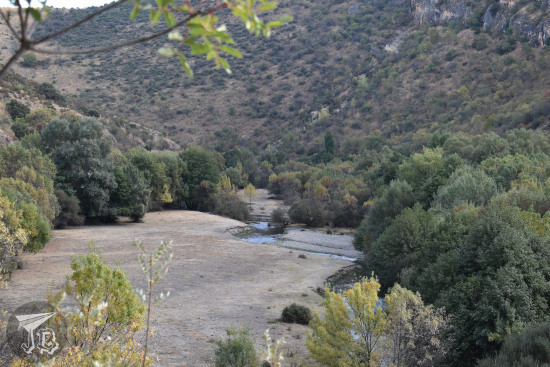
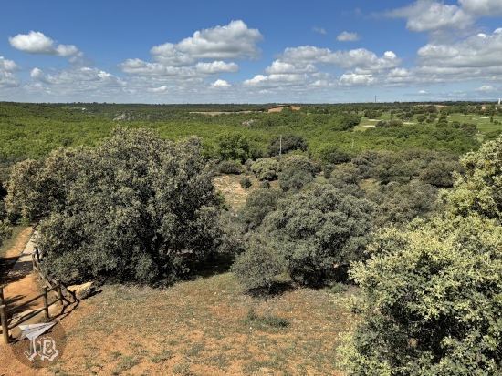
Mount Fuji aka Fuji-san [富士山] is a special mountain in Japan, both geologically and culturally. Japanese and tourists enjoy Fuji-san in different ways – contemplating it, visiting it, climbing it, going around it… Well… Guess who got into their thick head that they wanted to climb it? raises hand Exactly! Yours truly. I was already toying with the idea back in 2018, but I chickened out. However, as I mentioned before, this one time I wanted to scratch as many things off the bucket list as possible, so… There I went – kinda pushed by a feeling that if I did not do it, by the time I were back in Japan it might be too late as my health is not.… complying lately. But I had not hiked up a mountain before in my life…

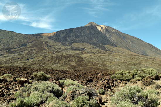
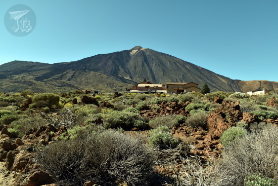
Mount Fuji is the most famous mountain in Japan. Its iconic image is everywhere – enamel pins, t-shirts, postcards, classical art… Located around 100 kilometres south-west of Tokyo, it is 3,776.24 metres high, which makes it the highest peak in the country. It was declared a UNESCO World Heritage Site in 2013.

Technically, Fuji-san is neither a mount nor a mountain, but a type of volcano known as a stratovolcano. Its current morphology was shaped by consecutive layers (“strata”) of lava hardening. It is mainly composed by a rock called basalt, and it is one of the few large basalt volcanos in the world. Basaltic lava is rather thick and slow-moving, so there are many lava tunnels and tree moulds created by the eruptions.

Fuji-san, as we know it today, was formed from a previous volcano (Komitake), and became active around 5,000 years ago. Around 2,300 years ago, there was a mud landslide (Gotemba mud flow [御殿場泥流, Gotemba deiryū]) that can still be identified. There have been several historical eruptions, twelve of them between the years 800 and 1083. There was a ten-day eruption of ashes and cinder in the year 864 (Jōgan 6 in the Japanese calendar, based on the different Emperor’s reign; 2019 is Reiwa 1, as current Emperor Naruhito just ascended the throne). In the year 1707 (Hōei 4 in the Japanese calendar), a few weeks after a big earthquake, the last known eruption took place. In the current Japanese Volcanic Alert Level, Mount Fuji is categorised as “Level 1: Potential for increased activity”, which is the lowest level.

Mount Fuji has frequently been depicted in Japanese art, most famously in Katsushika Hokusai’s [葛飾 北斎] Thirty-six Views of Mount Fuji [富嶽三十六景, Fugaku Sanjūrokkei] by, a series of ukiyo-e block prints (which are actually 46). Probably the best known among these is The Great Wave off Kanagawa, one copy of which is displayed at British Museum in London (actually, in 2017 they ran a whole exhibit around it and Hokusai).

Fuji-san is also an important element in the collective spirituality of Japan. In Shinto mythology, the goddess of Mount Fuji is Konohanasakuya-hime [木花咲耶姫]. She is enshrined in Fujinomiya town Fujisan Hongū Sengen Taisha [富士山本宮浅間大社]. Technically, this shrine has owned Mount Fuji since 1609, though there are no current records of ownership. The volcano stands at the boundary between the prefectures of Shizuoka and Yamanashi, and in order to manage the natural area, the Fuji-Hakone-Izu National Park [富士箱根伊豆国立公園, Fuji-Hakone-Izu Kokuritsu Kōen] was established.

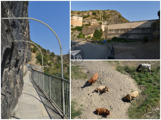
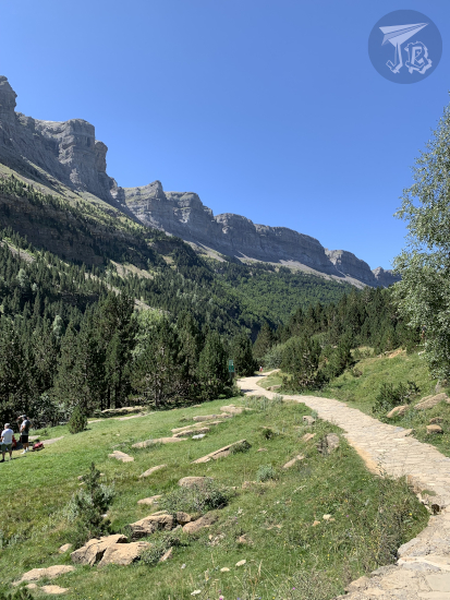
Depending on the actual weather, Fuji-climbing season extends from late June or early July to early September. It is not allowed to climb Fuji “off-season” without a permit. However, people do not usually climb the whole mountain, but start quite closer to the summit. There are roads leading up Mount Fuji up to around 3,200 metres, to an area called the Fifth Stations However, no private cars are allowed on those roads.

From the Fifth-Stations there are four trails or paths to the summit, colour-coded to help people find their way, especially on the way down:

  • Yoshida Trail [吉田ルート] (yellow). It starts at the Fuji-Subaru Line 5th Station [富士スバルライン五合目] (Yamanashi Prefecture). This is the trail recommended to “beginners” and thus the most crowded.
  • Subashiri Trail [須走ルート] (red) Head. It starts at the Subashiri Trail 5th Station [須走口五合目] (Shizuoka Prefecture).
  • Gotemba Trail [御殿場ルート] (green). It starts at the Gotemba Trail New 5th Station [御殿場口新五合目] (Shizuoka Prefecture).
  • Fujinomiya Trail [富士宮ルート] (blue). It starts at the Fujinomiya Trail 5th Station [富士宮口五合目] (Shizuoka Prefecture).

When I told D****e that I was planning to try to organise the climb, she did not believe me at first. As she realised I was being serious, she decided that she was crazy enough to want to come with me as “she could not let me do such a thing alone” and actually took over most of the planning, since she had done it before. I would have just found an agency, but I think she was better.

So off we went. As she was working, we organised our hike on a Saturday-Sunday trip weekend trip – and we did not realise until afterwards that we would be climbing during Mountain Day – Yama no Hi [山の日]. We packed snacks, water, and everything we thought we might need – in my case, also gloves which I eventually lost, and a ridiculous amount of layers. D****e was chill, but I was a little worried about all the equipment the Official webpage for Mt. Fuji Climbing said that was needed, including oxygen and helmets. There were also warnings in place, such as your mobile phone battery dying super-fast, or the need for an evacuation plan in case altitude sickness got too much. I was also worried about weather (especially rain) and temperature changes – thus all the layers. She insisted we would be fine.

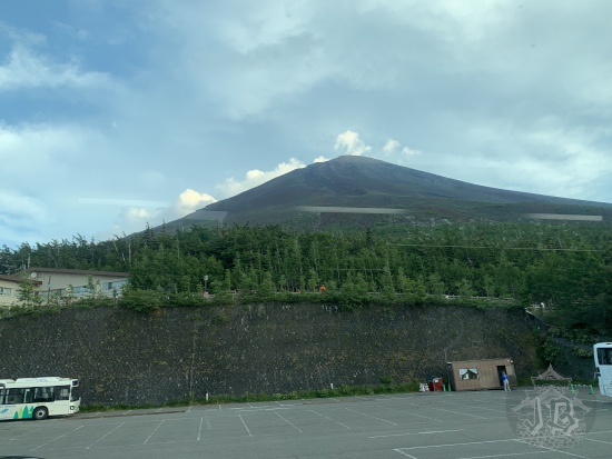
After a big lunch, we took the Shinjuku Expressway Bus around 16:00 on Saturday the 10th, and arrived at the Fuji Subaru Line Gogōme [富士スバルライン五合目] / Fuji Subaru Line 5th Station at 2,300 m around 17:30. We (she) had booked a mountain hut at the Seventh station so we “only” had to climb two stations, right? Right. Read: wrong.

Approaching Mount Fuji: the mountain looms half-hidden by the clouds.

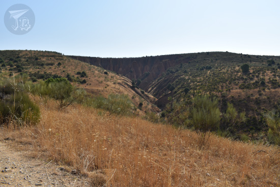
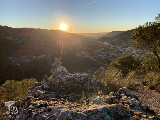
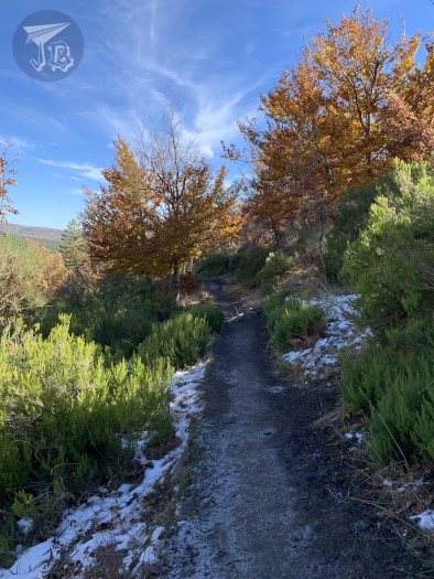
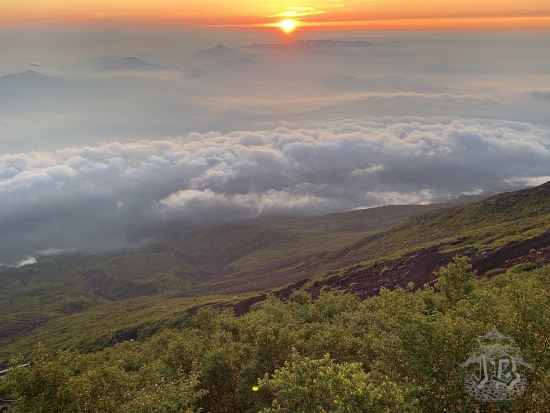
Right about the time of taking this picture it had sunk on me how much of a bad idea this had been (≧▽≦). I really wondered if it was too late to turn back and go home.

A date banner at Mount Fuji 5th Station, reading 2019 08 10

My first step was buying a staff – that we nicknamed the “Fuji-climbing stick”. The idea is that you use it to feel your way around and make sure that you step on solid ground, and especially when you hike down. However, (you’d never guess), you can get stamps burnt into the wooden stick as you hike up – usually for 300 ¥. Climbing Fuji can get expensive… D****e had chosen the Yoshida Trail [吉田ルート] for our ascending side (noborigawa [登り側]). And so… off we went.

From the Fifth Station, looking up at the summit.

From the Fifth Station, looking down at the car park and a sea of clouds underneath

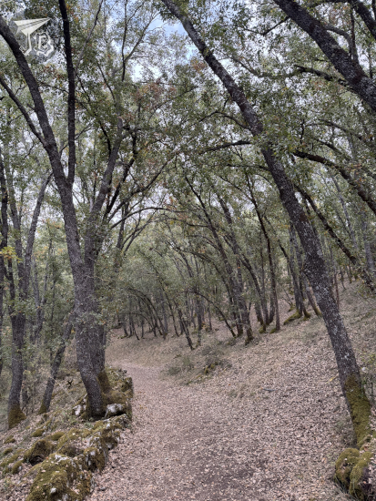
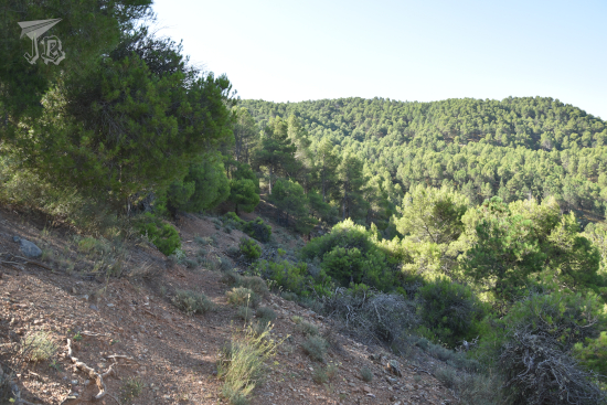
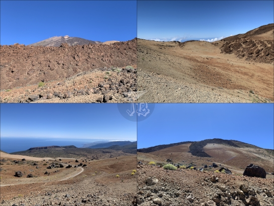
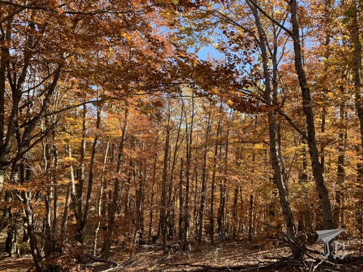
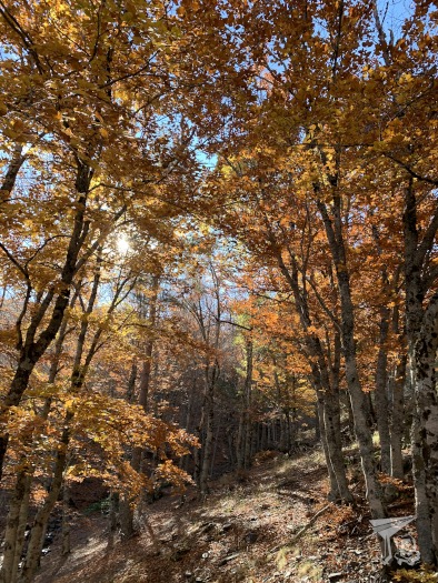
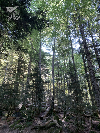
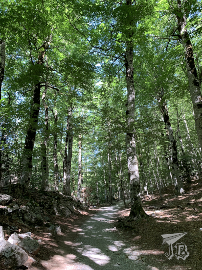
We started off climbing at around 18:00. Between the Fifth (2,300 m) and the Sixth Stations (2,390 m), you walk along some dirt paths in the forest, and there isn’t really that much “ascension”. As there was also light, the first hour was easy enough. This area is crowded due to all the “visitors” going for a “walk” from one of the Fifth Stations to another. We actually saw someone using up their oxygen at this point. That was weird.

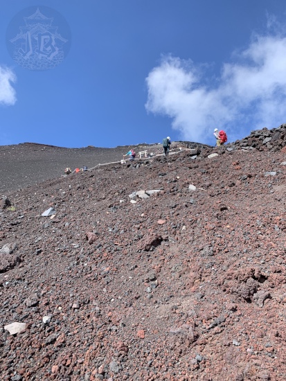
From the Sixth Station there was a first zig-zag upwards, with paths held up by some dams. This is one of the parts I found the hardest, as it is the same inclination all the time and I was not warmed up yet. Then, sunset came, and while it was pretty, it brought darkness upon us (yeah I’m being literary on this). Not that I had a problem with actual darkness, but other people’s torches and headlights kept blinding me, which made the most difficult parts hard to climb – because some people are idiots who point their lights forward and not downwards, where the ground is. Sheesh. There were parts that were just a gentle incline up, while others were stuck rocks or lava flows that you had to climb with your hand and feet.

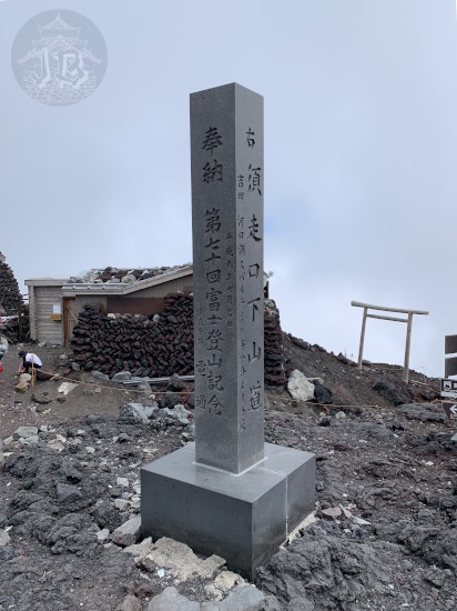
At the Seventh Station (2,700 m), the path changed and we started. Though there were some slopes, there were also stuck rocks and lava flows that I had to climb with my hands and feet. Fortunately, I could make use of the short stops we made to stamp my staff. Workers of the Mountain Huts use hot irons to burn the stamp into the wood. I think I got all the ones I could on my way up (no stamps on the way down).

The sea of clouds at the foot of Mount Fuji

Distant lights in the night, down

Mountain huts [富士山の山小屋, Fujisan no yamagoya] are tiny establishments where you can get some food or spend the night for around 10,000 ¥. They often require reservations, usually in Japanese, that is why D****e took charge of that part. Some of them have a bin for rubbish – because you can’t dispose of trash on the slopes, you have to take back what you brought in. They have toilets too, and require a tip. Most of them follow an “honour system” with a small coin box, but some have a guardian to collect the money.

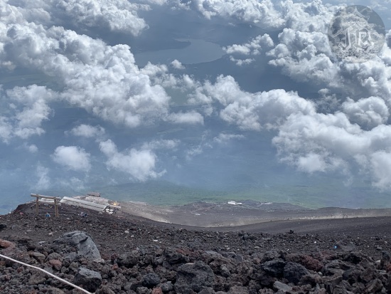
We continued upwards until we made it to our Mountain Hut, Shichigōme Torii sō [七合目 鳥居荘], the Seventh Station’s Torii-so at around 21:00. We had been told it was the one with the red torii, and it was a sight for sore eyes. It stands at 2,900 metres high, closer to the Eight Station than the Seventh – we had expected to find it sooner due to the name.

A torii gate lit up in the dark

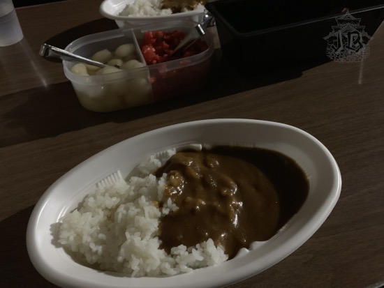
D****e had booked a bed and a meal. As we came into the hut, our staffs and backpacks were hung over the door, and we were given bags for our shoes and personal effects. We had a small riff-raff with the owners, because they claimed that we had arrived too late for food. However, D****e argued that the webpage said nothing about a time limit. Thus, we got some curry and rice as the dinner we had booked.

A dish of curry and rice.

Around 22:00, we used the toilet, and then we were shown to the common dormitory – the bed bunks are basically a line of futons put together so you share a blanket with the person next to you. The idiot I had to share with decided to lie on the blanket instead of under it, so she had me uncovered half the time until she left.

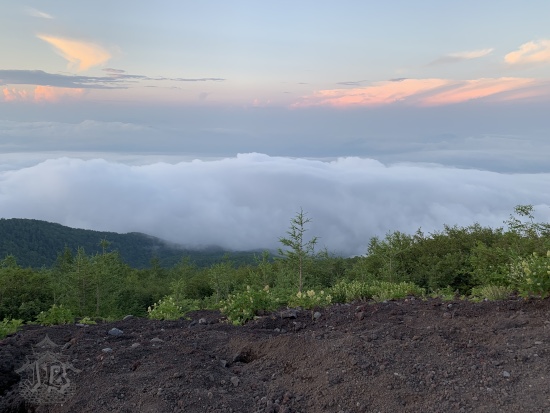
Thankfully, at around 23:00 there was a call for people who wanted to set off in time to see sunset from the summit, and she got going. Between getting uncovered, and lying down too soon after food, I started feeling queasy. I freaked out a little. I started turning in my head that I was going to get sick and not get to the summit and have to be evacuated. D****e helped me calm down and I managed to get a few hours of sleep.

But just a few. We were woken up by the noise around us around 4:15. I felt strangely not tired, and D****e indulged me. Thus, we got up and went outside to see sunrise. Sunrise from Mount Fuji!!! I mean… I can’t even. Unfortunately (and ironically) we left too early to get the stamp from our own hut! We continued our way and had breakfast at the next big rock where we could sit down.

Sunrise from the slopes of Mount Fuji.

After coffee (yes, I’m addicted enough to carry coffee to Mount Fuji), we went on hiking. To be honest this second day was not as bad as I had imagined – as in I was rather convinced that I was not going to be able to make it, especially during the night freak-out. My painkillers kicked in and I only felt a small buzz in my ears as pressure changed.

It did not take too long to arrive at the New Eighth Station (3,100 m). Once again the trail became irregular, which on one hand was tiresome, but at the same time, it was not tedious, so it did not feel as hard. Gloves were useful for this part of the hike, as I could hold on to things. We continued up to the Original 8th Station (3,400 m).

After the Original Eighth Station the trail became path-like again, with torii and stairs and fewer rocks you had to climb over, but a bunch of smaller ones that you had to step up on. Here I learnt to appreciate the actual usefulness of my staff. Vegetation disappeared gradually until the ground was barren.

I think I lost my gloves at the Ninth Station. We saw a group of people evacuating an injured / ill climber – we mentally awarded them like a million karma points, and after getting the injured person to help, they happily went back up again. One of them told us their group does it every year. I remember hugging some torii on the way, and a thousand thoughts twirling in my head.

Area closer to the summit of Mount Fuji. There is no vegetation and the ground looks reddish and more like gravel than actual rock.

Looking down from the barren area, there are clouds and a river at the foothill

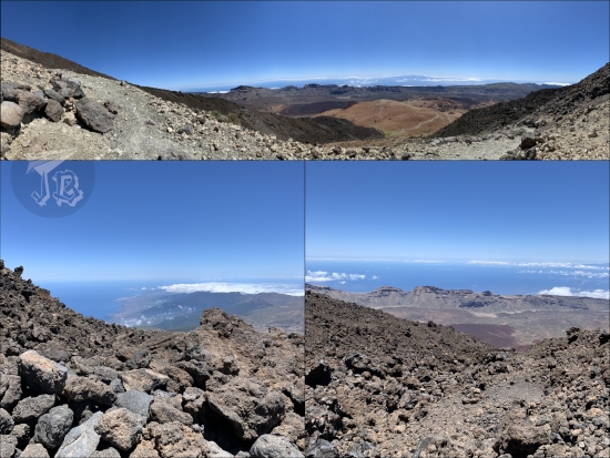
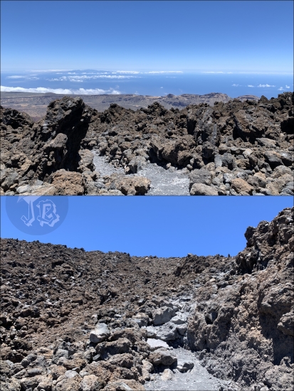
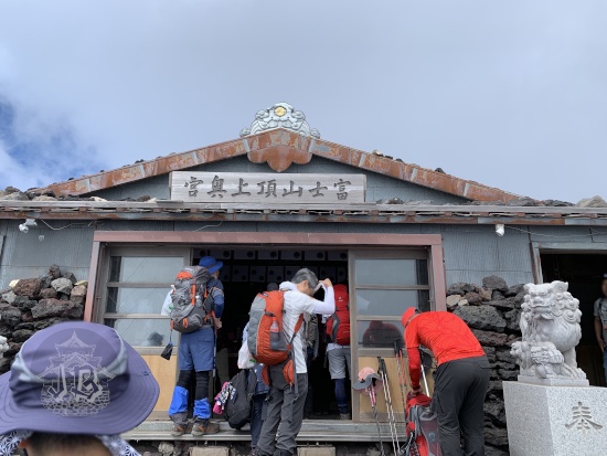
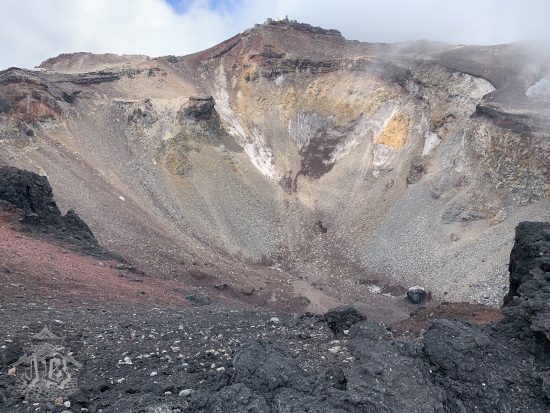
And then we made it. Around 11:00 we reached the rim of crater. I could not believe my own eyes when I stepped in front of the shrine Asama Taisha Okumiya Kusushi Jinja [淺間大社 奧宮 久須志神社] and Fuji-san Chōjō Yamaguchi-ya Honten [富士山頂上 山口屋 本店] aka Top of Mt. Fuji Yamaguchi Shop. I had made it. I had beaten my own limits, and reached the crater.

Entrance to the Temple on the Summit of Mount Fuji

Online certificate that you can download using a QR from the Top. It has the date as August 11 2019

Of course I needed to get all the stamps and the shuuin and the exclusive Coca-Cola bottle. We decided not to go around the crater to the highest point, just a handful of metres higher, because it would add some 90 minutes to our trek, and we preferred to just hang around where we were for that long. Because I was at the freaking crater of Mount Fuji! I was the Kami of the Mountain.

Brim of the crater of Mount Fuji

Crater of Mount Fuji

Stone marker at the summit

Cheers with two Mount Fuji exclusive Coca-Cola bottles

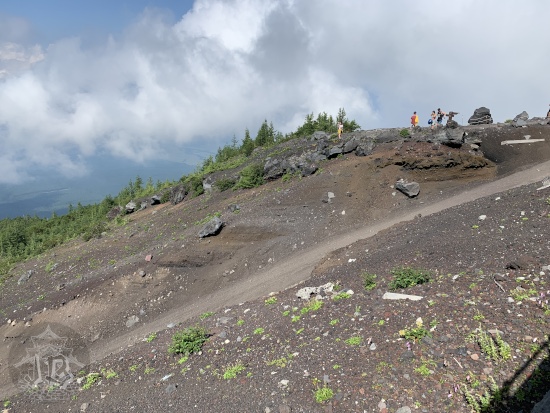
Walking around the crater would have been great, but we would be hard-pressed for time for our bus if we took too long. D****e asked me what I wanted to do, and I was happy staying around the crater taking pictures and enjoying the feeling. After an hour or so, we set on our way back down – the trail was a bulldozered zig-zag of gravel, boulders and volcanic sand, and it was even more exhausting than the way up.

It was tricky not to slide and fall. It took us about three hours until we were back to the forest area and the Sixth Station. We reached our Fifth Station around 15:30. I did not fall even once – thank you, Fuji-climbing boots from the Decathlon Children Section for not letting me down, literally!! I also acknowledge that we were super-lucky with the weather, we only had a few clouds just under the crater, and it was not too cold even for me – and no rain, which would have made the experience miserable.

The path down, bulldozered into a straight line.

We actually made it with some time to catch our bus, so we looked at the souvenir shops and Fujisankomitake Jinja [冨士山小御嶽神社].

A colourful and crowded shrine. A lot of the tourists in front of it are wearing shoes that were definitely not made for climbing.

My made-for-climbing shoes, and lower jeans, which were originally blue, looking orange due to the volcanic dust.

As we left, we could see Mount Fuji in all its glory, and I could not believe that I had actually been up there! The total experience had taken a bit over 27 hours, and it was exhausting but exhilarating.

View of Mount Fuji from the bus

However, the downfall had to come, and it came in the bus, about 20 minutes into the ride home – once I stopped moving, my body completely shut down in pain. My back cramped, headache hit, left knee got stuck, and the road trip was horrible. I did not want to have any dinner even if I knew I needed it, but a hot pot in the conbini managed to draw me and it was exactly what I needed!

Hot pot with vegetables, mushrooms and pork

Walked distance: 10th: 9988 steps / 7.14 km; 11th: 21107 steps / 15.1 km. However! The damn watch does not take into account that I CLIMBED A VOLCANO!! I mean, come on! Some of those steps had a 70 cm difference in height! I managed to do it, and I feel damn proud of myself for it, and I will forever proudly display my Fuji-climbing stick as proof of the feat. Also, just so you know 11th of August is Yama no Hi [山の日] (Mountain Day) so this was ironically well-timed, even if by pure chance!

The walking cane I used, covered in hot-iron stamps.

I know that hundreds of people climb Fuji-san every year, but for me those almost 3,776 metres represent something special. It was my very own challenge, something I never thought I would be able to do, and yet I managed. I was extremely proud of myself. I think it helped me become more adventurous, as I found out that I could really push my limits. There was a price to pay afterwards, yes. But I had made it and I don’t regret it (I did regret it a bit the following day going down the stairs though. But not much). I was the Kami of the Mountain.

31st July 2019: Journey to the East (2): To the bunnies! {Japan, summer 2019}

I caught the train early in the morning to get to Fukuyama [福山] (Hiroshima Prefecture), barely 15 minutes away from Okayama by train. I wanted to see the local castle, Fukuyama-jo [福山城], which I had not been able to see the last time I had been around because I was a bubblehead and missed the train that gave me leeway to stop (and it was a Monday and closed). Thus, this time I factored it in.

After visiting the castle I found the complex found by Abe Jinja [阿部神社] and Bingo Gokoku Jinja [備後護国神社].

And then Sanzoinari Jinja [三蔵稲荷神社].

These three shrines were located within the same park as the Castle, but my map also pointed out that Fukuyama Hachimangu [福山八幡宮] was not that far away, so I went to find it too.

On my way back I diverted because a building had drawn my attention and I wanted to find out what it was – it turned out to be, and I quote the “Holy Zion’s Park St. Valentine” [ホーリーザイオンズパークセントヴァレンタイン]. It was a wedding venue. Live and learn.

As I had some time before the train I wanted to take, I also checked the Fukujyukaikan [福寿会館], which turned out to be a ‘traditional house with a teahouse’, so I did not come in.

After that, I took another train to Mihara where I took the Kure line towards Takehara. However, I stopped halfway, in a small station called Tadanoumi [忠海]. What is there in Tadanoumi? The ferry to Okunoshima.

And what the hell is there in Okunoshima? Bunnies. Hundreds of tame rabbits which you can feed and which will climb on you to demand your food, or climb into your backpack of bag or whatever you’re carrying.

So yes, I went to Okunoshima [大久野島]. I could lie to you and tell you that I was there because of the island (horrific) history, and places like the Poison Gas Museum Ōkunoshima Dokugasu Shiryōkan [大久野島 毒ガス資料館].

Or the magically decaying Okunishima Jinja [大久野島神社].

Or the beautiful scenery.

But bluntly put I was there for the rabbits and bunnies and bunbuns and the fluff and the floppy ears and the straight ears too. Okunoshima is also known as Rabbit Island. After it was abandoned after WWII, apparently a bunch of students released some domestic rabbits and they have colonised the whole island. Now you can go and feed them, although you are encouraged not to grab them or ‘put your fingers near their mouths’. For three hours I pranced around finding bunnies and feeding bunnies.

Then I took the ferry back to Tadanaoumi as the sun started to set.

I continued on the Kure Line to Takehara [竹原市], the city / town Tadanoumi actually belongs to (and I was super lucky because there were disturbances and delays for hours starting the following train). Honestly it was just the nearest hotel I had found – I mean, when I went out the only thing I found to grab a bite to eat was a McDonald’s… and they made my fries to order. I also found out about the town’s unofficial mascot, a character called Momonekosama [ももねこ様], from an anime that is set in Takehara

I had saved up the following day as “buffer day”. I did not know whether to try and get to Kure, or directly back to Nagoya, I thought it would just depend on how tired I was… But the hotel had a little map about how Takehara’s historical district was “Little Kyoto”… I thought maybe that was worth checking out.

Walked distance: 19058 steps, 13.6 km

23rd July 2019: Arashiyama honours its name {Japan, summer 2019}

I started off the day at Yasui-Konpira-gu [安井金比羅宮], a shrine with a huge ema-like “mound” called Kushi-zuka [久志塚] with a hole in the middle. It is thought that if you write your wish on a paper, glue it on the mound and then crawl through the hole and back, your wish comes true. In case you’re wondering, no, I didn’t go through.

Then I walked all past Gion again to return to Gion Shirakawa [祇園白川] and Tatsumi Bashi [祇園 巽橋] to see the area by light. I saw Tatsumidaimyojin [辰巳大明神], the Kanikakuni monument, Kanikakuni Ishibumi (Koma-satsu) [かにかくに碑(駒札)], and a very cool heron (or crane?) who totally owned the place.

After this little stroll, it was still early so I headed off to the reconstructed castle Fushimi-Momoyama-jo [伏見桃山城]. It was a very cool castle, but it was not open to the public (this trip was not castle-lucky, now that I think about it).

Underneath the castle, I found the Mausoleum of Emperor Kanmu Kanmu Ten’nō Kashiharanomisasagi [桓武天皇 柏原陵].

And then I walked off to the opposite part of the hill. On my way I found some of the original rocks that had conformed the Ninomaru [二ノ丸跡] of Momoyama-Jo.

I kept ascending until I reached Meiji Ten’nō Fushimi Momoyama no Misasagi [明治天皇 伏見桃山陵], Emperor Meiji’s Tomb at Fushimi Momoyama, which was… somehow very sober and somewhat humble for such an important figure in Japanese history (then again I’ve recently visited the Spanish Royal Family Pantheon so… hm… yeah. Anything is more sober than that.)

After that I was tired and hot, so I needed a break – and the best way to have a break is a train ride. I rode back to Kyoto Station and from there I headed off towards the Arashiyama area. I wandered around the Bamboo Grove Arashiyama Chikurin no Shōkei [嵐山 竹林の小径] for a while. It was packed so I kept diverting towards other areas.

I walked into Rakushisha [落柿舎], a poet’s house, where I got a shuuin.

Then I went up the road to Nison-in [二尊院].

On my way back I stopped to admire the lotus flowers, which were in full bloom.

I considered going into the Museum of Korean arts, but as it was closed, my decision was irrelevant, so I decided to head back towards the Arashiyama Koen Nakanoshima Chiku [嵐山公園 中之島地区], the Nakanoshima area of Arashiyama Park. I saw the Kadono Ooi [葛野大堰], the small damn in the river, and crossed the Togetsu-kyō Bashi [渡月橋] bridge.

There I climbed up to Ichitani-Munakata-Jinja [櫟谷宗像神社].

I decided against climbing to the Monkey Park, and I was halfway back through the bridge, when the skies opened and a huge thunderstorm hit – so indeed, Arashiyama became the mountain of storms! I waited half of it under the canopy of a shop, and after twenty minutes I braved running across the street to the Lawson to get myself a sandwich and ate it as the rain dwindled enough for the streets to be walkable again.

Once that happened, I walked to the station and took a train back to Kyoto and then to Fushimi Inari Taisha [伏見稲荷大社]. I did two sweeps – one with light and once when the sun was setting. Of course I did not climb the whole mountain, I just stayed to see the main buildings and the Senbontorii [千本鳥居] (the loooong torii line) lit.

And finally I headed off back to have some food and rest.

Walked distance: 27897 steps, 19.9 km (so glad I took my cane today!)